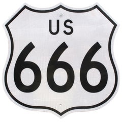
Rare, Original and Authentic New Mexico Route 666 Reflective Road Sign
View Similar Items
1 of 7
Rare, Original and Authentic New Mexico Route 666 Reflective Road Sign
About the Item
- Creator:New Mexico Dept of Transportation (Designer)
- Dimensions:Height: 24 in (60.96 cm)Width: 24 in (60.96 cm)Depth: 0.69 in (1.76 cm)
- Style:Mid-Century Modern (Of the Period)
- Materials and Techniques:
- Place of Origin:
- Period:
- Date of Manufacture:circa 1960s
- Condition:Wear consistent with age and use.
- Seller Location:Los Angeles, CA
- Reference Number:1stDibs: U1210299219210
Authenticity Guarantee
In the unlikely event there’s an issue with an item’s authenticity, contact us within 1 year for a full refund. DetailsMoney-Back Guarantee
If your item is not as described, is damaged in transit, or does not arrive, contact us within 7 days for a full refund. Details24-Hour Cancellation
You have a 24-hour grace period in which to reconsider your purchase, with no questions asked.Vetted Professional Sellers
Our world-class sellers must adhere to strict standards for service and quality, maintaining the integrity of our listings.Price-Match Guarantee
If you find that a seller listed the same item for a lower price elsewhere, we’ll match it.Trusted Global Delivery
Our best-in-class carrier network provides specialized shipping options worldwide, including custom delivery.You May Also Like
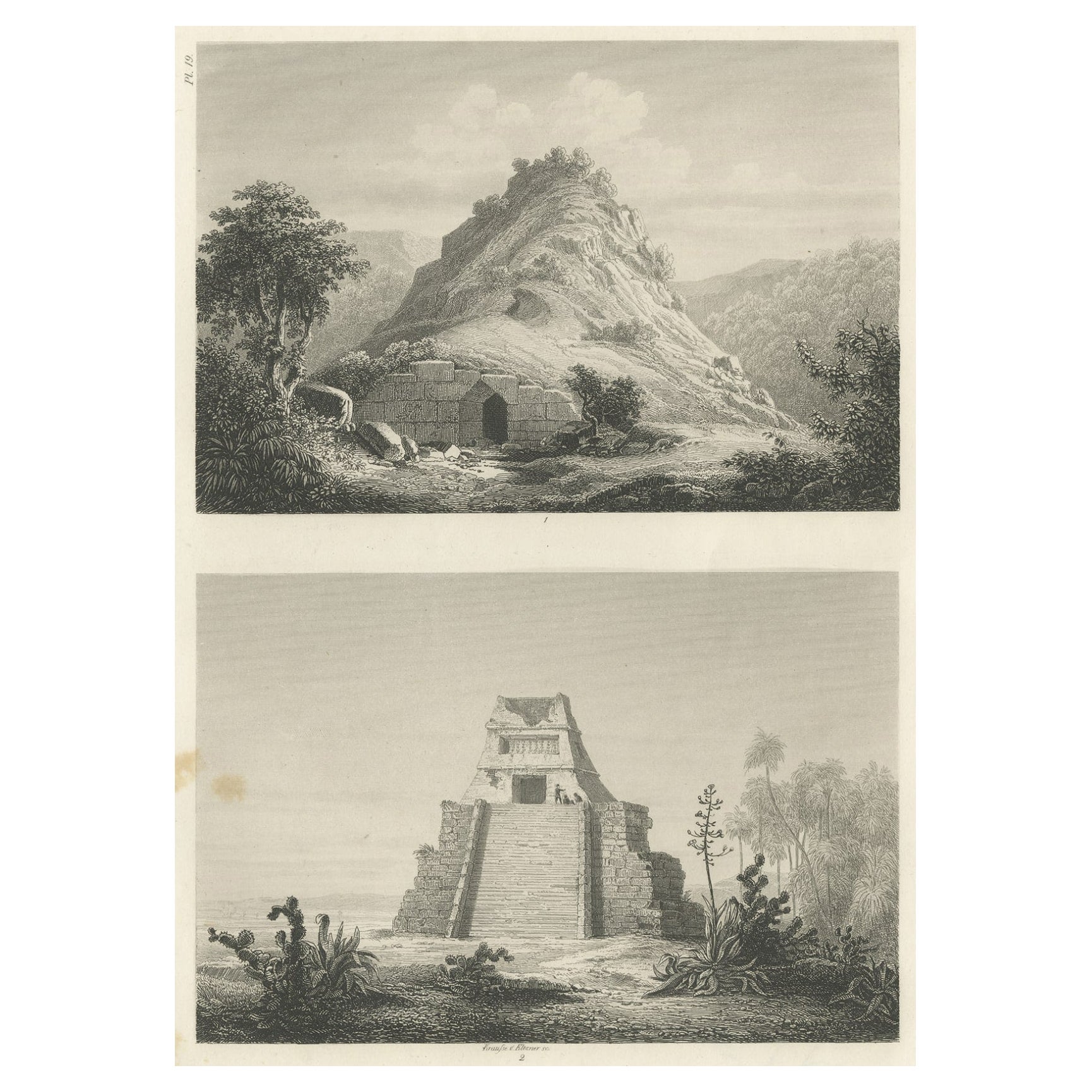
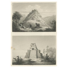
Original Rare Antique Print of Two Ruins in Mexico, 1857
Located in Langweer, NL
Two images on one sheet depicting ruins in Mexico. This print originates from 'Die Kunstwerke vom Alterthum bis auf die Gegenwart, oder, Wegweiser durch das ganze Gebiet der bildende...
Category
Antique 19th Century Prints
Materials
Paper
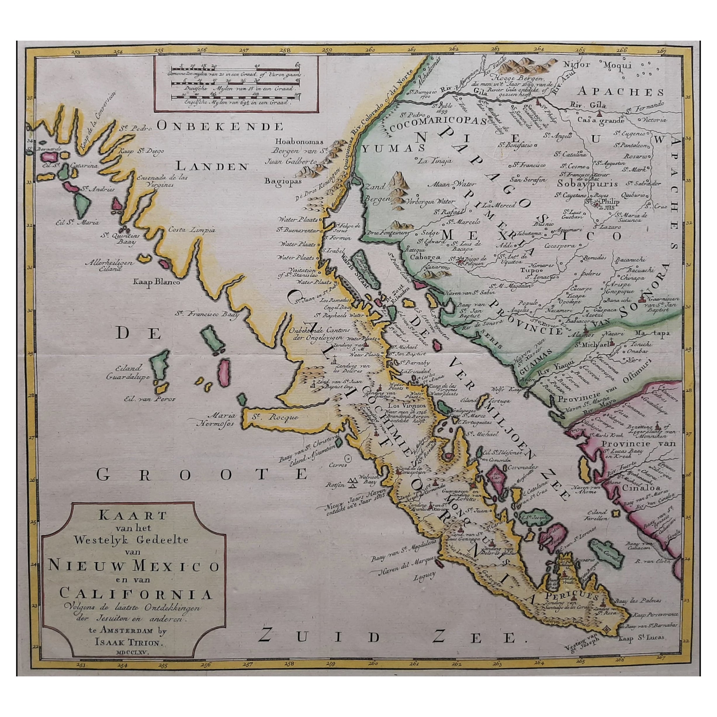
Original Antique Map of the Western Part of NEW MEXICO & CALIFORNIA
Located in Langweer, NL
Title: "Map of the Western Part of NEW MEXICO and CALIFORNIA According to the Latest Discoveries by the Jesuits and Others"
Description:
This exquisite original Dutch map, titled "...
Category
Antique 1760s Maps
Materials
Paper
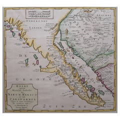
$1,209 Sale Price
20% Off
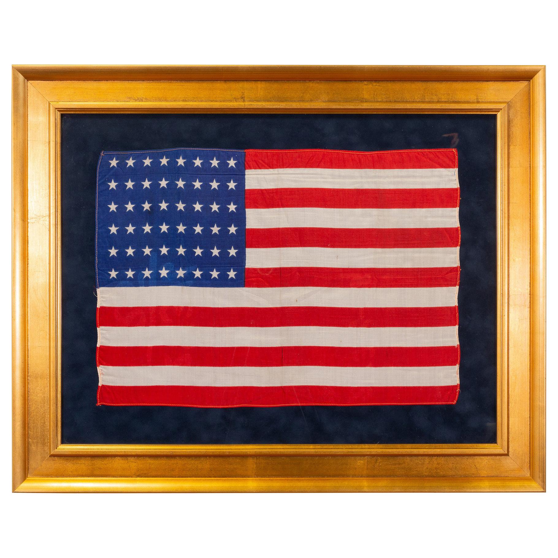
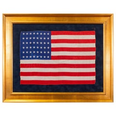
Vintage 1912 Arizona and New Mexico Statehood Flag
Located in Coeur d'Alene, ID
25th Design Patriotic American silk flag with 48 stars. Arizona Statehood Feb 14, 1912; New Mexico Statehood Jan 6, 1912
Period: 1912
Origin: United States
Size: 12" x 17".
Family ...
Category
Vintage 1910s American Historical Memorabilia
Materials
Silk
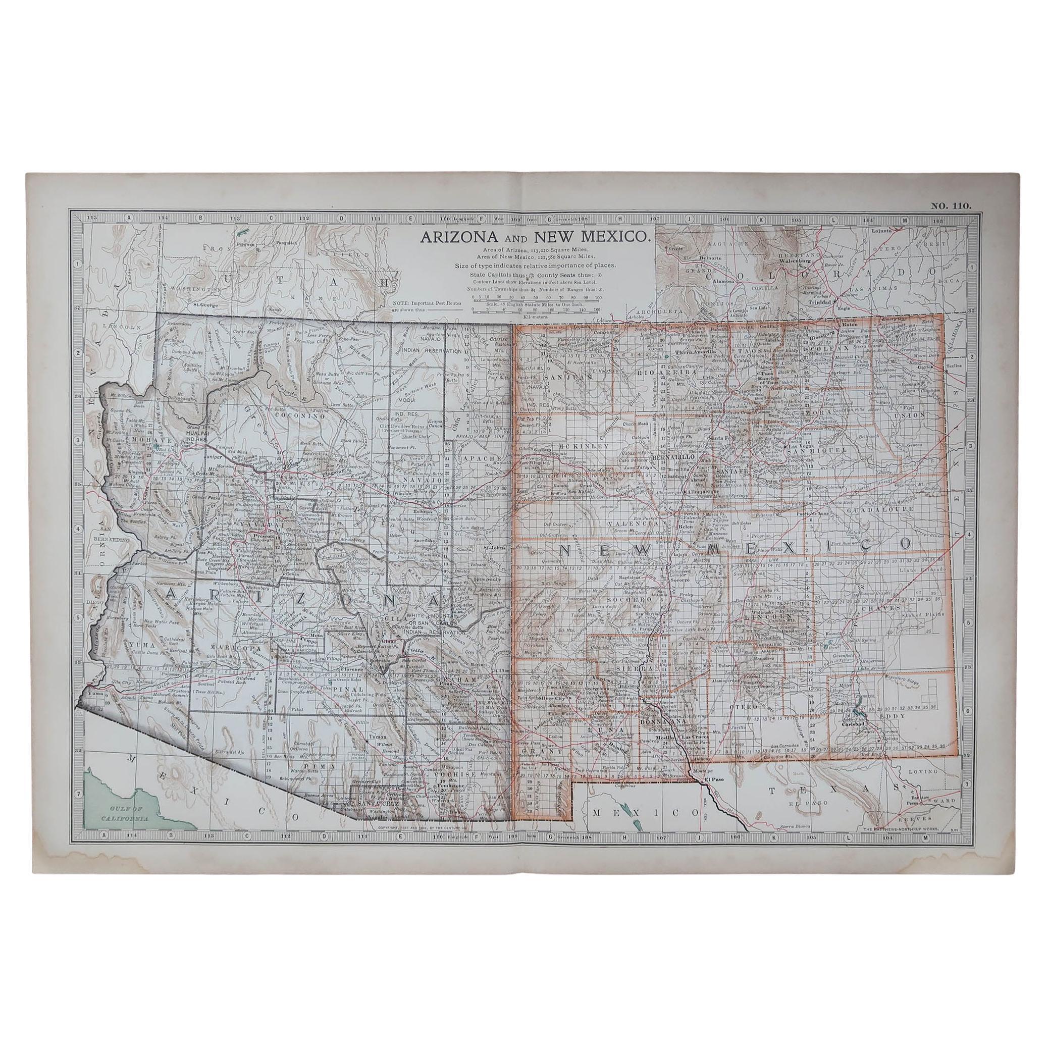
Original Antique Map of the American State of Arizona & New Mexico, 1903
Located in St Annes, Lancashire
Antique map of Arizona and New Mexico
Published By A & C Black. 1903
Original colour
Good condition
Unframed.
Free shipping
Category
Antique Early 1900s English Maps
Materials
Paper

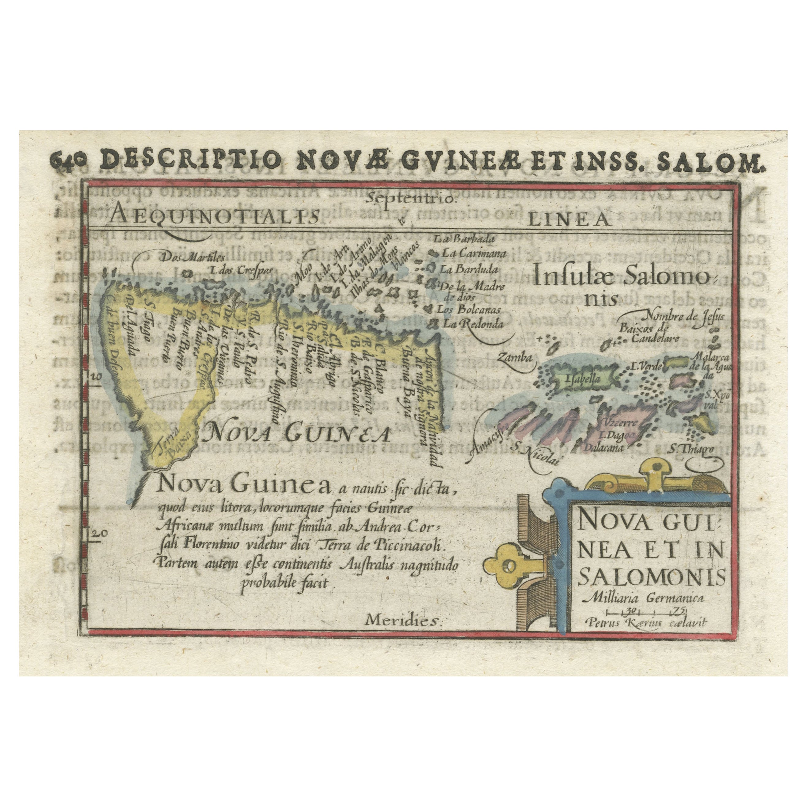
Rare Original Miniature Map of Papua New Guinea and the Salomon Islands, 1600
Located in Langweer, NL
Very handsome original old coloured copper engraving of Papua and the Solomon Island. Title of the map 'Descriptio Novae Guneae et Inss. Salom.
On the reverse text in Latin.
Ve...
Category
Antique Early 1600s Maps
Materials
Paper
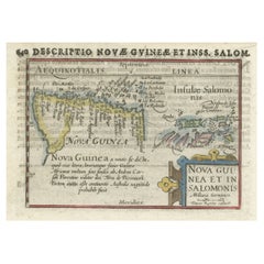
$502 Sale Price
20% Off
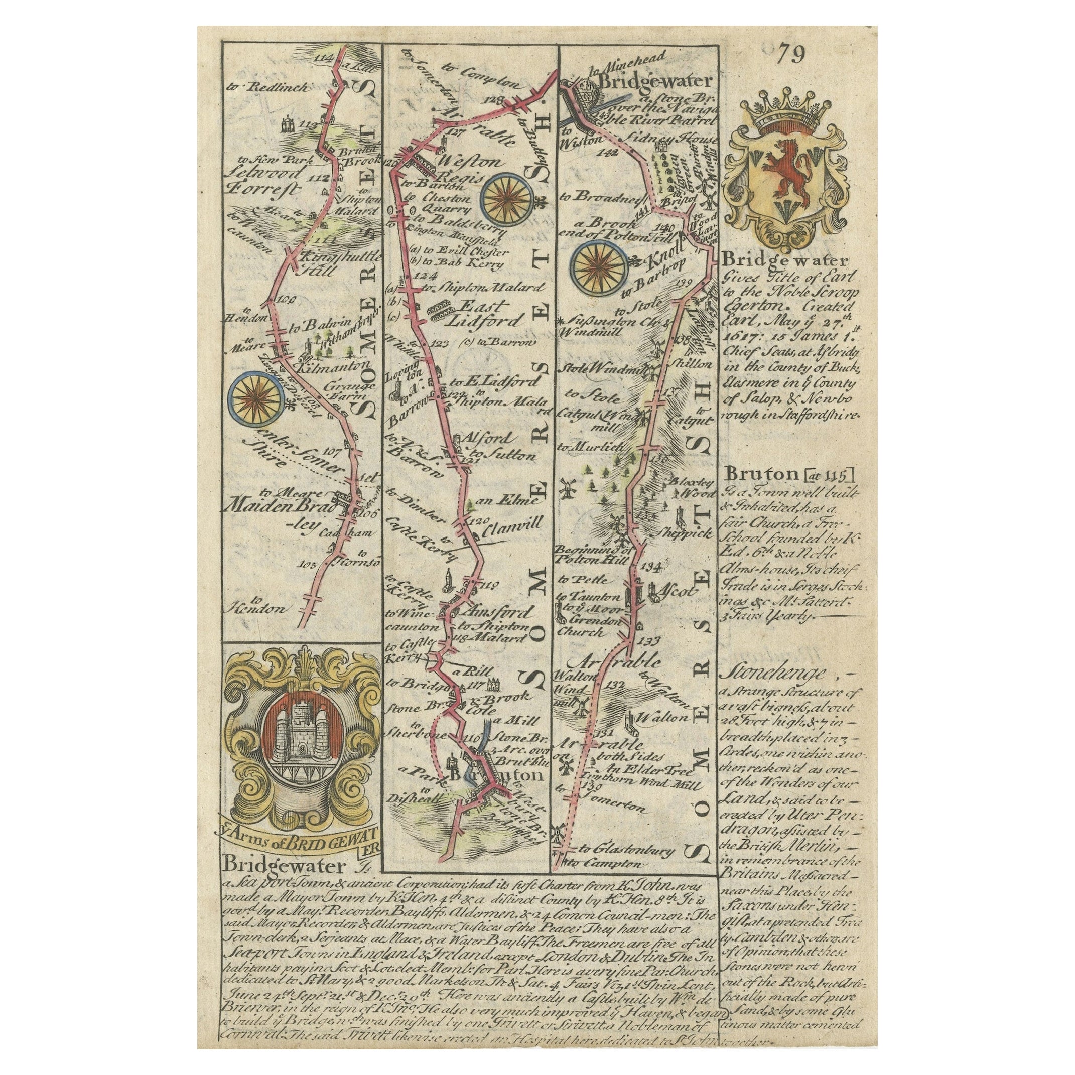
Rare Antique Map of the Route from Maiden Bridge to Dulverton, England, c.1720
By Bowen
Located in Langweer, NL
Antique map titled 'Bridgewater, Bruton'.
Double sided road strip map showing the route from Maiden Bridge to Dulverton, via Bruton, Weston Regis, Bridgewater and Dulverton. This map originates from 'Britannia Depicta or Ogilby Improv'd' by J. Owen and E. Bowen.
Artists and Engravers: The Owen and Bowen road strip maps were based on the far larger ones done by John Ogilby in the 1670s. Each map was finely engraved by Emanuel Bowen, who was one of the most renowned and prolific map makers of the 18th century. The maps also had the added feature of copius amounts of information, written by John Owen...
Category
Antique 18th Century Maps
Materials
Paper
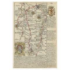
$130 Sale Price
20% Off
Recently Viewed
View AllMore Ways To Browse
Swiveling Coffee Table
Taller Silver Bird
Teak 1980s
Thomas Germany Porcelain
Tom Blue Furniture
Used Furniture Indianapolis
Used Rolex Wimbledon
Velvet Fringed Ottoman
Vintage Embroidered Turkish Kilim Rug
Vintage Farahan
Vintage Glass Coffee Pot
Vintage Indian Tapestry
Vintage Italian Caned Chair
Vintage Metal And Leather Dining Chairs
Vintage Orange Ashtray
Vintage Turkish Rug In Orange With Beige Medallion
Wooden Camel
Wright Table Company Chair