Victor Levasseur Maps
b. 1795
Victor Jules Levasseur (1795–1862) was a French cartographer widely known for his distinctive decorative style. He produced numerous maps more admired for the artistic content of the scenes and data surrounding the map than for the detail of the map. Victor Levasseur was born in 1795 in France. Little is known about his early life and education, but he emerged as one of the most prominent French cartographers of the 19th century. Levasseur lived during a time of significant political and geographical changes in France and Europe, which greatly influenced his work as a mapmaker.to
51
104
104
104
104
104
104
104
104
63
30
23
16
Creator: Victor Levasseur
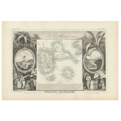
Antique Map of the French Colony Guadeloupe by V. Levasseur, 1854
By Victor Levasseur
Located in Langweer, NL
Antique map titled 'Colonies Françaises (en Amerique). Detailed map of the island of Guadeloupe in the Caribbean Sea, with decorative frame containing views of the island. This map o...
Category
Mid-19th Century Antique Victor Levasseur Maps
Materials
Paper
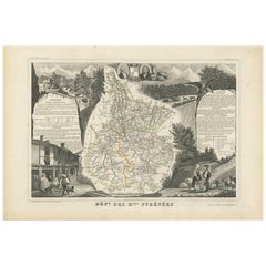
Antique Map of the Hautes Pyrenees 'France' by V. Levasseur, 1854
By Victor Levasseur
Located in Langweer, NL
Antique map titled 'Dépt. des Htes. Pyrénées'. Map of the French department of Hautes Pyrenees, France. This area is home to the wine producing region, Madiran. Madrian is best known...
Category
Mid-19th Century Antique Victor Levasseur Maps
Materials
Paper
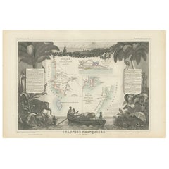
Antique Map of the French Colonies in Senegal and Madagascar by V. Levasseur
By Victor Levasseur
Located in Langweer, NL
The antique map titled 'Colonies Françaises (en Afrique)' presents a decorative depiction of the French colonies located in Senegal and Madagascar within Africa. Surrounding the map ...
Category
Mid-19th Century Antique Victor Levasseur Maps
Materials
Paper
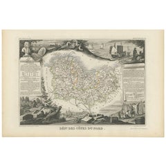
Antique Map of Côtes du Nord ‘France’ by V. Levasseur, 1854
By Victor Levasseur
Located in Langweer, NL
Antique map titled 'Dépt. des Côtes du Nord'. Map of the French department of Cotes du Nord, a maritime region in Brittany, France. The whole is surrounded by elaborate decorative en...
Category
Mid-19th Century Antique Victor Levasseur Maps
Materials
Paper
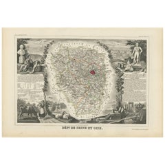
Antique Map of Seine et Oise 'France' by V. Levasseur, 1854
By Victor Levasseur
Located in Langweer, NL
Antique map titled 'Dépt. de Seine et Oise'. Map of the French department of Seine-et-Oise. Centred on Versailles, its administrative centre, Seine-et-Oise extends from Espernon to M...
Category
Mid-19th Century Antique Victor Levasseur Maps
Materials
Paper
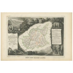
Antique Map of Basses-Alpes ‘France’ by V. Levasseur, 1854
By Victor Levasseur
Located in Langweer, NL
Antique map titled 'Dépt. des Basses-Alpes'. Map of the French department of Basses-Alpes, France. The whole is surrounded by elaborate decorative engravings designed to illustrate b...
Category
Mid-19th Century Antique Victor Levasseur Maps
Materials
Paper
Antique Map of Haut-Rhin, France by V. Levasseur, 1854
By Victor Levasseur
Located in Langweer, NL
Antique map titled 'Dépt. du Haut Rhin'. Map of the French department of Haut-Rhin, France. This mountainous area is part of the Alsace wine region and is known for its production of...
Category
Mid-19th Century Antique Victor Levasseur Maps
Materials
Paper
Antique Map of Calvados ‘France’ by V. Levasseur, 1854
By Victor Levasseur
Located in Langweer, NL
Antique map titled 'Dépt. du Calvados'. Map of the French department of Calvados, France. This area of France is known for its production of Calvados, the world's fines apple brandy....
Category
Mid-19th Century Antique Victor Levasseur Maps
Materials
Paper
Antique Map of the Pyrenees Orientales 'France' by V. Levasseur, 1854
By Victor Levasseur
Located in Langweer, NL
Antique map titled 'Dépt. des Pyréneés Orles'. Map of the French department of Pyrenees Orientales, France. This area is a well-known wine producing region. A wide variety of wines c...
Category
Mid-19th Century Antique Victor Levasseur Maps
Materials
Paper
Antique Map of Var 'France' by V. Levasseur, 1854
By Victor Levasseur
Located in Langweer, NL
Antique map titled 'Dépt. du Var'. Map of the French department of Var, the heart of the French Riviera or Côte d'Azur. Includes the resort cities of Cannes, Nice and San Tropez...
Category
Mid-19th Century Antique Victor Levasseur Maps
Materials
Paper
Antique Map of Basses Pyrénées ‘France’ by V. Levasseur, 1854
By Victor Levasseur
Located in Langweer, NL
Antique map titled 'Dépt. des Bses. Pyrénées'. Map of the French department of Basses Pyrenees, France. This department includes the Jurancon wine region, famous for its production d...
Category
Mid-19th Century Antique Victor Levasseur Maps
Materials
Paper
Hand Colored Antique Map of the Department of Haute Loire, France
By Victor Levasseur
Located in Langweer, NL
Antique map titled 'Dept. de la Haute Loire'. Map of the French department of Haute Loire, France. This area of France is part of the Loire Valley wine growing...
Category
Mid-19th Century Antique Victor Levasseur Maps
Materials
Paper
Hand Colored Antique Map of the department of Indre and Loire, France
By Victor Levasseur
Located in Langweer, NL
Antique map titled 'Dépt. d'Indre et Loire'. Map of the Department de L’Indre et Loire, France. This region is known for its fine wines, agriculture, distilled spirits, and cheese. T...
Category
Mid-19th Century Antique Victor Levasseur Maps
Materials
Paper
Old Map of the French department of Tarn, France
By Victor Levasseur
Located in Langweer, NL
Antique map titled 'Dépt. du Tarn'. Map of the French department of Tarn, France. This area produces a variety of traditional wines, including Cahors, Mauzac, Loin de l’Oeil and Onde...
Category
Mid-19th Century Antique Victor Levasseur Maps
Materials
Paper
Old Map of the French Department of Cantal, France
By Victor Levasseur
Located in Langweer, NL
Antique map titled 'Dépt. du Cantal'. Map of the French department of Cantal, France. This area of France is known for its production of Cantal, a firm cheese, named after the region...
Category
Mid-19th Century Antique Victor Levasseur Maps
Materials
Paper
Hand Colored Antique Map of the Department of Vaucluse, France
By Victor Levasseur
Located in Langweer, NL
Antique map titled 'Dépt de Vaucluse'. Map of the French department of Vaucluse, France. Vaucluse is the center of wine production in the southern Rhone. Some of the smartest wines in France can be found here. There is also a very strong movement towards the adoption of organic and biodynamic viticulture and natural wine making...
Category
Mid-19th Century Antique Victor Levasseur Maps
Materials
Paper
Hand Colored Antique Map of the department of Cantal, France
By Victor Levasseur
Located in Langweer, NL
Antique map titled 'Dépt. du Cantal'. Map of the French department of Cantal, France. This area of France is known for its production of Cantal, a firm cheese, named after the region...
Category
Mid-19th Century Antique Victor Levasseur Maps
Materials
Paper
Hand Colored Antique Map of the Department of Aude, France
By Victor Levasseur
Located in Langweer, NL
Antique map titled 'Dépt. de l'Aude'. Map of the French department of Aude, France. This area of France is famous for its wide variety of vineyards and wine production. In the east a...
Category
Mid-19th Century Antique Victor Levasseur Maps
Materials
Paper
Hand Colored Antique Map of the department of Finistère, France
By Victor Levasseur
Located in Langweer, NL
Antique map titled 'Dépt. du Finistère'. Map of the French department of Finistere, Brittany, France. This area of France is known for its cider production and excellent boar hunting...
Category
Mid-19th Century Antique Victor Levasseur Maps
Materials
Paper
Hand Colored Antique Map of the Department of Nord, France
By Victor Levasseur
Located in Langweer, NL
Antique map titled 'Dept. du Nord'. Map of the French department of Nord, France. This area is known for its production of Maroilles, a cow's milk cheese. This cheese is produced in ...
Category
Mid-19th Century Antique Victor Levasseur Maps
Materials
Paper
Hand Colored Antique Map of the department of Lozere, France
By Victor Levasseur
Located in Langweer, NL
Antique map titled 'Dept. de la Lozère'. Map of the French department of Lozere, France. This remote mountainous part of Languedoc is rural, sparcely populated, and extremely beautif...
Category
Mid-19th Century Antique Victor Levasseur Maps
Materials
Paper
Hand Colored Antique Map of the Department of Correze, France
By Victor Levasseur
Located in Langweer, NL
Antique map titled 'Dépt. de la Corrèze'. Map of the French department of Correze, France. This area of France is known for its production of Straw Wine, a sweet red or white wine. T...
Category
Mid-19th Century Antique Victor Levasseur Maps
Materials
Paper
Old Map of the French department of Ariège, France
By Victor Levasseur
Located in Langweer, NL
Antique map titled 'Dépt. de l'Ariège'. Map of the French department of Ariege, France. This area of France is known for its production of semi-soft and mild cheeses, such as Bethmal...
Category
Mid-19th Century Antique Victor Levasseur Maps
Materials
Paper
Hand Colored Antique Map of the Department of Eure-et-loir, France
By Victor Levasseur
Located in Langweer, NL
Antique map titled 'Dépt. d'Eure et Loir'. Map of the French department of Eure-et-Loir, France. This area is home to the famous Chartres Cathedral....
Category
Mid-19th Century Antique Victor Levasseur Maps
Materials
Paper
Hand Colored Antique Map of the Department of Calais, France
By Victor Levasseur
Located in Langweer, NL
Antique map titled 'Dépt. du Pas de Calais'. Map of the French department of Calais, France. This area is known for producing Maroilles, a soft cheese made from cow’s milk and with a...
Category
Mid-19th Century Antique Victor Levasseur Maps
Materials
Paper
Old Map of the French Department of Nièvre, France
By Victor Levasseur
Located in Langweer, NL
Antique map titled 'Dept. de la Nièvre'. Map of the French department of Nievre, France. Part of the prestiegous Burgundy or Bourgogne wine region this area is known for its producti...
Category
Mid-19th Century Antique Victor Levasseur Maps
Materials
Paper
Old Map of the French Department of Ardèche, France
By Victor Levasseur
Located in Langweer, NL
Antique map titled 'Dépt. de l'Ardèche'. Map of the Department of Ardèche, France. This region is known for its fine wines, agriculture, distilled spirits, and cheese. The capital ci...
Category
Mid-19th Century Antique Victor Levasseur Maps
Materials
Paper
Antique Map of Cher in France, 1854
By Victor Levasseur
Located in Langweer, NL
Antique map titled 'Dépt. des Bses. Pyrénées'. Map of the French department of Basses Pyrenees, France. This department includes the Jurancon wine region, famous for its production d...
Category
Mid-19th Century Antique Victor Levasseur Maps
Materials
Paper
Hand Colored Antique Map of the Department of Eure, France
By Victor Levasseur
Located in Langweer, NL
Antique map titled 'Dépt. de l'Eure'. Map of the French department of Eure, France. This region of France is home to Giverny, where impressionist Claude Monet’s home and garden can...
Category
Mid-19th Century Antique Victor Levasseur Maps
Materials
Paper
Hand Colored Antique Map of the Department of Marne, France
By Victor Levasseur
Located in Langweer, NL
Antique map titled 'Dépt. de la Marne'. Map of the French department of Marne, France. This department is home to the Champagne region where the world's finest sparkling wine is prod...
Category
Mid-19th Century Antique Victor Levasseur Maps
Materials
Paper
Old Map of the French Department of Eure-et-loir, France
By Victor Levasseur
Located in Langweer, NL
Antique map titled 'Dépt. d'Eure et Loir'. Map of the French department of Eure-et-Loir, France. This area is home to the famous Chartres Cathedral....
Category
Mid-19th Century Antique Victor Levasseur Maps
Materials
Paper
Antique Map of Asia by V. Levasseur, 1854
By Victor Levasseur
Located in Langweer, NL
Antique map titled 'Asie'. Map of the main Asian continent. The decorated border shows various images, as well as two blocks of statistical text on the continent, including populatio...
Category
Mid-19th Century Antique Victor Levasseur Maps
Materials
Paper
Hand Colored Antique Map of the Department of L'ain, France
By Victor Levasseur
Located in Langweer, NL
Antique map titled 'Dépt. de l'Ain'. Map of the French department of l'Ain, France. This area of France is known for its Bugey wines, which are generally aromatic and white. It is also known for its fine blue cheese...
Category
Mid-19th Century Antique Victor Levasseur Maps
Materials
Paper
Antique Map of Calais ‘France’ by V. Levasseur, 1854
By Victor Levasseur
Located in Langweer, NL
Antique map titled 'Dépt. du Pas de Calais'. Map of the French department of Calais, France. This area is known for producing Maroilles, a soft cheese made from cow’s milk and with a...
Category
Mid-19th Century Antique Victor Levasseur Maps
Materials
Paper
Old Map of the French Department of Loiret, France
By Victor Levasseur
Located in Langweer, NL
Antique map titled 'Dépt. du Loiret'. Map of the French department of Loiret, France. Surrounding the city of Orleans, Loiret is considered the heart of France and is a registered Unesco World Heritage Site. This area of France is also part of the Loire Valley wine region, and is especially known for its production of Pinot Noirs...
Category
Mid-19th Century Antique Victor Levasseur Maps
Materials
Paper
Hand Colored Antique Map of the Department of Tarn, France, circa 1852
By Victor Levasseur
Located in Langweer, NL
Antique map titled 'Dépt. du Tarn'. Map of the French department of Tarn, France. This area produces a variety of traditional wines, including Cahors, Mauzac, Loin de l’Oeil and Onde...
Category
Mid-19th Century Antique Victor Levasseur Maps
Materials
Paper
Antique Map of Côte d'Or ‘France’ by V. Levasseur, 1854
By Victor Levasseur
Located in Langweer, NL
Antique map titled 'Dépt. de la Côte d'Or'. Map of the French department of Cote D’Or, France. Part of France's Burgundy or Bourgogne wine region, a premier wine-growing region of Fr...
Category
Mid-19th Century Antique Victor Levasseur Maps
Materials
Paper
Antique Map of the French Colony of Algeria by V. Levasseur, 1854
By Victor Levasseur
Located in Langweer, NL
Antique map titled 'Algérie, Colonie Francaise'. Shows the region divided into the administrative provinces of Oban, Alger, and Constantine. The map proper is surrounded by elaborate...
Category
Mid-19th Century Antique Victor Levasseur Maps
Materials
Paper
Hand Colored Antique Map of the Department of L'Yonne, France
By Victor Levasseur
Located in Langweer, NL
Antique map titled 'Dept. de l'Yonne'. Map of the French department of L'Yonne, France. L'Yonne is of France's premier Burgundy wine region and produces some of the worlds finest red...
Category
Mid-19th Century Antique Victor Levasseur Maps
Materials
Paper
Hand Colored Antique Map of the department of Loiret, France
By Victor Levasseur
Located in Langweer, NL
Antique map titled 'Dépt. du Loiret'. Map of the French department of Loiret, France. Surrounding the city of Orleans, Loiret is considered the heart of France and is a registered Unesco World Heritage Site. This area of France is also part of the Loire Valley wine region, and is especially known for its production of Pinot Noirs...
Category
Mid-19th Century Antique Victor Levasseur Maps
Materials
Paper
Antique Map of the French Colony Martinique by V. Levasseur, 1854
By Victor Levasseur
Located in Langweer, NL
Antique map titled 'Colonies Françaises. Martinique, Amérique du Sud'. This map originates from ‘Atlas National de la France Illustré’. Published by A. Combette, Paris, 1854.
Category
Mid-19th Century Antique Victor Levasseur Maps
Materials
Paper
Antique Map of Finistère ‘France’ by V. Levasseur, 1854
By Victor Levasseur
Located in Langweer, NL
Antique map titled 'Dépt. du Finistère'. Map of the French department of Finistère, Brittany, France. This area of France is known for its cider production and excellent boar hunting...
Category
Mid-19th Century Antique Victor Levasseur Maps
Materials
Paper
Hand Colored Antique Map of the department of Ardennes, France
By Victor Levasseur
Located in Langweer, NL
Antique map titled 'Dépt. des Ardennes'. Map of the French department of Ardennes, France. Part of France's important Champagne producing region. The whole is surrounded by elaborate...
Category
Mid-19th Century Antique Victor Levasseur Maps
Materials
Paper
Old Map of the French Department of Indre, France
By Victor Levasseur
Located in Langweer, NL
Antique map titled 'Dept. de l'Indre'. Map of the French department of Indre, France. Part of the Loire Valley wine region, this area is known for its production of Chinon wines, typically red, and production of Pouligny-Saint-Pierre, goats'-milk cheese. It is also the birthplace of the great philosopher Rene Descartes...
Category
Mid-19th Century Antique Victor Levasseur Maps
Materials
Paper
Hand Colored Antique Map of the Department of Ardèche, France
By Victor Levasseur
Located in Langweer, NL
Antique map titled 'Dépt. de l'Ardèche'. Map of the Department of Ardèche, France. This region is known for its fine wines, agriculture, distilled spirits, and cheese. The capital ci...
Category
Mid-19th Century Antique Victor Levasseur Maps
Materials
Paper
Antique Map of Bourbon/Reunion 'France' by V. Levasseur, 1854
By Victor Levasseur
Located in Langweer, NL
Antique map titled 'Ile de la Réunion'. Map of the French department of Ile. Bourbon or Reunion. Bourbon, or Reunion, is a volcanic island off the coast of Africa. It is one of Franc...
Category
Mid-19th Century Antique Victor Levasseur Maps
Materials
Paper
Hand Colored Antique Map of the Department of Gard, France
By Victor Levasseur
Located in Langweer, NL
Antique map titled 'Départ. Du Gard'. Map of the French department of Gard, France. This area of France is known mainly for its red wine and production of Bleu des Causses, a soft an...
Category
Mid-19th Century Antique Victor Levasseur Maps
Materials
Paper
Antique Map of the World by A. Vuillemin, 1854
By Victor Levasseur
Located in Langweer, NL
This map originates from ‘Atlas National de la France Illustré’. Published by A. Combette, Paris, 1854.
Category
Mid-19th Century Antique Victor Levasseur Maps
Materials
Paper
Hand Colored Antique Map of the department of Hautes Alpes, France
By Victor Levasseur
Located in Langweer, NL
Antique map titled 'Dépt. des Hautes Alpes'. Map of the French department of Hautes Alpes, France. This area of France is known for its production of Cote...
Category
Mid-19th Century Antique Victor Levasseur Maps
Materials
Paper
Old Map of the French department of l'Aisne, France
By Victor Levasseur
Located in Langweer, NL
Antique map titled 'Dépt. de l'Aisne'. Map of the French department of l'Aisne, France. The whole is surrounded by elaborate decorative engravings designed to illustrate both the nat...
Category
Mid-19th Century Antique Victor Levasseur Maps
Materials
Paper
Hand Colored Antique Map of the department of Drôme, France
By Victor Levasseur
Located in Langweer, NL
Antique map titled 'Dépt. de la Drôme'. Map of the French department of Drôme, France. This area is known for its production of Picodon, a spicy goats-milk ch...
Category
Mid-19th Century Antique Victor Levasseur Maps
Materials
Paper
Old Map of the French department of Creuse, France
By Victor Levasseur
Located in Langweer, NL
Antique map titled 'Dépt. de la Creuse'. Map of the French department of Creuse, France. This region is well known for its apple cider made from Limousin apples and its international...
Category
Mid-19th Century Antique Victor Levasseur Maps
Materials
Paper
Hand Colored Antique Map of the Department of Ariège, France
By Victor Levasseur
Located in Langweer, NL
Antique map titled 'Dépt. de l'Ariège'. Map of the French department of Ariege, France. This area of France is known for its production of semi-soft and mild cheeses, such as Bethmal...
Category
Mid-19th Century Antique Victor Levasseur Maps
Materials
Paper
Hand Colored Antique Map of the Department of Creuse, France
By Victor Levasseur
Located in Langweer, NL
Antique map titled 'Dépt. de la Creuse'. Map of the French department of Creuse, France. This region is well known for its apple cider made from Limousin apples and its international...
Category
Mid-19th Century Antique Victor Levasseur Maps
Materials
Paper
Hand Colored Antique Map of the Department of Oise, France
By Victor Levasseur
Located in Langweer, NL
Antique map titled 'Dept. de l'Oise'. Old map of the French department of Oise, France. The map proper is surrounded by elaborate decorative engravings designed to illustrate both th...
Category
Mid-19th Century Antique Victor Levasseur Maps
Materials
Paper
Hand Colored Antique Map of the Department of Nièvre, France
By Victor Levasseur
Located in Langweer, NL
Antique map titled 'Dept. de la Nièvre'. Map of the French department of Nievre, France. Part of the prestiegous Burgundy or Bourgogne wine region this area is known for its producti...
Category
Mid-19th Century Antique Victor Levasseur Maps
Materials
Paper
Hand Colored Antique Map of the Department of Indre, France
By Victor Levasseur
Located in Langweer, NL
Antique map titled 'Dept. de l'Indre'. Map of the French department of Indre, France. Part of the Loire Valley wine region, this area is known for its production of Chinon wines, typically red, and production of Pouligny-Saint-Pierre, goats'-milk cheese. It is also the birthplace of the great philosopher Rene Descartes...
Category
Mid-19th Century Antique Victor Levasseur Maps
Materials
Paper
Hand Colored Antique Map of the department of Loir-et-Cher, France
By Victor Levasseur
Located in Langweer, NL
Antique map titled 'Dépt. de Loir et Cher'. Map of the French department Loir-et-Cher, France. This area is mainly known for its production of Selles-sur-Cher, a fine goats-milk chee...
Category
Mid-19th Century Antique Victor Levasseur Maps
Materials
Paper
Victor Levasseur maps for sale on 1stDibs.
Victor Levasseur maps are available for sale on 1stDibs. These distinctive items are frequently made of paper and are designed with extraordinary care. There are many options to choose from in our collection of Victor Levasseur maps, although beige editions of this piece are particularly popular. If you’re looking for additional options, many customers also consider maps by Johannes Janssonius, Jacques-Nicolas Bellin, and James Cook. Prices for Victor Levasseur maps can differ depending upon size, time period and other attributes — on 1stDibs, these items begin at $97 and can go as high as $411, while a piece like these, on average, fetch $220.
