Vintage Illustrated Maps

to
3
149
50
201
175
70
47
33
18
12
4
3
1
14
10
5
4
4
Sort By
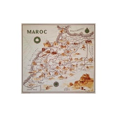
illustrated map of Morocco created in 1950 by Delaye
Located in PARIS, FR
Beautiful illustrated map of Morocco created in 1950 by Delaye. Main roads, car tracks, railroads
Category

1950s Vintage Illustrated Maps

Materials

Paper, Lithograph

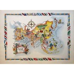
Jacques Liozu's 1951 illustrated map of Asia
By Jacques Liozu
Located in PARIS, FR
Jacques Liozu's 1951 illustrated map of Asia is an exceptional work of cartography that combines
Category

1950s Vintage Illustrated Maps

Materials

Paper, Lithograph

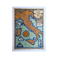
Illustrated map of Italy by Umberto Zimelli dating from 1933
Located in PARIS, FR
Very nice illustrated map of Italy dating from 1933. Italy - Tourism
Category

1930s Vintage Illustrated Maps

Materials

Linen, Paper, Lithograph

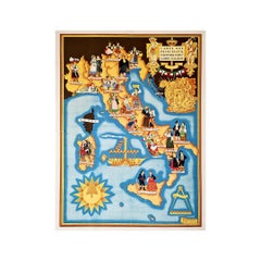
Illustrated map from 1934 of the main Italian popular costumes - Old map
Located in PARIS, FR
Very beautiful illustrated map from 1934 of the main Italian popular costumes. Italy - Tourism
Category

1930s Vintage Illustrated Maps

Materials

Linen, Paper, Lithograph

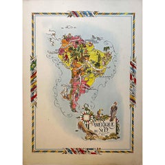
Jacques Liozu's 1951 illustrated map of South America
By Jacques Liozu
Located in PARIS, FR
Jacques Liozu's 1951 illustrated map of South America is an exceptional work of cartography that
Category

1950s Vintage Illustrated Maps

Materials

Paper, Lithograph

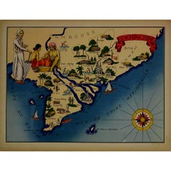
1943 original illustrated map of Cochinchine by Dylbert
Located in PARIS, FR
The 1943 original illustrated map of Cochinchine by Dylbert is a striking example of cartographic
Category

1940s Vintage Illustrated Maps

Materials

Linen, Paper, Lithograph

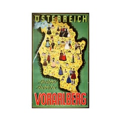
Original poster of Thurnher Weiss representing an illustrated map of Vorarlberg
Located in PARIS, FR
Original poster of Thurnher Weiss representing an illustrated map of Vorarlberg which is a region
Category

Mid-20th Century Vintage Illustrated Maps

Materials

Paper, Lithograph

Circa 1950 original illustrated map "Carte des Montagnes Suisses"
Located in PARIS, FR
The circa 1950 original illustrated map "Carte des Montagnes Suisses" by L. Koller is a beautifully
Category

1950s Vintage Illustrated Maps

Materials

Linen, Paper, Lithograph

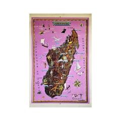
Illustrated Map of Madagascar by D. J. Allonsius 1953 Original Poster Africa
Located in PARIS, FR
Nice illustrated Map of Madagascar by D. J. Allonsius. This original poster was printed by
Category

1950s Vintage Illustrated Maps

Materials

Paper, Linen, Lithograph

Circa 1950 original illustrated map for "Carte France autour de Bordeaux"
Located in PARIS, FR
The circa 1950 original illustrated map for "Carte France autour de Bordeaux" is an excellent
Category

1950s Vintage Illustrated Maps

Materials

Linen, Paper

Jacques Liozu's 1951 illustrated map of Australia and Oceania
By Jacques Liozu
Located in PARIS, FR
Jacques Liozu's 1951 illustrated map of Australia and Oceania is a remarkable cartographic work
Category

1950s Vintage Illustrated Maps

Materials

Paper, Lithograph

Jacques Liozu's 1951 illustrated map of North and Central America
By Jacques Liozu
Located in PARIS, FR
Jacques Liozu's 1951 illustrated map of North and Central America is an exceptional work of
Category

1950s Vintage Illustrated Maps

Materials

Paper, Lithograph

Jacques Liozu's 1951 illustrated map of Central and Eastern Europe
By Jacques Liozu
Located in PARIS, FR
Jacques Liozu's 1951 illustrated map of Central and Eastern Europe is a cartographic work of great
Category

1950s Vintage Illustrated Maps

Materials

Paper, Lithograph

Original Vintage Illustrated Map Poster Afrique Equatoriale Francaise Cameroon
Located in London, GB
Original vintage illustrated map poster for Cameroun AOF Afrique Occidentale Francaise / Cameroon
Category

1950s French Vintage Illustrated Maps

Materials

Paper

Jacques Liozu's 1951 illustrated map of the region of Franche-Comté
By Jacques Liozu
Located in PARIS, FR
Jacques Liozu's 1951 illustrated map of Franche-Comté is a cartographic work of great beauty and
Category

1950s Vintage Illustrated Maps

Materials

Paper, Lithograph

Original Vintage Illustrated Map Poster Schematic Map Soviet Union USSR Russia
Located in London, GB
Original vintage illustrated map poster - Schematic Map of the Soviet Union's East Siberia and the
Category

1960s Russian Vintage Illustrated Maps

Materials

Paper

Jacques Liozu's 1951 illustrated map of Alsace and Lorraine in France
By Jacques Liozu
Located in PARIS, FR
Jacques Liozu's 1951 illustrated map of Alsace and Lorraine is a remarkable work of cartography
Category

1950s Vintage Illustrated Maps

Materials

Paper, Lithograph

1937 original poster illustrated map of the Exposition Internationale
Located in PARIS, FR
This 1937 original poster presents a detailed illustrated map of the Exposition Internationale des
Category

1930s Vintage Illustrated Maps

Materials

Paper, Lithograph, Linen

Original Vintage Africa Travel Poster Belgian Congo Congo Belge Illustrated Map
Located in London, GB
Laboulais (1903-1988) features an illustrated map depicting roads, railways, flight routes, national parks
Category

1940s Belgian Vintage Illustrated Maps

Materials

Paper

Original Vintage Illustrated Map Poster Railway Travel Normandy Brittany Paris
By Lucien Boucher
Located in London, GB
Original vintage travel poster featuring a colourful Illustrated Map of the State Railways Sea and
Category

1930s French Vintage Illustrated Maps

Materials

Paper

An original poster featuring an illustrated map of Tenerife - La Lucha
Located in PARIS, FR
A beautiful poster featuring an illustrated map of Tenerife or Tenerife, an island in Spain that
Category

1950s Vintage Illustrated Maps

Materials

Paper, Lithograph

Original Vintage Illustrated Map Poster Union Of South Africa MacDonald Gill
By "Leslie MacDonald ""Max"" Gill"
Located in London, GB
Original vintage illustrated map poster for the Union of South Africa - Philips pictorial map based
Category

1950s British Vintage Illustrated Maps

Materials

Paper

Original Vintage Advertising Poster Unilever South America Illustrated Map Art
Located in London, GB
Original vintage advertising poster for Unilever in South America featuring a colourful illustrated
Category

1950s British Vintage Illustrated Maps

Materials

Paper

Original Vintage British Railways Poster Illustrated Map of the Channel Islands
Located in London, GB
published by the Southern Region of British Railways. Colourful illustrated map of the Channel Islands
Category

1950s British Vintage Illustrated Maps

Materials

Paper

Original Vintage Advertising Poster Unilever Overseas India Illustrated Map
Located in London, GB
Original vintage advertising poster for Unilever Overseas India. Great illustrated map of India
Category

1950s British Vintage Illustrated Maps

Materials

Paper

Jacques Liozu's 1951 illustrated map of the region of Pays d'Ouest
By Jacques Liozu
Located in PARIS, FR
Jacques Liozu's 1951 illustrated map of the Pays d'Ouest is a remarkable cartographic work that
Category

1950s Vintage Illustrated Maps

Materials

Paper, Lithograph

Original Vintage Illustrated Map Poster Empire Industry Where Our Tea Comes From
Located in London, GB
version depicting colourful illustrated maps of India and Ceylon (now Sri Lanka) featuring the city names
Category

1930s British Vintage Illustrated Maps

Materials

Paper

Circa 1950 original illustrated map by André Lesot for "Carte de la Manche"
Located in PARIS, FR
The circa 1950 original illustrated map by André Lesot for "Carte de la Manche" is a significant
Category

1950s Vintage Illustrated Maps

Materials

Linen, Paper, Lithograph

1950 illustrated map Italy, Land of Saints and Sanctuaries
Located in PARIS, FR
In 1950, a highly detailed and artistically illustrated map titled Italie Terre de Saints et de
Category

1950s Vintage Illustrated Maps

Materials

Linen, Paper, Lithograph

Original WWII Illustrated Map Poster - Time And Tide Map Of The Atlantic Charter
By "Leslie MacDonald ""Max"" Gill"
Located in London, GB
Original vintage illustrated map poster in Spanish by the notable graphic designer, cartographer
Category

1940s British Vintage Illustrated Maps

Materials

Paper

Original Vintage Travel Poster Island Of Cyprus Illustrated Map Mediterranean
Located in London, GB
Original vintage travel poster for the Island of Cyprus featuring a map of the ancient historic
Category

1930s British Vintage Illustrated Maps

Materials

Paper

Original Vintage Travel Poster Air France Planisphere Illustrated Map Boucher
By Lucien Boucher
Located in London, GB
the top, a detailed map of Europe with the tagline - on the wings of Air France discover the world on
Category

1950s French Vintage Illustrated Maps

Materials

Paper

Original Vintage Travel Poster For La Normandie France Normandy Illustrated Map
Located in London, GB
Original vintage travel poster for Normandy - La Normandie France - featuring a pictorial map
Category

1950s French Vintage Illustrated Maps

Materials

Paper

Original Vintage Advertising Poster Tahiti New Caledonia Illustrated Route Map
By Hervé Baille
Located in London, GB
Caledonia and Australia service m.s. Caledonien Tahitien. Fantastic illustrated map design by Herve Baille
Category

1950s French Vintage Illustrated Maps

Materials

Paper

Antique Map of the Region of Utingeradeel by Meijer & Schaafsma, 1906
Located in Langweer, NL
Antique map titled 'Gemeente Friesland. Gemeente Utingeradeel'. This map illustrates part of
Category

20th Century Vintage Illustrated Maps

Materials

Paper

Original Vintage Poster BEA British European Airways International Air Route Map
Located in London, GB
Routes featuring an illustrated map showing the airline route lines and associated links with Aer Lingus
Category

1950s British Vintage Illustrated Maps

Materials

Paper

Original Vintage Travel Poster Map of Ireland Showing Places of Note & Interest
Located in London, GB
Original vintage poster - Map of Ireland showing places of note and interest. Colorful illustrated
Category

1950s British Vintage Illustrated Maps

Materials

Paper

Original Vintage Advertising Poster Messageries Maritimes Far East Map H Baille
By Hervé Baille
Located in London, GB
/ Cambodia Laos Courriers d'Extreme Orient / Far East featuring a fantastic illustrated map design by Herve
Category

1950s French Vintage Illustrated Maps

Materials

Paper

Original Vintage Poster The Story Map Of The West Indies Native Handicraft Motif
Located in London, GB
Original vintage poster - The Story Map of the West Indies - featuring a colourful illustrated map
Category

1930s American Vintage Illustrated Maps

Materials

Paper

Original Vintage Poster Union Of South Africa Map Natural & Industrial Resources
Located in London, GB
Original vintage illustrated map poster for the Union of South Africa Her Natural and Industrial
Category

1940s British Vintage Illustrated Maps

Materials

Paper

Original Vintage Rail Travel Map Poster France Map SNCF National French Railway
Located in London, GB
- featuring a colourful illustrated map by Jean Cheval and Alex Batany (as Cheval-Batany) of places of
Category

1950s French Vintage Illustrated Maps

Materials

Paper

Original Vintage Poster Pictorial Map Of Yorkshire British Railways Train Travel
Located in London, GB
colourful and detailed illustrated map of the historic county of Yorkshire in northern England with the coat
Category

1950s British Vintage Illustrated Maps

Materials

Paper

Original Vintage Poster French West Africa Map Afrique Occidentale Francaise Art
By alain cornic
Located in London, GB
Original vintage poster featuring an illustrated map of French West Africa / Afrique Occidentale
Category

1950s French Vintage Illustrated Maps

Materials

Paper

Union Pacific West vintage fun map railroad travel poster
Located in Spokane, WA
Representation: Explore the charm of the Midwest with an intricately illustrated map that brings the region to
Category

1960s American Modern Vintage Illustrated Maps

Materials

Offset

Original planisphere for Air France worldwide air network by Lucien Boucher
By Lucien Boucher
Located in PARIS, FR
planispheres. He created a new genre by drawing illustrated maps of the world showing all the routes of the
Category

1950s Vintage Illustrated Maps

Materials

Linen, Paper, Lithograph

1953 Lucien Boucher Original poster for Air France - Planisphere - Aviation
By Lucien Boucher
Located in PARIS, FR
. He created a new genre by drawing illustrated maps of the world showing all the routes of the flights
Category

1950s Vintage Illustrated Maps

Materials

Linen, Paper, Lithograph

Original Vintage Map Poster Marruecos Espanol Spanish Morocco Illustrated Design
Located in London, GB
Original vintage travel map poster for Marruecos Espanol / Spanish Morocco featuring a great
Category

1940s Spanish Art Deco Vintage Illustrated Maps

Materials

Paper

Stunning illustrated wine map by French artist Rémy Hétreau in the 1950s
Located in PARIS, FR
This stunning illustrated wine map, created by French artist Rémy Hétreau in the 1950s, is a
Category

1950s Vintage Illustrated Maps

Materials

Paper, Lithograph

Original map of the Belgian Congo illustrated by James Thiriar in 1954
Located in PARIS, FR
Beautiful map of the Belgian Congo illustrated by James Thiriar in 1954. James Thiriar, born in
Category

1950s Vintage Illustrated Maps

Materials

Linen, Paper, Lithograph

1939 original map for Air France titled "Nova et Vetera" by Lucien Boucher
By Lucien Boucher
Located in PARIS, FR
series of illustrated maps for Air France, "Nova et Vetera" stands out with its nostalgic allure and
Category

1930s Vintage Illustrated Maps

Materials

Linen, Paper, Lithograph

Circa 1935 map illustrated by André Giroux of the P.O Midi railroad network.
Located in PARIS, FR
Very beautiful map illustrated by André Giroux of the P.O Midi railroad network. The railway
Category

1930s Vintage Illustrated Maps

Materials

Linen, Paper, Lithograph

1953 Coronation Map for London Transport
Located in London, GB
Transport for the Coronation of Elizabeth II, this delightfully-coloured map illustrates the route taken by
Category

1950s Vintage Illustrated Maps

Materials

Lithograph

1937 Coronation Map for London Transport
Located in London, GB
Transport for the Coronation of George VI, this map illustrates the route the King took in 1936. And best of
Category

1950s Vintage Illustrated Maps

Materials

Lithograph

Wiltshire, original vintage map by Donald McCullough
Located in London, GB
of the Countryman magazine’s series of illustrated county maps, designed to celebrate the unique
Category

1940s Realist Vintage Illustrated Maps

Materials

Lithograph

Original 1940 Washington & Oregon Pictorial Map vintage poster
Located in Spokane, WA
heritage of the Pacific Northwest with this beautifully illustrated vintage map of Washington and Oregon
Category

1940s American Realist Vintage Illustrated Maps

Materials

Offset

Great Britain Scandinavia Northern France Netherland Germany Mural Map
Located in Berghuelen, DE
The vintage pull-down cottagecore mural map illustrates the North Sea countries with Great Britain
Category

1970s German Country Vintage Illustrated Maps

Materials

Canvas, Wood, Paper

Vintage German Map Rhineland Rollable Wall Chart Poster Print
Located in Berghuelen, DE
A country core vintage pull-down map illustrating the popular German region of the Rhineland
Category

1960s German Country Vintage Illustrated Maps

Materials

Canvas, Wood, Paper

Original Vintage Travel Route Poster Air France Planisphere Map Lucien Boucher
By Lucien Boucher
Located in London, GB
Original vintage planisphere travel route map poster promoting Air France the global air network of
Category

1940s French Vintage Illustrated Maps

Materials

Paper

1944 original map Les vins de Champagne – Vignobles du Bar-Séquanais
Located in PARIS, FR
the wines a unique mineral quality. Larmat’s map illustrates the undulating landscapes, hills, and
Category

1940s Vintage Illustrated Maps

Materials

Paper, Lithograph

1947 original map Gouvernement Généraux du Poitou, du Pays d'Aunis
Located in PARIS, FR
cultural essence of the regions they portray. This map illustrates the general governments (administrative
Category

1940s Vintage Illustrated Maps

Materials

Paper, Lithograph

  • 1
Get Updated with New Arrivals
Save "Vintage Illustrated Maps", and we’ll notify you when there are new listings in this category.

Vintage Illustrated Maps For Sale on 1stDibs

There is a broad range of vintage illustrated maps for sale on 1stDibs. Browse a selection of modern, contemporary or Impressionist versions of these works for sale today — there are 130 modern, 34 contemporary, 5 abstract, 4 Surrealist and 3 Impressionist examples available. These items have long been popular, with older editions for sale from the 20th Century and newer versions made as recently as the 20th Century. You can search the vintage illustrated maps that we have for sale on 1stDibs by color — popular works were created in bold and neutral palettes with elements of gray, black, beige and blue. These artworks have been a part of the life’s work for many artists, but the versions made by Uwe Ommer, (after) Henri Matisse, Henri Matisse, Brian Duffy and Lucien Boucher are consistently popular. The range of these distinct pieces — often created in lithograph, archival pigment print and pigment print — can elevate any room of your home.

How Much are Vintage Illustrated Maps?

The average selling price for vintage illustrated maps we offer is $1,642, while they’re typically $39 on the low end and $150,000 for the highest priced.