United States Map
to
84
656
248
447
403
194
189
146
142
112
49
46
45
42
42
42
39
27
24
23
21
21
20
19
19
19
12
11
10
9
8
8
8
7
7
4
3
1
1
1
1
1
1
94
12
7
7
6
Sort By
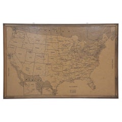
Vintage Framed United States Map
Located in Queens, NY
Vintage aged paper map of the United States mounted on particle board and framed in a simple wooden
Category
20th Century American Mid-Century Modern Maps
Materials
Wood, Paper
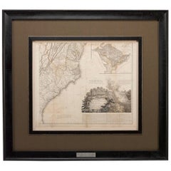
1812 United States Map, by Pierre Tardieu, Antique French Map Depicting the U.S.
By Pierre François Tardieu
Located in Colorado Springs, CO
Arrowsmith’s 4-sheet map of the United States, this map is completely engraved by Tardieu in Paris and
Category
Antique 1810s French Maps
Materials
Paper
H 43.5 in W 48 in D 2.25 in
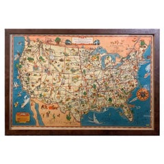
1939 "A Good-Natured Map of the United States" by Greyhound
Located in Colorado Springs, CO
Presented is an original 1939 map, titled “A Good-Natured Map of the United States Setting Forth
Category
Vintage 1930s American Art Deco Maps
Materials
Paper
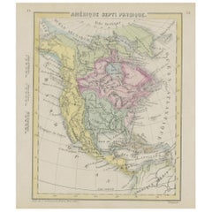
Small Map of the United States
Located in Langweer, NL
Antique map titled 'Amérique septe. Physique'. Small map of the United States. lithographed by C
Category
Antique Mid-19th Century Maps
Materials
Paper
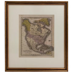
1830 Mexico and United States Framed Map
Located in Stamford, CT
Map of North America published circa 1830. Map shows United States into Canada. Mexico extending
Category
Antique 1830s American American Classical Maps
Materials
Glass, Wood, Paper
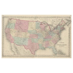
Antique Map Colton's United States of America
Located in Langweer, NL
Antique map titled 'Colton's United States of America'. Show railroads, canals, state capitals
Category
Antique Mid-19th Century Maps
Materials
Paper
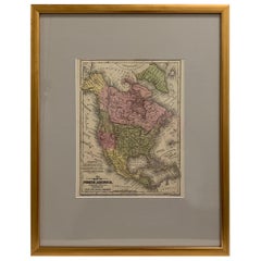
Framed 1839 Hand Colored Map of the United States
Located in Stamford, CT
Framed hand colored map of the United States of America from 1839. Newly framed in a giltwood frame.
Category
Antique 1830s American American Classical Maps
Materials
Giltwood, Paper, Glass
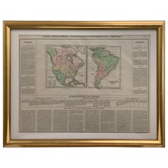
Framed 1820s Hand Colored Map of the United States
Located in Stamford, CT
Framed 1820s hand colored map photos of North America and South America. As found framed in
Category
Antique 1820s American Spanish Colonial Maps
Materials
Giltwood, Paper, Glass
Antique Map of The United States of North America, Pacific States, 1882
Located in Langweer, NL
The map is from the same 1882 Blackie Atlas and focuses on the Pacific States of the United States
Category
Antique 1880s Maps
Materials
Paper
1874 Map of the United States with Territorial Boundaries
Located in Langweer, NL
Title: 1874 Map of the United States with Territorial Boundaries
Description: This is an 1874 map
Category
Antique 1870s Maps
Materials
Paper
Antique Map of the United States by Titus '1871'
Located in Langweer, NL
Antique map titled 'The United States of America'. Original antique map of the United States. This
Category
Antique Late 19th Century Maps
Materials
Paper
Antique Map of the United States by Lowry, '1852'
Located in Langweer, NL
Antique map titled 'United States'. Four individual sheets of the United States. This map
Category
Antique Mid-19th Century Maps
Materials
Paper
Antique Map of the United States by Balbi '1847'
Located in Langweer, NL
Antique map titled 'Etats-Unis'. Original antique map of the United States. This map originates
Category
Antique Mid-19th Century Maps
Materials
Paper
1866 Ensign & Bridgman's Rail Road Map of the United States
Located in Colorado Springs, CO
Presented is an 1866 issue of “Ensign & Bridgeman’s Rail Road Map of the United States, showing
Category
Antique 1860s American Late Victorian Maps
Materials
Paper
Steel Engraved Map of the United States with Inset Map of Florida
Located in Langweer, NL
Antique map titled 'United States'. Steel engraved map of the United States. With small inset map
Category
Antique Mid-19th Century Maps
Materials
Paper
1856 U.S. Coast Survey Map of Chesapeake Bay and Delaware Bay
Located in Colorado Springs, CO
of the United States Coast Survey.
The Office of the Coast Survey, founded in 1807 by President
Category
Antique 1850s American Maps
Materials
Paper
Antique Map of the Eastern United States with Inset Map of Texas
Located in Langweer, NL
. Inset map of the "southern principal part of Texas." Shows states, major cities, railroads, topography
Category
Antique Mid-19th Century Maps
Materials
Paper
Large Original Antique Map of the United States of America. 1891
By Rand McNally & Co.
Located in St Annes, Lancashire
Fabulous map of The United States
Original color
By Rand, McNally & Co.
Dated 1891
Unframed
Category
Antique 1890s American Maps
Materials
Paper
"The United States from the Latest Authorities" Antique Wall Map, 1835
Located in Colorado Springs, CO
This is a 1835 map of “The United States from the Latest Authorities” by Ezra Strong. A hand
Category
Antique 1830s American Maps
Materials
Paper
1847 Ornamental Map of the United States & Mexico by H. Phelps
Located in Colorado Springs, CO
map of the United States expressing U.S. dominance of the North American continent. The hand-colored
Category
Antique 1840s American Maps
Materials
Paper
Antique Map of the United States with Vignette of Washington
Located in Langweer, NL
Antique map titled 'États-Unis'. A very attractive and detailed late 19th century map of the United
Category
Antique Late 19th Century Maps
Materials
Paper
Old Decorative Pictorial Map of the United States, circa 1953
Located in Langweer, NL
Antique map titled 'A Pictorial Map of the United States of America Showing Principal Regional
Category
20th Century Maps
Materials
Paper
Original Antique Map of United States, Grattan and Gilbert, 1843
Located in St Annes, Lancashire
Great map of United States
Drawn and engraved by Archer
Published by Grattan and Gilbert. 1843
Category
Antique 1840s English Maps
Materials
Paper
Antique Map of the Eastern United States by Levasseur '1875'
Located in Langweer, NL
map of the Eastern United States. This map originates from 'Atlas de Géographie Moderne Physique et
Category
Antique Late 19th Century Maps
Materials
Paper
Antique Map of The United States of North America, 1882
Located in Langweer, NL
This is a historical map titled "The United States of North America, Central Part" from the 1882
Category
Antique 1880s Maps
Materials
Paper
Antique Map of the Southern United States with Inset Map of New Orleans
Located in Langweer, NL
Antique map titled 'Die Staaten von Arkansas Mississippi, Louisiana & Alabama'. Detailed map of the
Category
Antique Mid-19th Century Maps
Materials
Paper
H 9.06 in W 12.21 in D 0.02 in
Large Vintage Maps of the United States, in 3 Sections, 1920
Located in St Annes, Lancashire
Great maps of the USA in 3 sections
Unframed
Original color
By John Bartholomew and Co
Category
Vintage 1920s British Maps
Materials
Paper
1859 "Map of the United States of America..." by J. H. Colton
By J.H. Colton
Located in Colorado Springs, CO
Presented is an 1859 “Map of the United States of America, the British Provinces, Mexico, the West
Category
Antique 1850s American Maps
Materials
Paper
Antique Map of the United States ' North East ' by Johnston '1909'
Located in Langweer, NL
Antique map titled 'United States of North America'. Original antique map of United States of North
Category
Early 20th Century Maps
Materials
Paper
Antique Map of the United States 'North West' by Johnston, '1909'
Located in Langweer, NL
Antique map titled 'United States of North America'. Original antique map of the United States of
Category
Early 20th Century Maps
Materials
Paper
Antique Map of the United States ' South East ' by Johnston '1909'
Located in Langweer, NL
Antique map titled 'United States of North America'. Original antique map of United States of North
Category
Early 20th Century Maps
Materials
Paper
Antique Map of the United States of North America, c.1882
Located in Langweer, NL
Antique map titled 'United States of North America'. Old map of the United States of North America
Category
Antique 1880s Maps
Materials
Paper
Antique Map of the United States of America by Lapie '1842'
Located in Langweer, NL
Antique map titled 'Carte des États-Unis d'Amérique'. Map of the United States of America (USA
Category
Antique Mid-19th Century Maps
Materials
Paper
Colourful Old Detailed Map of Northern Carolina, United States of America
Located in Langweer, NL
Vintage map titled 'The Geographical Publishing Company's Premier Map of North Carolina'. Beautiful
Category
Early 20th Century Maps
Materials
Paper
H 15.56 in W 21.46 in D 0.02 in
1863 "Lloyd's New Map of the United States, the Canadas, and New Brunswick"
Located in Colorado Springs, CO
Presented is “Lloyd's New Map of the United States, the Canadas and New Brunswick, From the latest
Category
Antique 1860s American Maps
Materials
Linen, Wood, Paper
Ornate 1850s Map of the United States: Featuring Iconic Landmarks and Portrets
Located in Langweer, NL
Ornate 1850s Map of the United States: Featuring Iconic Landmarks and Historical Portraits
This
Category
Antique 1850s Maps
Materials
Paper
H 10.95 in W 14.26 in D 0.01 in
Antique Map of the United States with inset map of the region of Mexico City
Located in Langweer, NL
the United States of America showing the Caribbean. With an inset map of the surrounding area of
Category
Antique Mid-19th Century Maps
Materials
Paper
H 14.69 in W 17.92 in D 0.02 in
Antique Map of the United States of North America by Johnston '1909'
Located in Langweer, NL
Antique map titled 'United States of North America'. Original antique map of United States of North
Category
Early 20th Century Maps
Materials
Paper
Antique Railroad Map of the United States by Rand, McNally & Co, 1900
Located in Langweer, NL
Antique map titled 'Rand, McNally & Co's New Official Railroad map of the United States with
Category
20th Century Maps
Materials
Linen, Paper
Antique Map of the United States of North America by Wyld '1845'
Located in Langweer, NL
Antique map titled 'Map of The United States of North America'. Original antique map of the United
Category
Antique Mid-19th Century Maps
Materials
Paper
Antique Map of the Northeastern United States and Canada by Tardieu, 1802
Located in Langweer, NL
.
States and Provinces Mentioned:
The map covers various states in the northeastern United States and
Category
Antique Early 1800s Maps
Materials
Paper
H 16.34 in W 22.25 in D 0.01 in
Antique Map of Part of the United States Including Lower California & Arizona
Located in Langweer, NL
Antique map of part of the United States of America including Lower California, Arizona and part of
Category
Antique Late 19th Century Maps
Materials
Paper
H 15.08 in W 18.75 in D 0.02 in
Old Map the United States and Central America, Including Mexico, ca.1860
Located in Langweer, NL
Antique map titled 'Vereinigte Staaten von Nord America und Mexico'.
Old map the United States
Category
Antique 1860s Maps
Materials
Paper
Antique Map with Hand Coloring of the United States and the Caribbean
Located in Langweer, NL
the United States of America showing the Caribbean. With an inset map of the surrounding area of
Category
Antique Late 19th Century Maps
Materials
Paper
H 15.08 in W 18.71 in D 0.02 in
Antique Map of the United States of America, also showing the Caribbean
Located in Langweer, NL
the United States of America showing the Caribbean. With an inset map of the surrounding area of
Category
Antique Mid-19th Century Maps
Materials
Paper
H 14.38 in W 17.88 in D 0.02 in
Antique Map of The United States Southern Section by A & C. Black, 1870
Located in Langweer, NL
Antique map titled 'United States Southern Section'. Original antique map of Map of The United
Category
Antique Late 19th Century Maps
Materials
Paper
H 17.52 in W 23.63 in D 0.02 in
Antique Map of The United States and Canada by A & C. Black, 1870
Located in Langweer, NL
Antique map titled 'United States North Eastern Section and Canada'. Original antique map of Map of
Category
Antique Late 19th Century Maps
Materials
Paper
Antique Map of the Early United States by Pierre Antoine Tardieu (1784-1869)
Located in Langweer, NL
," depicting the early United States and adjacent regions. This map, created by Pierre Antoine Tardieu, shows
Category
Antique Early 1800s Maps
Materials
Paper
H 16.34 in W 22.25 in D 0.01 in
Antique Map of the Coal Fields of the United States by Walker '1874'
Located in Langweer, NL
Antique map titled 'Map of the coal fields of the United States, compiled from state reports and
Category
Antique Late 19th Century Maps
Materials
Paper
Antique 1844 J Calvin Smith JH Colton Midwest United States Survey Map 27"
By J.H. Colton
Located in Dayton, OH
Antique framed black and white map of seven Midwestern American states. Guide Through Ohio
Category
Antique 1840s Maps
Materials
Paper
H 21 in W 26.5 in D 0.5 in
English Engraved Hand Colored Map of the North Eastern United States, circa 1817
Located in Charleston, SC
English copper engraved hand colored map of the North Eastern United States matted under glass in a
Category
Antique 1810s English George III Maps
Materials
Paper, Paint, Giltwood, Glass
H 22 in W 25.75 in D 1 in
Early 19th Century Hand Colored Map of the United States and Caribbean Islands
Located in Hamilton, Ontario
" (United States and Greater Antilles).
Category
Antique Early 19th Century French Maps
Materials
Paper
H 13.5 in W 10 in D 0.975 in
Set of 4 Antique Maps of part of the United States of America
Located in Langweer, NL
Set of four individual antique maps of part of the United States. Published as part of a set of six
Category
Antique Mid-19th Century Maps
Materials
Paper
Set of 2 Antique Maps of the United States by W. G. Blackie, 1859
Located in Langweer, NL
Antique map titled 'The United States of North America, Atlantic States and Valley of the
Category
Antique Mid-19th Century Maps
Materials
Paper
1842 Wall Map of the United States by J. H. Young, Published by S. A. Mitchell
Located in Colorado Springs, CO
Presented is an 1842 hanging “Map of the United States,” engraved by J. H. Young and published by
Category
Antique 1840s American Maps
Materials
Paper
H 45 in W 38 in D 1 in
Antique Map of the Eastern United States with Only the Northern Part of Florida
Located in Langweer, NL
. Inset map of the "southern principal part of Texas." Shows states, major cities, railroads, topography
Category
Antique Mid-19th Century Maps
Materials
Paper
H 14.45 in W 17.92 in D 0.02 in
Pl. 9 Antique Map of the Air Movement of the United States by Walker '1874'
Located in Langweer, NL
Office of the Chief Signal Officer of the Army'. Antique map of the barometer air movement of the United
Category
Antique Late 19th Century Maps
Materials
Paper
H 21.66 in W 31.11 in D 0.02 in
Old German Map of the United States, Central America and the West Indies, c.1870
Located in Langweer, NL
Antique map titled 'Westindien, Mittelamerica und Vereinigte Staten'. Old map of the United States
Category
Antique 19th Century Maps
Materials
Paper
H 13.78 in W 17.68 in D 0 in
"Atlas to Accompany Monograph XXXII on the Geology of Yellowstone National Park"
By United States Geological Survey
Located in Colorado Springs, CO
the United States Geological Survey’s principal geologists when it was established in 1879.
In 1883
Category
Antique Early 1900s American Maps
Materials
Leather, Fabric, Paper
H 23.13 in W 20 in D 1.75 in
Antique Chart of the Storm Centres of the United States, 1874
Located in Langweer, NL
. '. Chart of the frequency of the storm centres of the United States. Originates from 'Statistical Atlas of
Category
Antique Late 19th Century Maps
Materials
Paper
- 1
- ...
Get Updated with New Arrivals
Save "United States Map", and we’ll notify you when there are new listings in this category.
United States Map For Sale on 1stDibs
Find many varieties of an authentic United states map available at 1stDibs. Each United states map for sale was constructed with extraordinary care, often using paper, wood and metal. There are 317 variations of the antique or vintage United states map you’re looking for, while we also have 6 modern editions of this piece to choose from as well. Whether you’re looking for an older or newer United states map, there are earlier versions available from the 18th Century and newer variations made as recently as the 21st Century. When you’re browsing for the right United states map, those designed in Mid-Century Modern, Industrial and Victorian styles are of considerable interest. Many designers have produced at least one well-made United states map over the years, but those crafted by Rand McNally & Co., Curtis Jere and Denoyer-Geppert are often thought to be among the most beautiful.
How Much is a United States Map?
Prices for a United states map can differ depending upon size, time period and other attributes — at 1stDibs, they begin at $69 and can go as high as $80,000, while the average can fetch as much as $1,550.
Questions About United States Map
- 1stDibs ExpertFebruary 13, 2024Yes, there are watches that are made in the United States. Over the last few decades, a number of luxury watchmakers have begun manufacturing their timepieces in the U.S. Among them are RGM, Xeric and Shinola. One of the most famous American watchmakers is Elgin National, which produced watches in the U.S. from 1863 through the 1960s. On 1stDibs, shop a large selection of watches.
- 1stDibs ExpertMarch 22, 2022Yes, Marc Chagall migrated to the United States. The Jewish artist fled Europe during World War II, moving to New York City in 1941. He settled in France in 1947 and lived there until he died in 1985. On 1stDibs, shop a range of Marc Chagall art.
