Roman Empire Map

to
4
31
2
33
13
19
1
1
1
32
3
1
1
1
33
33
33
2
1
Sort By
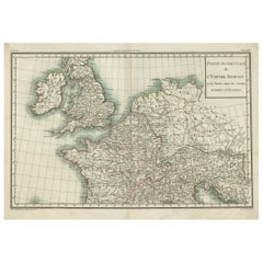
Western Roman Empire Map: British Isles & Gaul - 1802 Tardieu Atlas
Located in Langweer, NL
) **Geographical Scope:** This antique map illustrates the western part of the Roman Empire or the known world of
Category

Antique Early 1800s Maps

Materials

Paper

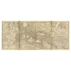
Rare 1730 Roman Empire Map by Moll - Detailed and Engraved Masterpiece
Located in Langweer, NL
An Historical Map of the Roman Empire and the Neighbouring Barbarous Nations by Herman Moll - Circa
Category

Antique 1730s Maps

Materials

Paper

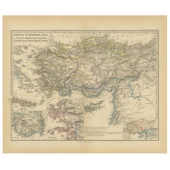
Asia Minor and Provinces: A Roman Empire Map from Spruner-Menke Atlas, 1880
Located in Langweer, NL
during the Roman Empire. The map is interesting for a number of reasons: 1. **Comprehensive Detail
Category

Antique 1880s Maps

Materials

Paper

Original Antique Map of the Roman Empire
Located in Langweer, NL
Antique map titled 'Carte de l'Empire Romain'. Original antique map of the Roman Empire, two sheets
Category

Antique Late 18th Century Maps

Materials

Paper

Original Antique Map of the Roman Empire
H 19.06 in W 27.84 in D 0.02 in
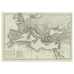
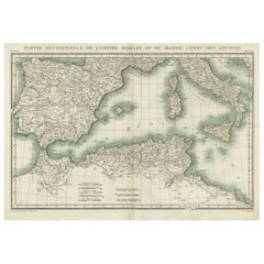
Iberian Peninsula & Mediterranean Map: Western Roman Empire, by Tardieu, 1802
Located in Langweer, NL
Antique Map with Title: "Partie Occidentale de l'Empire Romain ou du Monde connu des Anciens
Category

Antique Early 1800s Maps

Materials

Paper

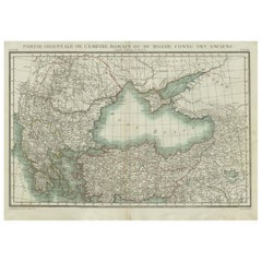
Black Sea & Eastern Mediterranean Map: Eastern Roman Empire, Tardieu Atlas, 1802
Located in Langweer, NL
map illustrates the eastern part of the Roman Empire or the known world of the ancients. It focuses on
Category

Antique Early 1800s Maps

Materials

Paper

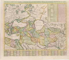
18th-Century Map of the Eastern Roman Empire by Henri Chatelain, c. 1719
Located in Langweer, NL
Title: 18th-Century Map of the Eastern Roman Empire by Henri Chatelain, c. 1719 Description: This
Category

Antique 1710s Maps

Materials

Paper

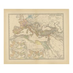
Imperium Romanum: A Detailed Map of the Roman Empire in its Zenith, 1880
Located in Langweer, NL
This original antique map, titled "IMPERIVM ROMANVM", is a detailed depiction of the Roman Empire
Category

Antique 1880s Maps

Materials

Paper

Antique Map of Part of the Roman Empire by H. Kiepert, circa 1870
By Heinrich Kiepert
Located in Langweer, NL
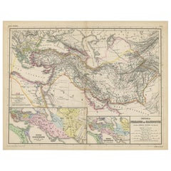
Antique map titled 'Imperia Persarum et Macedonum'. Depicts part of the Roman Empire, from Greece
Category

Antique Late 19th Century Maps

Materials

Paper

Antique Map of The Regions of Italy and Sicily during the Roman Empire, 1880
Located in Langweer, NL
during the Roman Empire. These regions are distinguished by different colors outlining their boundaries
Category

Antique 1880s Maps

Materials

Paper

Antique Map of the British Isles According to the Geography of the Roman Empire
Located in Langweer, NL
shows a rudimentary outline of the islands according to the geography of the Roman Empire, after
Category

Antique Late 18th Century Maps

Materials

Paper

Antique Map of Britain in Roman Times
Located in Langweer, NL
register of the stations and distances along the various roads of the Roman empire. This map originates
Category

Antique Early 19th Century Maps

Materials

Paper

Antique Map of Britain in Roman Times
H 17.6 in W 11.07 in D 0.02 in
Antique Map Made After a Roman Papyrus Travel Map, Known as Peutinger Map, 1773
Located in Langweer, NL
as Peutinger's Tabula or Peutinger Table, is an illustrated itinerarium (ancient Roman road map
Category

Antique 18th Century Maps

Materials

Paper

Ancient Italy: Regions and Rome in the Roman Empire, Published in 1880
Located in Langweer, NL
. 4. **Infrastructure**: The map includes Roman roads, aqueducts, and possibly the locations of
Category

Antique 1880s Maps

Materials

Paper

18th-Century Map of the Swiss Confederation by Robert de Vaugondy
Located in Langweer, NL
Roman Empire. Condition: The map is in very good condition, with sharp engraving and well-preserved
Category

Antique 1750s Maps

Materials

Paper

Rare 1572 Map of Ancient Rome with Monuments by Ligorio, Braun & Hogenberg
Located in Langweer, NL
, monuments, and surviving antiquities from the Roman Empire. The map intricately portrays the city as it
Category

Antique 16th Century Maps

Materials

Paper

Johannes Janssonius' 17th-Century Map of the Duchy of Bremen in Germany
Located in Langweer, NL
Roman Empire. This map is a fascinating artifact, offering insights into the political, geographical
Category

Antique 1650s Maps

Materials

Paper

Bishopric of Hildesheim Map in Northern Germany by Willem & Joan Blaeu, 1645
Located in Langweer, NL
Roman Empire. The map shows the area surrounding the city of Hildesheim, which served as the seat of the
Category

Antique 1640s Maps

Materials

Paper

Ancient Gaul: A Cartographic Overview of Gallic Tribes and Roman Provinces, 1880
Located in Langweer, NL
representation of the Roman province before the fall of the Roman Empire. 2. **Rich Detail**: The map includes
Category

Antique 1880s Maps

Materials

Paper

North African Coasts: Marmarica to Mauretania in Roman Times, Published in 1880
Located in Langweer, NL
depicted on the map is during Roman antiquity, specifically during the Roman Republic and Roman Empire when
Category

Antique 1880s Maps

Materials

Paper

Empire of the Parthians: Historical Cartographic Masterpiece by d'Anville, 1819
Located in Langweer, NL
Persia, rivaling the Roman Empire. The map showcases the vast expanse of the Parthian Empire, stretching
Category

Antique 1810s Maps

Materials

Paper

Original Old Composite of Several Maps of the Ancient World on One Sheet, 1880
Located in Langweer, NL
Europe, North Africa, and parts of Asia, reflecting the Roman Empire at its extent. The map includes
Category

Antique 1880s Maps

Materials

Paper

Rare Engraved City Plan of Nuremberg, Bavaria by Christoph Weigel, 1718
Located in Langweer, NL
within the Holy Roman Empire. Condition Report: The map is slightly stained but in very good condition
Category

Antique 1710s Maps

Materials

Paper

Vintage Hand-Painted Map of Roman Empire
Located in Houston, TX
Hand-painted school chart in Flemish depicting the Roman Empire and its two chief rivals. The chart
Category

Vintage 1950s Belgian Maps

Antique Map of Europe by J. Janssonius, circa 1650
Located in Langweer, NL
northern tip of Africa, as it was during the time of the Roman Empire. The map is filled with ancient place
Category

Antique Mid-17th Century Maps

Materials

Paper

Framed Map of Roman Empire
Located in Essex, MA
Dated 1626. Depicting the Roman Empire. Hand colored.
Category

Antique 1650s English Maps

Materials

Paper

Framed Map of Roman Empire
H 27.5 in W 32.5 in D 1.5 in
Antique Map of the Roman Empire 'c.1860'
Located in Langweer, NL
Antique map titled 'Empire Romain'. Large, original antique map of the Roman Empire. This map
Category

Antique Mid-19th Century Maps

Materials

Paper

Antique Map of the Roman Empire 'c.1860'
H 24.02 in W 33.08 in D 0.02 in
Antique Map of the Roman Empire by Johnson, '1872'
Located in Langweer, NL
Antique map titled 'Johnson's Roman Empire in the time of Christ and his Apostles'. Original map of
Category

Antique Late 19th Century Maps

Materials

Paper

Antique Map of the Roman Empire by Lapie, 1842
Located in Langweer, NL
Antique map titled 'Carte de l'Empire Romain'. Map of the Roman Empire. This map originates from
Category

Antique Mid-19th Century Maps

Materials

Paper

Antique Map of the Roman Empire by Lapie, 1842
H 19.89 in W 26.78 in D 0.02 in
Antique Map of the Roman Empire by H. Kiepert, circa 1870
By Heinrich Kiepert
Located in Langweer, NL
Antique map titled 'Imperium Romanium'. This map depicts a large part of Europe including countries
Category

Antique Late 19th Century Maps

Materials

Paper

Antique Map of the Netherlands in the time of the Domination by the Roman Empire
Located in Langweer, NL
'. Copper engraved map of the Netherlands in the time of the domination by the Roman Empire. The map also
Category

Antique Mid-18th Century Maps

Materials

Paper

The Roman Empire from the Time of Constantine the Great, Published in 1880
Located in Langweer, NL
Roman Empire from the time of Constantine the Great." This map is designed to represent the Roman
Category

Antique 1880s Maps

Materials

Paper

1838 The History of the Decline and Fall of the Roman Empire
By Edward Gibbon
Located in Bath, GB
folding maps. Complete in eight volumes. 'The Decline and Fall of the Roman Empire’ has become one of
Category

Antique 1830s European Books

Materials

Paper

Get Updated with New Arrivals
Save "Roman Empire Map", and we’ll notify you when there are new listings in this category.

Roman Empire Map For Sale on 1stDibs

At 1stDibs, there are many versions of the ideal roman empire map for your home. Frequently made of paper, animal skin and fabric, every roman empire map was constructed with great care. You’ve searched high and low for the perfect roman empire map — we have versions that date back to the 18th Century alongside those produced as recently as the 20th Century are available. Each roman empire map bearing neoclassical hallmarks is very popular. You’ll likely find more than one roman empire map that is appealing in its simplicity, but Johann Baptist Homann, Heinrich Kiepert and Rand McNally & Co. produced versions that are worth a look.

Finding the Right Collectibles-curiosities for You

Antique and vintage collectibles and curiosities can bring whimsy and wonder to any interior. 

Decorating with old scientific instruments, historical memorabilia and vintage musical instruments, as well as other authentic collectibles and curiosities that can be found on 1stDibs, presents an opportunity to create a unique, natural history museum-like atmosphere in your home that can provoke conversation as often as it pays tribute to how far we’ve come in understanding our world. 

And bringing collectibles and curiosities into your space is actually on trend — Wunderkammern, or curiosity cabinets, were all the rage in Europe during the 1500s and continued to have adherents there and in the U.S. in the following centuries. Today, however, they’re experiencing a real surge in popularity and influencing how many interior designers are furnishing and decorating homes — combining contemporary with antique, scientific with tribal, earthly with extraterrestrial, Les Lalanne tables with Flemish tapestries.

The original Wunderkammern were entire rooms filled with objects demonstrating their owners’ worldly knowledge: A proper one included artificiala or preciosa (objets d’art); naturalia (such as skeletons, shells, minerals); exotica (taxidermy or dried plants); and scientifica (scientific instruments), frequently alongside religious relics and ancient artifacts.

Pay tribute to a history of rich and diverse musical traditions that have taken shape all over the world by decorating your home with a collection of antique and vintage musical instruments — with a little help from strong hanging wire or some wall hooks, vintage brass instruments such as a gong, French horn or trumpet can help elevate a home office or complement the efforts you’ve made to ensure a welcoming vibe in your home’s entryway. Bells or antique wind instruments can add provocative metallic contrasts to dark woods as tabletop decorative objects.  

Create an intriguing focal point with Georgian scientific instruments, such as stick barometers with mahogany cases or lacquered brass telescopes. These items stem from an era named for the monarchies of the four King Georges, who ruled England in succession starting in 1714 (plus King William’s reign, which lasted until 1837). Just as there was beautiful jewelry produced during the period that today is coveted by collectors, there is much to be found in the collectibles and curiosities realm too.

Wanderlust, nostalgia and a shared love of good design are contributing factors to certain trends in decorating — just as vintage trunks and luggage have reappeared as furniture or home accents in a bedroom or foyer, decorating with globes, maps or nautical objects is similarly rooted in the allure of travel and a penchant for the stylish finishing touch that collectibles bring to our homes.

Find a wide range of antique and vintage collectibles and curiosities on 1stDibs.

Read More

Medal-Worthy Memorabilia from Epic Past Olympic Games

Get into the games! These items celebrate the events, athletes, host countries and sporting spirit.

Ahoy! You’ve Never Seen a Collection of Sailor Art and Kitsch Quite Like This

French trendsetter and serial collector Daniel Rozensztroch tells us about his obsession with objects related to seafaring men.

39 Incredible Swimming Pools

It's hard to resist the allure of a beautiful pool. So, go ahead and daydream about whiling away your summer in paradise.

Pamela Shamshiri Shares the Secrets behind Her First-Ever Book and Its Effortlessly Cool Interiors

The sought-after designer worked with the team at Hoffman Creative to produce a monograph that beautifully showcases some of Studio Shamshiri's most inspiring projects.

Moroccan Artworks and Objects Take Center Stage in an Extraordinary Villa in Tangier

Italian writer and collector Umberto Pasti opens the doors to his remarkable cave of wonders in North Africa.

Montecito Has Drawn Royalty and Celebrities, and These Homes Are Proof of Its Allure

Hollywood A-listers, ex-pat aristocrats and art collectors and style setters of all stripes appreciate the allure of the coastal California hamlet — much on our minds after recent winter floods.

Whaam! Blam! Pow! — a New Book on Pop Art Packs a Punch

Publishing house Assouline and writer Julie Belcove have teamed up to trace the history of the genre, from Roy Lichtenstein, Andy Warhol and Yayoi Kusama to Mickalene Thomas and Jeff Koons.

The Sparkling Legacy of Tiffany & Co. Explained, One Jewel at a Time

A gorgeous new book celebrates — and memorializes — the iconic jeweler’s rich heritage.