North Africa Map
to
4
34
3
17
11
10
8
7
4
3
3
3
3
2
2
2
2
2
2
2
1
1
1
1
1
1
1
1
1
1
1
1
1
1
1
1
2
1
1
1
Sort By
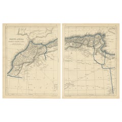
Antique Map of North Africa by Lowry '1852'
Located in Langweer, NL
Antique map titled 'North Africa Marocco Algiers & Tunis'. Two individual sheets of North Africa
Category
Antique Mid-19th Century Maps
Materials
Paper
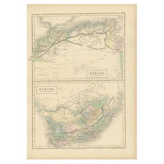
Antique Map of North Africa and South Africa by Black, 1854
Located in Langweer, NL
Antique map titled 'Africa north part - Africa south part'. Old map of Africa showing the region of
Category
Antique 19th Century Maps
Materials
Paper
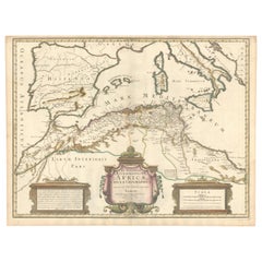
1700 Guillaume Delisle Map: Western Mediterranean & Moorish North Africa
Located in Langweer, NL
1700 Guillaume Delisle Map: Western Mediterranean & Moorish North Africa
This hand-colored map
Category
Antique Early 1700s Maps
Materials
Paper
H 19.1 in W 25.2 in D 0.02 in
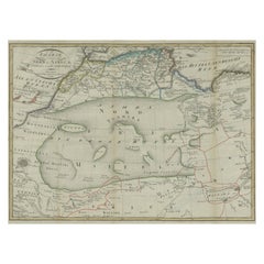
Antique Map of North Africa including the Sahara Desert
Located in Langweer, NL
Antique map titled 'Charte von Nord-Africa'. Scarce map of North Africa. Includes a fantastic
Category
Antique Early 19th Century Maps
Materials
Paper
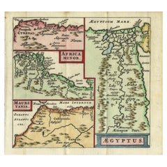
Antique Map of North Africa showing Egypt, Mauritania and Africa Minor, 1672
Located in Langweer, NL
Antique map titled 'Africa Minor, Mauritania , Aegyptus.' Charming miniature map of North Africa
Category
Antique 17th Century Maps
Materials
Paper
H 5.63 in W 5.12 in D 0 in
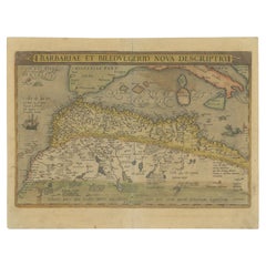
Antique Map of North Africa by Ortelius, c.1580
Located in Langweer, NL
Africa. The map covers the regions of Barbaria and Biledulgerid, essentially the territories north and
Category
Antique 16th Century Maps
Materials
Paper
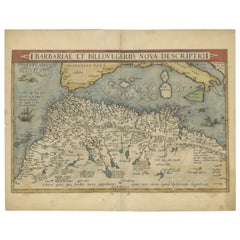
Antique Map of North Africa by Ortelius, c.1600
Located in Langweer, NL
Antique map titled 'Barbariae et Biledulgerid nova descriptio'.
Old map of coastal North Africa
Category
Antique 17th Century Maps
Materials
Paper
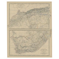
Antique Map of North and South Africa by Johnston, 1882
Located in Langweer, NL
Two antique maps on one sheet titled 'N.W. Africa, Marocco, Algeria & Tunis' and 'Southern Africa
Category
Antique 19th Century Maps
Materials
Paper
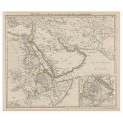
North & Central Africa & Arabia, Inset Map of Habesch 'Ethiopia & Eritrea', 1845
Located in Langweer, NL
Antique map titled 'Mittel- und Nord-Africa (östl. Theil) und Arabien'.
This map depicts North
Category
Antique 1840s Maps
Materials
Paper
H 14.18 in W 17.33 in D 0 in
1640 Map of North Africa Nova Barbariae Descriptio or The Barbarian Coast
Located in Langweer, NL
1640 Antique Map of North Africa 'Nova Barbariae Descriptio' by Johannes Janssonius
This antique
Category
Antique 1640s Maps
Materials
Paper
H 20.08 in W 23.43 in D 0 in
Old Map of North Africa Depicting Libya, Morocco, Algeria, Tunis Etc, 1922
Located in Langweer, NL
Antique map of Africa titled 'Northern Africa'.
Old map of North Africa depicting Libya
Category
Vintage 1920s Maps
Materials
Paper
H 17.92 in W 23.23 in D 0 in
Antique Map of North and West Africa by J.B. Elwe, 1792
Located in Langweer, NL
Beautiful richly engraved map of North and West Africa, based upon the earlier maps of De L'Isle
Category
Antique Late 19th Century Maps
Materials
Paper
Copper-Engraved Map Showing the Algerian Coast of North Africa, Published 1683
Located in Langweer, NL
showing the Algerian coast of North Africa. Published 1683.
Artists and Engravers: Nicholas Sanson
Category
Antique 1680s Maps
Materials
Paper
H 8.51 in W 11.78 in D 0 in
"Nova Barbariae Descriptio", a 17th Century Hand-Colored Map of North Africa
By Johannes Janssonius
Located in Alamo, CA
This original attractive 17th century hand-colored map of North Africa entitled "Nova Barbariae
Category
Antique Mid-17th Century Dutch Maps
Materials
Paper
H 22.38 in W 29 in D 0.13 in
Rare Map of North Africa Depicting Numidia, Libia and Morocco, Published C.1740
Located in Langweer, NL
Antique map Africa titled 'Mauretania, Numidia, Gaetulia & c.'.
Rare map of North Africa
Category
Antique 1740s Maps
Materials
Paper
H 9.45 in W 14.57 in D 0 in
Antique Map of North-Western and South Africa by A.K. Johnston, 1865
Located in Langweer, NL
Two maps on one sheet titled 'North-Western Africa' and 'Southern Africa'. Depicting Morocco
Category
Antique Mid-19th Century Maps
Materials
Paper
Map of the West African coast from the North of Mauretania to Guinee, 1788
Located in Langweer, NL
Verga, and of the Course of the Rivers Senega and Gambia.'
Map of the African coast from the north
Category
Antique 1780s Maps
Materials
Paper
H 21.7 in W 14.93 in D 0 in
Very Attractive Map of North and South America and Western Part of Africa, 1744
Located in Langweer, NL
Antique map titled 'Nieuwe Kaart van America.' Very attractive map of North and South America, the
Category
Antique 18th Century Maps
Materials
Paper
H 16.34 in W 21.26 in D 0 in
Antique Map of Northern Africa by Perthes, 1848
Located in Langweer, NL
Antique map titled 'Africa Propria (..)'. Old map of North Africa and the region of Babylon
Category
Antique 19th Century Maps
Materials
Paper
Antique Map of Northwest Africa by Bartholomew, 1922
Located in Langweer, NL
Antique map of Africa titled 'North-West Africa'. Old map of north-west Africa depicting Morocco
Category
20th Century Maps
Materials
Paper
Crossroads of Continents: Spain's North African Enclaves in 1903
Located in Langweer, NL
The image for sale is a historical map of Spanish possessions in North Africa, dated 1903. The map
Category
Antique Early 1900s Maps
Materials
Paper
Rare Antique Map of 'Barbarie' or Northern Africa, 1655
Located in Langweer, NL
Tripoli et Pays Circomvoisins'. This map depicts North Africa with Malta and originates from 'Cartes
Category
Antique 17th Century Maps
Materials
Paper
Antique Map of Western and Eastern Barbary in Africa, c.1744
Located in Langweer, NL
of the Eastern Parts of Barbary'. Decorative maps of North Africa and the Southern Mediterranean
Category
Antique 18th Century Maps
Materials
Paper
North African Coasts: Marmarica to Mauretania in Roman Times, Published in 1880
Located in Langweer, NL
The map with the title "MARMARICA, CYRENAICA, AFRICA, NUMIDIA, MAURETANIA secundum Italiam Poetarum
Category
Antique 1880s Maps
Materials
Paper
H 15.56 in W 18.51 in D 0 in
18th-Century Biblical Map of the Colonies of Ham: Africa, Middle East and Beyond
Located in Langweer, NL
.
### Key Features and Analysis:
1. Regions Depicted:
- North Africa: The map shows the regions of
Category
Antique 1790s Maps
Materials
Paper
H 9.06 in W 11.03 in D 0 in
Large Decorative Map of the Iberian Peninsula
Located in Langweer, NL
Islands and part of the north coast of Africa. The map is based on the cartography of Rodrigo Mendez Sylva
Category
Antique Mid-18th Century Maps
Materials
Paper
Vintage Mural Map of North Africa Countrycore African Wall Chart Decoration
Located in Berghuelen, DE
The wall map shows North Africa. It was published by Westermann-Schulwandkarten. Used as teaching
Category
Late 20th Century German Country Prints
Materials
Canvas, Wood, Paper
H 61.42 in W 100.01 in D 0.79 in
Africa. North-East Part. Century Atlas antique vintage map
Located in Melbourne, Victoria
'The Century Atlas. Africa. North-East Part'
Original antique map, 1903.
Inset map of 'Nile Delta
Category
Early 20th Century Victorian More Prints
Materials
Lithograph
Africa. North-West Part. Century Atlas antique vintage map
Located in Melbourne, Victoria
'The Century Atlas. Africa. Southern Part'
Original antique map, 1903.
Central fold as issued
Category
Early 20th Century Victorian More Prints
Materials
Lithograph
illustrated map of Morocco created in 1950 by Delaye
Located in PARIS, FR
are represented. This illustrated map is printed by Perceval in Rabat.
Map - North Africa
Category
1950s Prints and Multiples
Materials
Paper, Lithograph
The War: An Intimate History, 1941-1945 Hardcover Book by Ken Burns
Located in North Hollywood, CA
were shipped off to Europe, the Pacific, and North Africa.
Enriched by maps and hundreds of
Category
Early 2000s American Mid-Century Modern Books
Materials
Paper
Ptolemaic map of North Africa, Libya, Egypt by Mercator - Engraving - 17th c
By Gerard Mercator
Located in Zeeland, Noord-Brabant
(…).' - A beautiful Ptolemaic map covering ancient North Africa, specifically Libya and part of Ethiopia but
Category
1690s Old Masters More Prints
Materials
Engraving
1730 Dutch Map of the Italian Pennisula and Mediterranean
Located in Colorado Springs, CO
surrounding parts of France and the Balkans, and a portion of North Africa. The map is based on the geography
Category
Antique 1730s European Maps
Original Vintage PLM Railway Poster Paris Algeria Europe North Africa Route Map
By Robert Falcucci
Located in London, GB
including various cities in Europe and North Africa marked along the red and blue lines - Bordeaux Vichy
Category
Vintage 1930s French Art Deco Posters
Materials
Paper
H 38.98 in W 24.81 in D 0.04 in
Original Vintage Poster-Jean Piaubert-E Olive Oil from Tunisia, c.1925
Located in SAINT-OUEN-SUR-SEINE, FR
of North Africa and Tunisia, with the cities of Bizerte, Tunis, Sousse, Sfax, Mahares.
Jean Piaubert
Category
20th Century Art Deco Posters
Materials
Paper
Antique Map of North Africa by Ortelius 'circa 1580'
Located in Langweer, NL
Antique map titled 'Africae Propriae Tabula (..)'. Interesting Ortelius map of North Africa and the
Category
Antique 16th Century Maps
Materials
Paper
The Roman Empire from the Time of Constantine the Great, Published in 1880
Located in Langweer, NL
East and North Africa.
This map serves as a historical document, capturing the grandeur of the Roman
Category
Antique 1880s Maps
Materials
Paper
H 15.56 in W 18.51 in D 0 in
Original Vintage PLM Railway Poster Paris Algeria Europe North Africa Route Map
By Robert Falcucci
Located in London, GB
including various cities in Europe and North Africa marked along the red and blue lines - Bordeaux Vichy
Category
1930s Art Deco More Prints
Materials
Paper
Collection of Eight Jigsaws Geographical Maps by Delamarche and Dien
By Delamarche and Dien
Located in Paris, FR
;
-A map of Asia ;
-A map of south America ;
-A map of north America
-A map of Africa ;
-And a map
Category
Antique Early 19th Century French Maps
Get Updated with New Arrivals
Save "North Africa Map", and we’ll notify you when there are new listings in this category.
North Africa Map For Sale on 1stDibs
Choose from an assortment of styles, material and more with respect to the north africa map you’re looking for at 1stDibs. Each north africa map for sale was constructed with extraordinary care, often using paper, canvas and fabric. Your living room may not be complete without a north africa map — find older editions for sale from the 18th Century and newer versions made as recently as the 20th Century. A north africa map, designed in the Art Deco style, is generally a popular piece of furniture. A well-made north africa map has long been a part of the offerings for many furniture designers and manufacturers, but those produced by Robert Falcucci and Johannes Janssonius are consistently popular.
How Much is a North Africa Map?
A north africa map can differ in price owing to various characteristics — the average selling price 1stDibs is $473, while the lowest priced sells for $129 and the highest can go for as much as $6,182.
