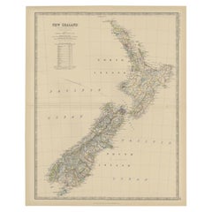
New Zealand Map
to
18
53
4
33
17
11
8
7
6
6
5
4
4
3
3
3
3
2
2
2
2
2
2
2
2
2
1
1
1
1
2
1
1
1
1
Sort By
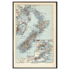
Antique Map of New Zealand, 1895
Located in Langweer, NL
Antique map titled 'Neu-Seeland.' Map of New Zealand. With inset maps of the large cities. This
Category
Antique 19th Century Maps
Materials
Paper
Antique Map of New Zealand by Johnston '1909'
Located in Langweer, NL
Antique map titled 'New Zealand'. Original antique map of New Zealand. With inset maps of Chatham
Category
Early 20th Century Maps
Materials
Paper
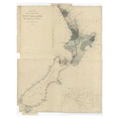
Antique Map of New Zealand by Arrowsmith '1844'
Located in Langweer, NL
Antique map titled 'Map of the colony of New Zealand from official documents'. A scarce map of New
Category
Antique Mid-19th Century Maps
Materials
Paper
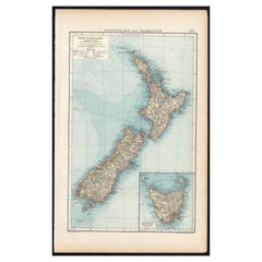
Antique Map of New Zealand and Tasmania, 1904
Located in Langweer, NL
This large antique map is taken from; 'Andrees Allgemeiner Handatlas in 126 Haupt-Und 139
Category
20th Century Maps
Materials
Paper
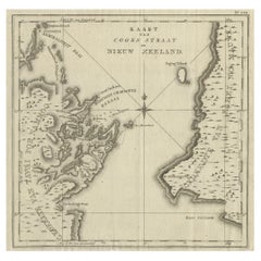
Antique Map of Cook's Strait in New Zealand, 1803
Located in Langweer, NL
Antique map New Zealand titled 'Kaart van Cooks Straat in Nieuw Zeeland'. Antique map of Cook's
Category
Antique 19th Century Maps
Materials
Paper
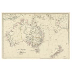
Antique Map of Australia and New Zealand, c.1860
Located in Langweer, NL
Antique map titled 'Australia and New Zealand'. Unusual edition of this map of Australia and New
Category
Antique 19th Century Maps
Materials
Paper
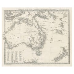
German Antique Map of Australia and New Zealand, 1857
Located in Langweer, NL
Australia and New Zealand, including excellent detail in the settled regions of both. Large list of
Category
Antique 19th Century Maps
Materials
Paper
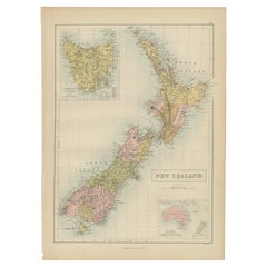
Antique Map of New Zealand by A & C. Black, 1870
Located in Langweer, NL
Antique map titled 'New Zealand'. Original antique map of New Zealand with inset Maps of Australia
Category
Antique Late 19th Century Maps
Materials
Paper
Antique Map of New Zealand by Scottish Geographer Johnston, 1882
Located in Langweer, NL
Antique map titled 'New Zealand'.
Old map of New Zealand. This map originates from 'The Royal
Category
Antique 19th Century Maps
Materials
Paper
Large Original Vintage Map of New Zealand, North Island, circa 1920
Located in St Annes, Lancashire
Great map of North Island, New Zealand
Original color.
Good condition / minor foxing to
Category
Vintage 1920s English Edwardian Maps
Materials
Paper
Large Original Vintage Map of New Zealand, South Island, circa 1920
Located in St Annes, Lancashire
Great map of South Island, New Zealand
Original color.
Good condition / repair to a minor
Category
Vintage 1920s English Edwardian Maps
Materials
Paper
Antique Map of Australasia, New Zealand, Polynesia & the Pacific Ocean, 1840
Located in Langweer, NL
Antique map titled 'The Pacific Ocean'.
This map depicts Australasia, New Zealand, Polynesia
Category
Antique 1840s Maps
Materials
Abalone, Paper
H 13.39 in W 16.15 in D 0 in
Antique Map of Australia and New Zealand by W. G. Blackie, 1859
Located in Langweer, NL
Antique map titled 'Australia and New Zealand'. Original antique map of Australia and New Zealand
Category
Antique Mid-19th Century Maps
Materials
Paper
1882 Map of Australia and New Zealand with Regional and Geographical Features
Located in Langweer, NL
This 1882 map of Australia and New Zealand, published by Blackie and Son as part of the
Category
Antique 1880s Maps
Materials
Paper
H 14.97 in W 22.45 in D 0 in
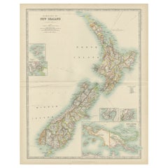
1882 Original Antique Map of New Zealand with Inset of Auckland's Environs
Located in Langweer, NL
This 1882 map of New Zealand, published by Blackie and Son as part of the 'Comprehensive Atlas and
Category
Antique 1880s Maps
Materials
Paper
H 22.45 in W 15.36 in D 0 in
Map of New Zealand Showing Maori Culture and Early Colonial Settlements, 1851
Located in Langweer, NL
being depicted.
The map of New Zealand you've mentioned would have been created when New Zealand was a
Category
Antique 1850s Maps
Materials
Paper
H 14.26 in W 10.71 in D 0 in
Old Map of the Oceans Around Australia, Indonesia and New Zealand, 1880
Located in Langweer, NL
Antique map titled 'Océanie'.
Old map of the oceans around Australia, Indonesia and New Zealand
Category
Antique 1880s Maps
Materials
Paper
Antique Map of Australia, New Zealand and Oceania by F. von Stülpnagel, 1850
Located in Langweer, NL
Antique map titled 'Australien und Polynesien in Mercators Projection'. A map of Australia, New
Category
Antique Mid-19th Century Maps
Materials
Paper
H 15.16 in W 18.31 in D 0.02 in
Map of Australia, New Zealand, Part of China, Japan and Southeast Asia, 1857
Located in Langweer, NL
German Antique map titled 'Australien'. Map of Australia, New Zealand, part of China, Japan and
Category
Antique 19th Century Maps
Materials
Paper
H 23.23 in W 27.96 in D 0 in
Antique Map of Oceania and the Pacific Ocean, Australia and New Zealand, 1826
Located in Langweer, NL
Antique map of Australia titled 'Karte von Australien'. Old map of Australia and New Zealand
Category
Antique 19th Century Maps
Materials
Paper
H 8.47 in W 9.85 in D 0 in
Detailed Map of New Zealand Showing the Route of Capt. Cook's First Voyage, 1803
Located in Langweer, NL
Antique map New Zealand titled 'De Rivier de Theems en Mercurius Baai in Nieuw Zeeland'. Detailed
Category
Antique 19th Century Maps
Materials
Paper
H 13.78 in W 20.48 in D 0 in
Antique Map of the Dusky Bay or Dusky Sound of New Zealand by Captain Cook, 1803
Located in Langweer, NL
Antique map New Zealand titled 'Schets van de Donkere Baai in Nieuw Zeeland 1773'.
Antique map
Category
Antique Early 1800s Maps
Materials
Paper
H 11.03 in W 19.3 in D 0 in
Antique Map of Oceania by Johnston, 1882
Located in Langweer, NL
New Zealand. This map originates from 'The Royal Atlas of Modern Geography, Exhibiting, in a Series of
Category
Antique 19th Century Maps
Materials
Paper
Antique Map of Polynesia and Australasia by Neele, 1825
Located in Langweer, NL
Antique map titled 'Polynesia and Australasia'. It shows Australia (New Holland), part of Asia, New
Category
Antique Early 19th Century Maps
Materials
Paper
Antique Map of East Asia by Coronelli, circa 1690
Located in Langweer, NL
Antique map of East Asia showing New Holland and parts of Van Diemens Land and New Zealand. This
Category
Antique Late 17th Century Maps
Materials
Paper
Antique Miniature Map of the Western Hemisphere, with California as an Island
Located in Langweer, NL
Northwest Coast of America and an incomplete New Zealand. This map originates from 'Description de l
Category
Antique Late 17th Century Maps
Materials
Paper
H 8.27 in W 5.6 in D 0.02 in
Print of Maps of Islands of the South Pacific, Incl. Pitcairn & Dusky Bay, 1788
Located in Langweer, NL
rose and inset of Dusky Bay on New Zealand. This map originates from 'Atlas encyclopedique: contenant
Category
Antique 1780s Maps
Materials
Paper
H 12.21 in W 18.31 in D 0 in
Original Vintage Travel Advertising Poster NAC New Zealand Airways Airline Map
Located in London, GB
plane over a route map of New Zealand marking the stops in the country and international flight links
Category
Vintage 1950s New Zealand Posters
Materials
Paper
H 37.6 in W 28.75 in D 0.04 in
Map Mural Rollable Poster Vintage Wall Chart Australia New Zealand Polynesia
Located in Berghuelen, DE
Map Mural Rollable Poster Vintage Wall Chart Australia New Zealand Polynesia
A beautiful vintage
Category
Vintage 1970s German Country Posters
Materials
Canvas, Wood, Paper
H 70.87 in W 64.57 in D 0.79 in
Vintage Mural Map Rollable Wall Chart Poster Australia New Zealand Indonesia
Located in Berghuelen, DE
Vintage Mural Map Rollable Wall Chart Poster Australia New Zealand Indonesia
The vintage pull-down
Category
Vintage 1970s German Country Posters
Materials
Canvas, Wood, Paper
H 39.38 in W 48.04 in D 0.79 in
"Choke II: Cook Strait (North & South Island, New Zealand)" - ceramic - map
By Gregor Turk
Located in Atlanta, GA
This ceramic wall sculpture features a topographic map in black and white.
Gregor is inspired by
Category
2010s Abstract Sculptures
Materials
Ceramic
Original WWII Map of New Zealand - Natural & Industrial Resources in War & Peace
By "Leslie MacDonald ""Max"" Gill"
Located in London, GB
Original vintage World War Two pictorial map for New Zealand her natural and Industrial resources
Category
Vintage 1940s British Posters
Materials
Paper
H 30.52 in W 20.08 in D 0.04 in
Serj Tankian, Kiwi in Pangea.
By Serj Tankian
Located in La Canada Flintridge, CA
in an abstract representation of the map of New Zealand, evoking the natural beauty and the personal
Category
2010s Abstract Expressionist Abstract Paintings
Materials
Acrylic
The Older Couple, Original Painting
By Libby Ramage
Located in San Francisco, CA
piece is a map of New Zealand, selected for its Bay of Plenty which appears on the middle right side
Category
21st Century and Contemporary Outsider Art Mixed Media
Materials
Mixed Media
Captain James Cook: 18th C. Portrait by William Hodges After Cook's 2nd Voyage
By William Hodges
Located in Alamo, CA
to explore the eastern coast of Australia, and he was the first to map the New Zealand coastline. He
Category
1770s Portrait Prints
Materials
Engraving
Antique Map of New Zealand by G.F. Cram, 'circa 1906'
Located in Langweer, NL
Antique map titled 'New Zealand'. Large map of New Zealand with a small legend of the Chatham
Category
20th Century Maps
Materials
Paper
Rare Robert Bénard Map Engraving - South Pacific Australia New Zealand 1774
Located in Malvern, Victoria
Rare Robert Bénard map of the South Pacific, showing Australia and New Zealand
Bénard, Robert
Category
Antique 1770s Maps
H 29.14 in W 41.34 in D 1.19 in
Map of New Zealand - Etching / engraving - 18th Century
Located in Zeeland, Noord-Brabant
door den Luitenant J. Cook met het schip de Endeavour' - (Map / Chart of New Zealand explored in the
Category
1790s Contemporary More Prints
Materials
Engraving
Original Vintage Travel Advertising Poster NAC New Zealand Airways Airline Map
Located in London, GB
plane over a route map of New Zealand marking the stops in the country and international flight links
Category
1950s More Prints
Materials
Paper
Original WWII Map Of New Zealand - Natural & Industrial Resources In War & Peace
By "Leslie MacDonald ""Max"" Gill"
Located in London, GB
Original vintage World War Two pictorial map for New Zealand Her Natural and Industrial Resources
Category
1940s More Prints
Materials
Paper
Antique Map of Australia and New Zealand with Dutch Text, 1852
Located in Langweer, NL
Antique map titled 'Het vaste land van Australië met de voornaamste omliggende eilanden'. Map of
Category
Antique 19th Century Maps
Materials
Paper
Antique Map of New Zealand by Lowry '1852'
Located in Langweer, NL
Antique map titled 'New Zealand'. Original map of New Zealand. This map originates from 'Lowry's
Category
Antique Mid-19th Century Maps
Materials
Paper
Large Original Vintage Map of New Zealand, 1903
Located in St Annes, Lancashire
Great map of New Zealand
Original color.
Published by W. & A.K. Johnston. 1903
Unframed.
Category
Antique Early 1900s English Maps
Materials
Paper
Original Antique Map of New Zealand, Grattan & Gilbert, 1843
Located in St Annes, Lancashire
Great map of New Zealand.
Drawn and engraved by Archer.
Published by Grattan and Gilbert
Category
Antique 1840s English Other Maps
Materials
Paper
Large Original Vintage Map of New Zealand, circa 1920
Located in St Annes, Lancashire
Great map of New Zealand
Original color.
Published by Alexander Gross
Repairs to a couple
Category
Vintage 1920s English Victorian Maps
Materials
Paper
Antique Map of New Zealand by W. G. Blackie, 1859
Located in Langweer, NL
Antique map titled 'New Zealand'. Original antique map of New Zealand included map of Sandwich
Category
Antique Mid-19th Century Maps
Materials
Paper
Antique Map of Hawaii, New Zealand, Fiji and Surrounding Islands
Located in Langweer, NL
Original antique map of Hawaii, New Zealand, Fiji, Tonga, Samoa, French Polynesia, Marquesas, and
Category
Antique Late 19th Century Maps
Materials
Paper
Large Original Vintage Map of New Zealand, North Island, circa 1920
Located in St Annes, Lancashire
Great map of North Island, New Zealand
Original color.
Good condition
Published by
Category
Vintage 1920s English Edwardian Maps
Materials
Paper
Large Original Vintage Map of New Zealand, South Island, circa 1920
Located in St Annes, Lancashire
Great map of South Island, New Zealand
Original color.
Good condition
Published by
Category
Vintage 1920s English Edwardian Maps
Materials
Paper
Antique Map of Australia and New Zealand by H. Kiepert, 1874
Located in Langweer, NL
and New Zealand. With color key in lower left.
The map is prepared by H. Kiepert and published in
Category
Antique Late 19th Century Maps
Materials
Paper
Large Original Vintage Map of New Zealand, North Island, circa 1920
Located in St Annes, Lancashire
Great map of North Island, New Zealand
Original color.
Good condition / minor foxing to
Category
Vintage 1920s English Edwardian Maps
Materials
Paper
Large Original Antique Map of New Zealand by William Hughes, 1847
Located in St Annes, Lancashire
Great map of New Zealand
Drawn and engraved by William Hughes
Steel engraving
Original
Category
Antique 1840s Scottish Maps
Materials
Paper
Antique Dutch Map of Australia 'Nieuwe Holland' and New Zealand, c.1873
Located in Langweer, NL
Antique map titled 'Het vaste land van Australië'. Old map depicting Australia and New Zealand with
Category
Antique 19th Century Maps
Materials
Paper
Old Print Showing New Zealand, Cuba, Iceland etc. Lakes, Mountains, Rivers, 1851
Located in Langweer, NL
Mountains in the Western Hemisphere'. This map depicts the islands of New Zealand, Cuba, Iceland etc., the
Category
Antique 1850s Maps
Materials
Paper
H 14.57 in W 10.24 in D 0 in
Antique Map of Oceania by Delamarche, 1836
Located in Langweer, NL
.' Antique map of Oceania comprising Australia and Polynesia, New Zealand and Indonesia. This map originates
Category
Antique 19th Century Maps
Materials
Paper
Antique Map of Oceania by A.K. Johnston, 1865
Located in Langweer, NL
Antique map titled 'Oceania'. Depicting Australia, Malaysia, Tasmania, New Zealand, Polynesia and
Category
Antique Mid-19th Century Maps
Antique Map of Australia and the East Indies by Johnson, '1872'
Located in Langweer, NL
Indies, with an inset map of New Zealand. This map originates from 'Johnson's New Illustrated Family
Category
Antique Late 19th Century Maps
Materials
Paper
'Australien', antique map of Australia, New Zealand, Indonesia, SW Pacific, 1812
Located in Melbourne, Victoria
). Published in Augsburg, circa 1812. Early German map of Australia. The imperial city of Augsburg was a
Category
Early 19th Century Naturalistic Landscape Prints
Materials
Engraving
Vintage Pull Down Map Australia Oceania New Zealand Wall Chart Poster Print
Located in Berghuelen, DE
The wall map shows Australia and Oceania. It was published by Westermann-Schulwandkarten. Used as
Category
Mid-20th Century German Country Prints
Materials
Canvas, Wood, Paper
H 66.93 in W 81.5 in D 0.79 in
Get Updated with New Arrivals
Save "New Zealand Map", and we’ll notify you when there are new listings in this category.
New Zealand Map For Sale on 1stDibs
At 1stDibs, there are many versions of the ideal new zealand map for your home. A new zealand map — often made from paper, canvas and fabric — can elevate any home. You’ve searched high and low for the perfect new zealand map — we have versions that date back to the 19th Century alongside those produced as recently as the 20th Century are available. A new zealand map, designed in the Victorian style, is generally a popular piece of furniture. A well-made new zealand map has long been a part of the offerings for many furniture designers and manufacturers, but those produced by Leslie MacDonald Gill are consistently popular.
How Much is a New Zealand Map?
Prices for a new zealand map start at $71 and top out at $3,189 with the average selling for $296.
