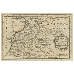
Morocco Map
to
5
30
4
17
14
11
6
6
5
4
4
3
2
2
2
2
2
1
1
1
1
1
1
1
1
1
1
1
1
1
1
1
1
1
1
Sort By
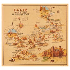
Delaye, Original Vintage Poster, South Morocco Map, Maghreb, Marrakech, 1930
Located in SAINT-OUEN-SUR-SEINE, FR
Original Vintage Poster for South Morocco Map dating from 1930 by Jean Theophile Delaye.
Artist
Category
Vintage 1930s French Art Deco Posters
Materials
Paper
H 29.93 in W 28.15 in D 0.04 in
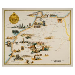
Gayraud, Original Vintage Poster, Morocco Map, Royal Air Maroc, Essaouira, 1950
Located in SAINT-OUEN-SUR-SEINE, FR
tourism in Morocco.
Artist: Gayraud M.
Title: L’architecture – Royal Air Maroc
Date: circa 1950
Size (w
Category
Vintage 1950s French Mid-Century Modern Posters
Materials
Paper
H 25.2 in W 20.87 in D 0.4 in
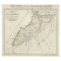
Original Antique Map of Fez and Morocco
Located in Langweer, NL
Antique map titled 'Karte von Fes und Marócos (..)'. Original old map of Fez (or Fes) and Morocco
Category
Antique Late 18th Century Maps
Materials
Paper
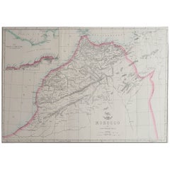
Large Original Antique Map of Morocco. Edward Weller, 1861
Located in St Annes, Lancashire
Great map of Morocco
Lithograph engraving by Edward Weller
Original colour
Published, 1861
Category
Antique 1860s English Victorian Maps
Materials
Paper
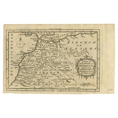
Antique Map of the Empire of Morocco by Kitchin, c.1760
By Thomas Kitchin
Located in Langweer, NL
Antique map titled 'A Map of the Empire of Morocco Comprehending the Kingdoms of Fez, Morocco
Category
Antique 18th Century Maps
Materials
Paper
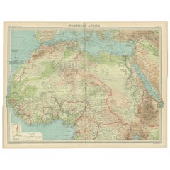
Old Map of North Africa Depicting Libya, Morocco, Algeria, Tunis Etc, 1922
Located in Langweer, NL
, Morocco, Algeria, Tunis and surroundings. This map originates from 'The Times' atlas.
Artists and
Category
Vintage 1920s Maps
Materials
Paper
H 17.92 in W 23.23 in D 0 in
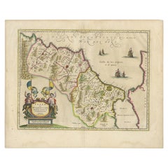
Antique Map of Morocco Showing Towns of Marakesh, Taradant and Fez, 1636
Located in Langweer, NL
Antique map titled 'Fezzae et Marocchi regna Africae Celeberrima'. Map of Morocco, showing large
Category
Antique 17th Century Maps
Materials
Paper
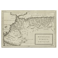
Rare Map of North Africa Depicting Numidia, Libia and Morocco, Published C.1740
Located in Langweer, NL
Antique map Africa titled 'Mauretania, Numidia, Gaetulia & c.'.
Rare map of North Africa
Category
Antique 1740s Maps
Materials
Paper
H 9.45 in W 14.57 in D 0 in
Old Map of the Kingdoms of Fez, Algiers, Segelmese, Tafilet and Morocco, ca.1760
Located in Langweer, NL
Antique map titled 'A Map of the Empire of Morocco Comprehending the Kingdoms of Fez, Morocco
Category
Antique 1760s Maps
Materials
Paper
H 5.12 in W 8.08 in D 0 in
Old Map of Morocco, The Canary Islands, Madeira, Inset of Penon de Velez, 1605
Located in Langweer, NL
Antique map titled 'Fessae et Marocchi Regna'. Original antique map of Morocco, extending south to
Category
Antique 17th Century Maps
Materials
Paper
H 20.48 in W 17.33 in D 0 in
Antique Decorative Coloured Map Marocco, Algeria and Tunis, 1882
Located in Langweer, NL
regions as understood in the late 19th century.
**Map of Morocco, Algeria, and Tunis:**
This map details
Category
Antique 1880s Maps
Materials
Paper
Antique Map of North Africa by Ortelius, c.1600
Located in Langweer, NL
and the Mediterranean. The map extends from Morocco and the Sahara to Libya and shows most of the
Category
Antique 17th Century Maps
Materials
Paper
Antique Map of Tunis and Tripoli in Northern Africa, circa 1880
By J. Migeon
Located in Langweer, NL
Empire of Morocco. This map originates from 'Géographie Universelle Atlas-Migeon' by J. Migeon.
Artists
Category
Antique 19th Century Maps
Materials
Paper
Old Print of a Partridge in Front of The Walled City of Azemmour, Morocco, c1630
Located in Langweer, NL
partridge in the foreground, with the walled city (Azemmour in Morocco) behind.
From: 'Thesauri Philo
Category
Antique 1630s Maps
Materials
Paper
H 5.99 in W 7.49 in D 0 in
North African Coasts: Marmarica to Mauretania in Roman Times, Published in 1880
Located in Langweer, NL
to parts of modern-day Libya, Tunisia, Algeria, and Morocco.
Notable Features of the Map:
1
Category
Antique 1880s Maps
Materials
Paper
H 15.56 in W 18.51 in D 0 in
Framed Print of an Antique German Map of Morocco
Located in Queens, NY
Antique German map (print) of Morocco (circa 1728) featuring a central map above two city views
Category
Mid-20th Century German Biedermeier Paintings
Materials
Wood
illustrated map of Morocco created in 1950 by Delaye
Located in PARIS, FR
Beautiful illustrated map of Morocco created in 1950 by Delaye. Main roads, car tracks, railroads
Category
1950s Prints and Multiples
Materials
Paper, Lithograph
Original Vintage Map Poster Marruecos Espanol Spanish Morocco Illustrated Design
Located in London, GB
Original vintage travel map poster for Marruecos Espanol / Spanish Morocco featuring a great
Category
Vintage 1940s Spanish Art Deco Posters
Materials
Paper
H 27.56 in W 38.39 in D 0.04 in
Choke II: Strait of Gibraltar (Spain & Morocco) - ceramic - map - black & white
By Gregor Turk
Located in Atlanta, GA
This ceramic wall sculpture features a topographic map in black and white.
As a self-proclaimed
Category
2010s Abstract Sculptures
Materials
Ceramic
Original Vintage Air Maroc Travel Poster Route Map France Morocco Spain Services
By E. Esperance
Located in London, GB
jet plane flying towards the viewer with propellers on each wing and a route map in the background of
Category
Vintage 1950s French Posters
Materials
Paper
H 39.97 in W 25.6 in D 0.04 in
Les Arts Traditionnels au Maroc by Dr. M. Sijelmassi, Hardcover Book in French
By Berber Tribes of Morocco
Located in North Hollywood, CA
, and other examples of traditional Moroccan arts, 41 maps. Cloth cover
Title: LES ARTS TRADITIONNELS AU
Category
Late 20th Century Moroccan Arts and Crafts Books
Materials
Paper
H 11 in W 10 in D 1.5 in
Original Vintage Map Poster Marruecos Espanol Spanish Morocco Illustrated Design
Located in London, GB
Original vintage travel map poster for Marruecos Espanol / Spanish Morocco featuring a great
Category
1940s Art Deco More Prints
Materials
Paper
Original Vintage Air Maroc Travel Poster Route Map France Morocco Spain Services
By E. Esperance
Located in London, GB
jet plane flying towards the viewer with propellers on each wing and a route map in the background of
Category
1950s More Prints
Materials
Paper
Ptolemaic map of NW Africa, Morocco and Algeria by Mercator - Engraving - 17th c
By Gerard Mercator
Located in Zeeland, Noord-Brabant
map covering ancient northwestern Africa, including present day Morocco and Algeria. The interior
Category
1690s Old Masters More Prints
Materials
Engraving
Original Vintage Paris Orleans Railway Poster France Algeria Morocco Travel Map
Located in London, GB
Relations France Algerie Maroc / Good Relations France Algeria Morocco - featuring a dynamic Art Deco design
Category
Vintage 1930s French Art Deco Posters
Materials
Paper
H 38.98 in W 24.22 in D 0.04 in
Original Antique Map of Morocco in Northern Africa with Decorative Cartouche
Located in Langweer, NL
Antique map titled 'Fezzae et Marocchi (..)'. Striking map of Morocco, showing large fortified
Category
Antique Mid-17th Century Maps
Materials
Paper
H 12.52 in W 14.06 in D 0.02 in
Antique Map of Morocco, Algeria and Tunisia by W. G. Blackie, 1859
Located in Langweer, NL
Antique map titled 'Morocco, Algeria and Tunis'. Original antique map of Morocco, Algeria and
Category
Antique Mid-19th Century Maps
Materials
Paper
Antique Map of Northern Africa by Ortelius 'circa 1590'
Located in Langweer, NL
. The map extends from Morocco and the Sahara to Libya and shown most of the Mediterranean, including
Category
Antique 16th Century Maps
Materials
Paper
Original Vintage Poster Air Atlas Mountains Travel Map Casablanca Morocco Maroc
Located in London, GB
Original vintage travel poster published by the Moroccan airline Air Atlas (Compagnie Cherifienne
Category
Vintage 1940s Moroccan Posters
Materials
Paper
H 13.78 in W 9.45 in D 0.04 in
Original Vintage Map Poster Morocco Maroc Regne Sidi Mohamed Ben Yousef Sultan
Located in London, GB
l'Empire Cherifien hegira 1566 - featuring an illustrated map design of the ancient north Africa country of
Category
Vintage 1940s Moroccan Posters
Materials
Paper
H 31.5 in W 44.49 in D 0.04 in
Vintage Tuareg Hand Tooled Leather Bag with Africa Map
Located in North Hollywood, CA
Leather African vintage Tuareg satchel bag with map of Africa embroidered on the pocket.
Vintage
Category
20th Century Moroccan Backpacks
Original Vintage Poster Air Atlas Mountains Travel Map Casablanca Morocco Maroc
By Robert Falcucci
Located in London, GB
Original vintage travel poster published by the Moroccan airline Air Atlas (Compagnie Cherifienne
Category
1940s More Prints
Materials
Paper
Original Vintage Paris Orleans Railway Poster France Algeria Morocco Travel Map
Located in London, GB
Relations France Algerie Maroc / Good Relations France Algeria Morocco - featuring a dynamic Art Deco design
Category
1930s Art Deco More Prints
Materials
Paper
Original Vintage Map Poster Morocco Maroc Regne Sidi Mohamed Ben Yousef Sultan
Located in London, GB
l'Empire Cherifien hegira 1566 - featuring an illustrated map design of the ancient north Africa country of
Category
1940s More Prints
Materials
Paper
Get Updated with New Arrivals
Save "Morocco Map", and we’ll notify you when there are new listings in this category.
Morocco Map For Sale on 1stDibs
Find the exact morocco map you’re shopping for in the variety available on 1stDibs. There are many Art Deco, Abstract and Old Masters versions of these works for sale. You’re likely to find the perfect morocco map among the distinctive items we have available, which includes versions made as long ago as the 18th Century as well as those made as recently as the 21st Century. When looking for the right morocco map for your space, you can search on 1stDibs by color — popular works were created in bold and neutral palettes with elements of beige, blue, brown and orange. Creating a morocco map has been a part of the legacy of many artists, but those crafted by Robert Falcucci, Gerard Mercator and Gregor Turk are consistently popular. Frequently made by artists working in paper, ceramic and engraving, these artworks are unique and have attracted attention over the years.
How Much is a Morocco Map?
The price for a morocco map in our collection starts at $288 and tops out at $5,693 with the average selling for $3,389.
