Maps Of Mediterranean
to
13
39
6
29
23
8
8
8
6
5
4
4
3
3
3
3
3
2
2
2
1
1
1
1
1
1
1
1
1
1
1
1
1
1
1
1
1
1
1
Sort By
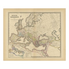
Old Map of Mediterranean Powers: Pompey to Actium (66-31 BC), Published in 1880
Located in Langweer, NL
This is a historical map that depicts the Mediterranean region during a specific timeframe in Roman
Category
Antique 1880s Maps
Materials
Paper
H 15.56 in W 18.51 in D 0 in
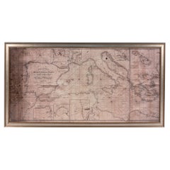
Large Framed Map of the Mediterranean
Located in Queens, NY
Large map/chart chart of The Mediterranean and the Grecian Archipelago showing Italy, Sardinia
Category
20th Century French Mid-Century Modern Maps
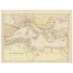
Mediterranean Tapestry: A 19th Century Map of the Mediterranean Shores, 1882
Located in Langweer, NL
This map, titled "The Shores of the Mediterranean," is part of the 1882 atlas by Blackie & Son, and
Category
Antique 1880s Maps
Materials
Paper
H 11.03 in W 14.97 in D 0 in
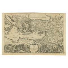
Antique Map of the Eastern Mediterranean, C.1710
Located in Langweer, NL
'. Antique map of the Eastern Mediterranean with details of the travels by Apostle Paul and other apostles
Category
Antique 18th Century Maps
Materials
Paper
Large Decorative Antique Map of the Mediterranean, ca.1770
Located in Langweer, NL
fine engraved double-page and folding maps that join to create a large wall map of the Mediterranean
Category
Antique 1770s Maps
Materials
Paper
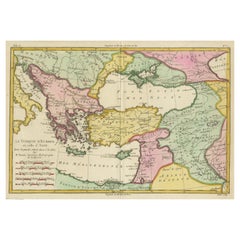
Antique Map of the Eastern Mediterranean and the Balkans
Located in Langweer, NL
Antique map titled 'La Turquie d'Europe et celle d'Asie'. Attractive double page map of the Eastern
Category
Antique Late 18th Century Maps
Materials
Paper
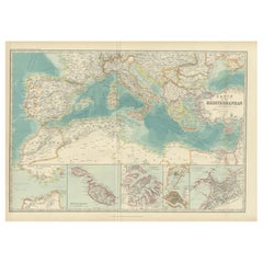
Antique Map of the Basin of the Mediterranean by Johnston '1909'
Located in Langweer, NL
Antique map titled 'Basin of the Mediterranean'. Original antique map of the basin of the
Category
Early 20th Century Maps
Materials
Paper
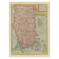
Antique Map of Asia Minor, Cyprus, and the Eastern Mediterranean
Located in Langweer, NL
Antique map titled 'Natoliae quae olim Asia Minor nova descriptio'. Original antique map of Asia
Category
Antique Early 17th Century Maps
Materials
Paper
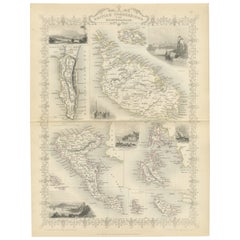
Old Map of British Mediterranean Territories with Images of Historic Sites, 1851
Located in Langweer, NL
John Tallis & Company was a British map-making firm that gained widespread acclaim in the 19th
Category
Antique 1850s Maps
Materials
Paper
H 14.26 in W 10.71 in D 0 in
Historical Map of Greece and the Eastern Mediterranean by Delisle - 1780
Located in Langweer, NL
Historical Map of Greece and the Eastern Mediterranean by Guillaume Delisle - 1780 Reissue
This
Category
Antique 1780s Maps
Materials
Paper
H 19.69 in W 26.54 in D 0.01 in
Rare and Interesting Small Antique Woodcut Map of the Mediterranean, 1568
Located in Langweer, NL
Very rare untitled antique woodcut map showing the region of the missionary journeys of Apostle
Category
Antique 16th Century Maps
Materials
Paper
H 5.63 in W 6.78 in D 0.02 in
Old Dutch Map of the Region Around the Mediterranean Sea, 1773
Located in Langweer, NL
Antique map titled 'Kaart van een Deel der Middelandsche Zee (..)'.
Old map of the region
Category
Antique 1770s Maps
Materials
Paper
Antique Map of Islands in the Mediterranean by Bowen, 'c.1760'
Located in Langweer, NL
Antique map titled 'Particular Draughts of some of the chief African Islands (..)'. Eight small
Category
Antique Mid-18th Century Maps
Materials
Paper
Scarce Map of the Mediterranean and Parts of Europe, Africa & Middle East, 1725
Located in Langweer, NL
, om het Evangelium J.C. te prediken.
Scarce map of the Mediterranean and contiguous parts of Europe
Category
Antique 1720s Maps
Materials
Paper
H 15.75 in W 18.51 in D 0 in
1700 Guillaume Delisle Map: Western Mediterranean & Moorish North Africa
Located in Langweer, NL
1700 Guillaume Delisle Map: Western Mediterranean & Moorish North Africa
This hand-colored map
Category
Antique Early 1700s Maps
Materials
Paper
H 19.1 in W 25.2 in D 0.02 in
Antique Map Eastern Mediterranean by D. Stoopendaal 'circa 1710'
Located in Langweer, NL
'. Antique map of the Eastern Mediterranean with details of the travels by Apostle Paul and other apostles
Category
Antique Early 18th Century Dutch Maps
Materials
Paper
Antique Map of the Mediterranean Sea and Surroundings by Keizer & de Lat, 1788
Located in Langweer, NL
the Mediterranean Sea and surroundings. This map originates from 'Nieuwe Natuur- Geschied- en
Category
Antique Late 18th Century Maps
Materials
Paper
H 8.08 in W 12.6 in D 0.02 in
Antique Map of the Mediterranean and the Persian Gulf by Danckerts, c.1718
Located in Langweer, NL
Antique map titled 'De Gelegentheyt Van't Paradys en 't Landt Canaan.' Dutch Bible map covering the
Category
Antique 18th Century Maps
Materials
Paper
H 16.34 in W 21.26 in D 0 in
Highly Decorative Map of The Eastern Mediterranean and The Middle East, ca.1700
Located in Langweer, NL
(..).'
Highly decorative map of the eastern Mediterranean and the Middle East features the tract of St. Paul
Category
Antique Early 1700s Maps
Materials
Paper
H 16.74 in W 19.89 in D 0 in
Antique Map of Eastern Mediterranean and Asia Minor by a Benedictine, c.1725
Located in Langweer, NL
gospel. This map shows the east Mediterranean countries and Asia Minor; Turkey, Greece, Cyprus, Malta
Category
Antique 18th Century Maps
Materials
Paper
H 19.1 in W 22.05 in D 0 in
Biblical Map of the Region from the Mediterranean through the Persian Gulf, 1720
Located in Langweer, NL
interesting map covers the region from the Mediterranean through the Persian Gulf. Detail is omitted in favor
Category
Antique 1720s Maps
Materials
Paper
H 17.09 in W 20.08 in D 0 in
Curious Map of the Laptev Sea 'Arctic Ocean' and the Mediterranean, ca.1700
Located in Langweer, NL
Antique map, untitled.
Map of the Laptev Sea (Arctic Ocean) and the Mediterranean, printed for
Category
Antique Early 1700s Maps
Materials
Paper
H 10.63 in W 8.31 in D 0 in
Old Map of the Sinai Peninsula Showing the Mediterranean and the Red Sea, 1773
Located in Langweer, NL
Antique map of the Sinai Peninsula showing the Mediterranean Sea to the north and the Red Sea to
Category
Antique 1770s Maps
Materials
Paper
H 17.05 in W 21.19 in D 0 in
Cádiz 1901: Nautical Crossroads of the Atlantic and Mediterranean
Located in Langweer, NL
The map illustrates the province of Cádiz, located in the autonomous community of Andalusia, Spain
Category
Antique Early 1900s Maps
Materials
Paper
Original Antique Engraving of a Sea Chart of the Western Mediterranean, ca.1650
Located in Langweer, NL
the Western Mediterranean. The map extends from the Straits of Gibralter to Italy and Sicily and the
Category
Antique 1650s Maps
Materials
Paper
H 18.71 in W 22.64 in D 0 in
Rare Antique Bible Map of Southern Europe by A. Schut, 1743
Located in Langweer, NL
Antique map of the Mediterranean and a large part of Europe, illustrating the voyage of St. Paul to
Category
Antique Mid-18th Century Maps
Materials
Paper
Decorative Antique Map of Cyprus and Asia Minor by Christoph Weigel, Circa 1720
Located in Langweer, NL
cartography
- Ancient cities map
- Maps of the Mediterranean Sea
- Historical map with medallions
- Weigel
Category
Antique 1720s Maps
Materials
Paper
H 14.57 in W 18.12 in D 0 in
Original Vintage Travel Poster Island Of Cyprus Illustrated Map Mediterranean
Located in London, GB
Original vintage travel poster for the Island of Cyprus featuring a map of the ancient historic
Category
Vintage 1930s British Posters
Materials
Paper
H 20.08 in W 29.93 in D 0.04 in
Antique Map of Greece and the Mediterranean by Hachette & Cie, '1896'
Located in Langweer, NL
Antique map of Greece titled 'Grèce'. Old map of Greece and other parts of the Mediterranean
Category
Antique Late 19th Century Prints
Materials
Paper
H 14.77 in W 18.12 in D 0.02 in
Mediterranean, State I
By Robert Motherwell
Located in Toronto, Ontario
composition, emphatically framing a map of the Mediterranean coast, specifically Spain, France, and Italy
Category
1970s Abstract Expressionist Abstract Prints
Materials
Lithograph, Screen
1730 Dutch Map of the Italian Pennisula and Mediterranean
Located in Colorado Springs, CO
Exceptional 1730 Dutch map, entitled: L'Italie Dressee sur les Observations de Mrs. de l'Academie
Category
Antique 1730s European Maps
Hammond's Map of the Mediterranean, Europe, and Africa, circa 1941
Located in Colorado Springs, CO
This is an original WWII folding folio map of the Mediterranean, Europe, and Africa. The map was
Category
Vintage 1940s Maps
Interesting Detailed Antique Map of Region Around The Mediterranean Sea, 1882
Located in Langweer, NL
Antique map titled 'Basin of the Mediterranean'.
Old map of the region aroung the Mediterranean
Category
Antique 1880s Maps
Materials
Paper
H 0 in W 24.1 in L 0 in
Antique Map of Elba in Tuscany, Italy, Site of Napoleon's First Exile, c.1620
Located in Langweer, NL
Antique map titled 'Elba Isola olim Ilua'. Old map of Elba, a Mediterranean island in Tuscany
Category
Antique 17th Century Maps
Materials
Paper
H 10.83 in W 15.75 in D 0 in
Nautical Map of the Mediterranean Sea from Le petit Neptune françois, 1763
By G. A. Rizzi-zannoni
Located in Milan, IT
Antique nautical map of the Mediterranean sea from La Spezia to Roussillon, from Le petit Neptune
Category
Antique 1760s French Nautical Objects
H 12.21 in W 14.18 in D 0.79 in
Antique Map of the Mediterranean by A.K. Johnston, 1865
Located in Langweer, NL
Antique map titled 'Basin of the Mediterranean'. With an inset map of Marseille, Genoa, Gibraltar
Category
Antique Mid-19th Century Maps
Materials
Paper
Antique Map of the Eastern Mediterranean by N. Visscher, circa 1680
Located in Langweer, NL
'. Decorative map of the Eastern Mediterranean, from Italy and Sicily to Asia Minor, Armenia, Iraq and the Red
Category
Antique Late 17th Century Maps
Materials
Paper
Antique Map of the Mediterranean, Telemachus' Journey, Publ. Early 18th Century
Located in Langweer, NL
Title: Carte des voyages de Télémaque.
Description: Antique map of Telemachus journey, the son
Category
Antique Early 18th Century Maps
Materials
Paper
H 6.5 in W 10.63 in D 0 in
Antique Map of British Possessions in the Mediterranean by J. Tallis, circa 1851
Located in Langweer, NL
atlas. The 'British Possessions in the Mediterranean' map was typical of the many Fine ones which
Category
Antique Mid-19th Century Maps
H 14.65 in W 10.56 in D 0.02 in
Antique Map of 'African' Islands in the Mediterranean Sea and The Atlantic, 1747
Located in Langweer, NL
Antique map titled 'Particular draughts of some of the chief African Islands in the Mediterranean
Category
Antique 18th Century Maps
Materials
Paper
H 19.49 in W 15.16 in D 0 in
Antique Map of Northern Africa by Ortelius 'circa 1590'
Located in Langweer, NL
Edition, 'circa 1590'.
Double-page engraved map of northern Africa and western Mediterranean Sea. 18 1
Category
Antique 16th Century Maps
Materials
Paper
Antique Map Northern Africa by I. Tirion, circa 1770
By Isaak Tirion
Located in Langweer, NL
Antique map Africa titled 'Het Noordelykste deel van Afrika, behelzende Barbarie, Egypte enz. Als
Category
Antique Mid-18th Century Dutch Maps
Materials
Paper
Vintage Map of Mediterranean Grecian Archipelago
Located in Chicago, IL
Measures: 42.25" W x 1.25" D x 29.25" H
white wood frame
20th century
American.
Category
20th Century American Maps
Vintage Nautical Map of the Mediterranean
Located in West Hollywood, CA
Vintage hand drawn nautical map chart tracing the routes and stops of the USS John W. Weeks while
Category
20th Century Unknown Maps
Materials
Wood
Framed Antique Map of Southern France & the Mediterranean Found in Paris
Located in Houston, TX
his antique map was rolled up and tucked away inside a Parisian antique market stall when we
Category
Antique 19th Century French Maps
Materials
Paper
Hermes Gold-Plated Lock Pendant Necklace - 2003
By Hermès
Located in London, Chelsea
was created in 2003 to celebrate the Mediterranean Sea. The cadena lock features a stylized map of the
Category
Early 2000s French Pendant Necklaces
Materials
Gold Plate
Get Updated with New Arrivals
Save "Maps Of Mediterranean", and we’ll notify you when there are new listings in this category.
Maps Of Mediterranean For Sale on 1stDibs
Choose from an assortment of styles, material and more with respect to the maps of mediterranean you’re looking for at 1stDibs. Each maps of mediterranean for sale was constructed with extraordinary care, often using paper. You’ve searched high and low for the perfect maps of mediterranean — we have versions that date back to the 18th Century alongside those produced as recently as the 20th Century are available. A well-made maps of mediterranean has long been a part of the offerings for many furniture designers and manufacturers, but those produced by G. A. Rizzi-zannoni are consistently popular.
How Much is a Maps Of Mediterranean?
Prices for a maps of mediterranean can differ depending upon size, time period and other attributes — at 1stDibs, they begin at $146 and can go as high as $2,600, while the average can fetch as much as $669.
