Antique Maps Of Texas

to
6
27
21
40
18
16
8
8
6
6
5
4
4
4
3
2
1
1
2
1
1
1
1
Sort By
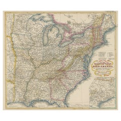
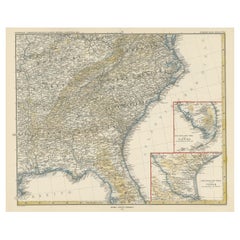
Antique Map of the Eastern United States with Inset Map of Texas
Located in Langweer, NL
. Inset map of the "southern principal part of Texas." Shows states, major cities, railroads, topography
Category

Mid-19th Century Antique Maps Of Texas

Materials

Paper

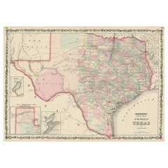
Large Antique Map of the State of Texas, 1861
Located in Langweer, NL
Antique map titled 'Johnson's New Map of the State of Texas' Large map of Texas, shows railroads
Category

Mid-19th Century Antique Maps Of Texas

Materials

Paper

Large Antique Map of the State of Texas, 1861
H 18.04 in W 26.58 in D 0.02 in
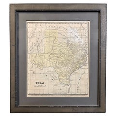
1853 "Texas" Map by Daniel Burgess
Located in Colorado Springs, CO
This is an original map of Texas from 1853, published by Daniel Burgess. The map was issued in
Category

1850s American Victorian Antique Maps Of Texas

Materials

Paper

Antique 1853 "Texas" Map by Daniel Burgess
1853 "Texas" Map by Daniel Burgess
H 15.63 in W 13.63 in D 1 in
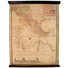
1847 Antique Map of Mexico, Texas and California by Samuel Augustus Mitchell
By Samuel Augustus Mitchell 1
Located in Colorado Springs, CO
right. The map is considered to be an adaptation of Mitchell's earlier 1846 A New Map of Texas, Oregon
Category

1840s American Antique Maps Of Texas

Materials

Paper

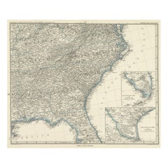
Antique Map of the Region of Georgia with Inset Maps of Florida and Texas
Located in Langweer, NL
southern part of Texas. This map was part of a set of six individual sheets with maps of the United States
Category

Late 19th Century Antique Maps Of Texas

Materials

Paper

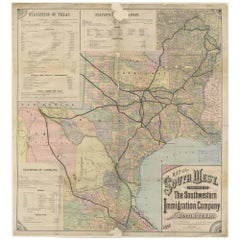
Southwestern U.S. Immigration Map for Texas, Arkansas, and Louisiana, 1881
Located in Langweer, NL
, Texas. The map is dated 1881. Description: - The map encompasses parts of Texas, New Mexico, Arkansas
Category

1880s Antique Maps Of Texas

Materials

Paper

Antique Map of Tennessee, Kentucky, Virginia, Alabama, Georgia and Surroundings
Located in Langweer, NL
southern part of Texas. This map was part of a set of six individual sheets with maps of the United States
Category

Mid-19th Century Antique Maps Of Texas

Materials

Paper

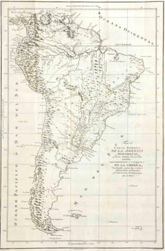
Direccion de Hidrografia... - Etching by Tomàs Gozàlez - 1802
Located in Roma, IT
(engravers), Juan Morata y Gangoiti (engraver of the text). Rare map of Mexico, Texas, Alta and Baja
Category

Early 1800s Modern Antique Maps Of Texas

Materials

Etching

1886 Lithograph Map of Texas by William Bradley & Bros.
Located in San Antonio, TX
A map of Texas printed by William Bradley & Bros. Maps. Printed in 1886.
Category

1880s Academic Antique Maps Of Texas

Materials

Lithograph

1909 Double-Sided Map of Texas and Oklahoma by The George F. Cram Company
Located in San Antonio, TX
1920s. This double-sided map of Texas and Oklahoma was printed by the George F. Cramp Company in 1909.
Category

Early 1900s Academic Antique Maps Of Texas

Materials

Lithograph, Pastel

Richardson's New Map of the State of Texas
By Willard Richardson 1, Charles Desilver
Located in Houston, TX
). Richardson's New Map of the State of Texas Including part of Mexico Compiled from Government Surveys and Other
Category

Mid-19th Century American Other Antique Maps Of Texas

Richardson's New Map of the State of Texas
H 22.75 in W 30.25 in D 0.5 in
1908 "Map of Texas" by The Kenyon Company
Located in Colorado Springs, CO
Presented is an antique map of the state of Texas, printed as a pocket map in 1908 by The Kenyon
Category

Early 1900s American Antique Maps Of Texas

Materials

Paper

1846 Antique Map of Texas, Oregon, California, and Regions Adjoining by Mitchell
By Samuel Augustus Mitchell 1
Located in Colorado Springs, CO
This is a finely colored example of the 1846 version of Mitchell's seminal map of Texas, Oregon
Category

1840s American Antique Maps Of Texas

Materials

Paper

1883 "Map of Texas and Indian Territory" by Hiram H. Hardesty
Located in Colorado Springs, CO
Presented is a very detailed “Map of Texas and Indian Territory” by Hiram H. Hardesty. This map is
Category

1880s American Antique Maps Of Texas

Materials

Paper

Antique Map of Texas, the Rocky Mountains, Southwest and Mexico
Located in Langweer, NL
. Tardieu, 1821. One of the few regional maps focusing on Texas and the Rocky Mountains during the period.
Category

Early 19th Century Antique Maps Of Texas

Materials

Paper

Map of the State of Texas
Located in Dallas, TX
an early state map of Texas, published in Philadelphia 1848, panhandle pictured inset at left
Category

19th Century American Antique Maps Of Texas

Materials

Paper, Ink

1870 Texas Map by Colton
Located in Colorado Springs, CO
This is a highly detailed map of Texas, colored by counties and showing the early County
Category

1870s American Antique Maps Of Texas

1870 Texas Map by Colton
H 21.25 in W 30 in D 2 in
Texas Civil War Map, circa 1863
Located in Colorado Springs, CO
This is an exceptional printing of A. J. Johnson's highly desirable map of the state of Texas. The
Category

1860s American Antique Maps Of Texas

Texas Civil War Map, circa 1863
H 20 in W 29 in D 1.5 in
1856 Map of the State of Texas by J. H. Colton
Located in Colorado Springs, CO
This is a colorful and intricately engraved map of the state of Texas, by prominent 19th century
Category

1850s American Antique Maps Of Texas

Materials

Paper

1873 Colton's Texas Hand-Colored Antique Map
Located in Colorado Springs, CO
Presented is a hand-colored, detailed map of the state of Texas. It was published by G. W. and C. B
Category

1870s American Antique Maps Of Texas

Materials

Paper

Republic of Texas and Mexico, Antique French Map, circa 1840
Located in Colorado Springs, CO
First published in 1834, this is the sixth edition of Adrien H. Brue's landmark map of the North
Category

1840s French Antique Maps Of Texas

Materials

Paper

1859 "Colton's New Map of the State of Texas..." by Johnson & Browning
Located in Colorado Springs, CO
Presented is "Colton's New Map of the State of Texas Compiled from De Cordova's Large Map
Category

1850s American Antique Maps Of Texas

Materials

Paper

Antique Map of Mexico, Texas and Upper California by Lapie, 1842
Located in Langweer, NL
Antique map titled 'Carte des États-Unis du Méxique'. Map of Mexico, Texas and Upper California
Category

Mid-19th Century Antique Maps Of Texas

Materials

Paper

1842 Mercator Projection Map of the World, Texas as an Independent Republic
Located in Colorado Springs, CO
Folding wall map of the world, showing Texas as an independent republic, in publisher's portfolio
Category

1840s Antique Maps Of Texas

Antique Map of the Western United States, Mexico and Texas as a Republic
Located in Langweer, NL
Antique map titled 'Mexique'. This map covers the western United States, Mexico and the independent
Category

Mid-19th Century Antique Maps Of Texas

Materials

Paper

1846 "Traveller's Guide and Map of the United States" Antique Wall Map by Ensign
Located in Colorado Springs, CO
the state of Texas, which was annexed to the United States in 1845. The map indicates principal cities
Category

1840s American Antique Maps Of Texas

Materials

Paper

1845 United States Hanging Wall Map by T & E. H. Ensign
Located in Colorado Springs, CO
the state of Texas, which was annexed to the United States in 1845. The map indicates principal cities
Category

1840s American Antique Maps Of Texas

Materials

Paper

The Life of Stephen F. Austin: Founder of Texas, 1793-1836, First, circa 1925
Located in Colorado Springs, CO
slipcase, which features an early map of the Republic of Texas on the cover.
Category

1920s Antique Maps Of Texas

"The Life of Stephen Austin" by Eugene Baker, Signed First Edition, 1925
Located in Colorado Springs, CO
Barker, Eugene C. The Life of Stephen F. Austin, Founder of Texas 1793-1836: a Chapter in the
Category

1920s American Antique Maps Of Texas

Materials

Paper

Large Original Antique Map of Texas, USA, 1894
By Rand McNally & Co.
Located in St Annes, Lancashire
Fabulous map of Texas. Original color. By Rand, McNally & Co. Published, 1894. Repair
Category

1890s American Antique Maps Of Texas

Materials

Paper

Detailed Antique Map of Texas and Indian Territory, 1875
Located in Langweer, NL
Description: Antique map titled 'Gray's New Map of Texas and the Indian Territory'. Detailed map of
Category

1870s Antique Maps Of Texas

Materials

Paper

Large Original Antique Map of Texas 'West', USA, C.1900
Located in St Annes, Lancashire
Fabulous map of Texas, West Original color Engraved and printed by the George F. Cram Company
Category

1890s American Antique Maps Of Texas

Materials

Paper

Large Original Antique Map of Texas ( East ), USA, circa 1900
Located in St Annes, Lancashire
Fabulous map of Texas, East Original color Engraved and printed by the George F. Cram Company
Category

1890s American Antique Maps Of Texas

Materials

Paper

Large Original Vintage Map of Texas and Adjacent States, circa 1920
Located in St Annes, Lancashire
Great map of Texas and adjacent States Original color. Good condition Published by
Category

1920s English Antique Maps Of Texas

Materials

Paper

Large Original Antique Map of Texas, United States &c. Fullarton, C.1870
Located in St Annes, Lancashire
Great map of Texas. Also showing Indian Territory, Arkansas, Louisiana etc From the celebrated
Category

1870s Scottish Antique Maps Of Texas

Materials

Paper

Antique Map of Texas, California and the Southwest by Tallis, c.1850
Located in Langweer, NL
Antique map titled 'Mexico, California and Texas'. Decorative regional map of the Texas, California
Category

Mid-19th Century Antique Maps Of Texas

Materials

Paper

Original Antique Map of The American State of Texas, 1889
Located in St Annes, Lancashire
Great map of Texas Drawn and Engraved by W. & A.K. Johnston Published By A & C Black
Category

1880s Scottish Victorian Antique Maps Of Texas

Materials

Paper

Original Antique Map of the American State of Texas ( Eastern Part ), 1903
Located in St Annes, Lancashire
Antique map of Texas ( Eastern part ) Published By A & C Black. 1903 Original colour Good
Category

Early 1900s English Antique Maps Of Texas

Materials

Paper

Original Antique Map of the American State of Texas ( Western Part ), 1903
Located in St Annes, Lancashire
Antique map of Texas ( Western part ) Published By A & C Black. 1903 Original colour Good
Category

Early 1900s English Antique Maps Of Texas

Materials

Paper

1882 Colton's 'New Medium' Map of the State of Texas, the Indian Territory, Etc
Located in Colorado Springs, CO
This is a large separately-published pocket map of Texas by G.W. & C.B. Colton. Published in 1882
Category

1880s American Antique Maps Of Texas

Materials

Paper

1882 Railroad Map of Southern Texas, Antique Map by George Cram
Located in Colorado Springs, CO
Presented is the railroad and county map of the southern part of the state of Texas by George Cram
Category

1880s American Antique Maps Of Texas

Materials

Paper

1843 Republic of Texas United States Wall Map
Located in Colorado Springs, CO
This is Ensign's 1843 Travellers Guide, and Map of the United States, containing the Roads
Category

19th Century American Antique Maps Of Texas

1844 Map of the United States, Antique Map, Featuring the Republic of Texas
Located in Colorado Springs, CO
including the "strawberry" shaped Republic of Texas. The actual map portion itself measures 17 x 37.5" and
Category

19th Century American Antique Maps Of Texas

Materials

Paper

Framed 19th Century Colton Map of Mexico, Texas, California and US Territories
By J.H. Colton
Located in Alamo, CA
This framed 19th century map of the southern portions of North America by J. H. Colton, published
Category

Mid-19th Century American Other Antique Maps Of Texas

Materials

Paper

History of Texas, From 1685-1892, Two Volumes, circa 1892
Located in Colorado Springs, CO
-- presented in a matching cloth slipcase featuring an early map of the Republic of Texas. Published in 1892
Category

1890s Antique Maps Of Texas

Life of Stephen F. Austin by Barker, Signed 1st Edition, 1925, Texas History
Located in Colorado Springs, CO
biography in Texas literature. Signed in full by the author -- Eugene C. Barker. Bound in quarter leather
Category

1920s Antique Maps Of Texas

Antique Mid-19th Century Wall Map of North America by Lienhart Holle
Located in Vienna, AT
during this time that Holle published 2 very rare American maps, one of Texas and one of the United
Category

19th Century German Biedermeier Antique Maps Of Texas

Antique Mid-19th Century Wall Map of North America by Lienhart Holle, 1870
By Lienhart Holle
Located in St. Margarethen, AT
maps. It was during this time that Holle published two very rare American maps, one of Texas and one of
Category

1870s European Other Antique Maps Of Texas

Materials

Paper

Get Updated with New Arrivals
Save "Antique Maps Of Texas", and we’ll notify you when there are new listings in this category.

Antique Maps Of Texas For Sale on 1stDibs

Find a variety of antique maps of texas available on 1stDibs. Each of these unique antique maps of texas was constructed with extraordinary care, often using paper. There are all kinds of antique maps of texas available, from those produced as long ago as the 19th Century to those made as recently as the 20th Century. There are many kinds of antique maps of texas to choose from, but at 1stDibs, Victorian antique maps of texas are of considerable interest. Many antique maps of texas are appealing in their simplicity, but Samuel Augustus Mitchell, Charles Desilver and J.H. Colton produced popular antique maps of texas that are worth a look.

How Much are Antique Maps Of Texas?

Prices for antique maps of texas start at $45 and top out at $22,000 with the average selling for $1,200.

Read More

Medal-Worthy Memorabilia from Epic Past Olympic Games

Get into the games! These items celebrate the events, athletes, host countries and sporting spirit.

Ahoy! You’ve Never Seen a Collection of Sailor Art and Kitsch Quite Like This

French trendsetter and serial collector Daniel Rozensztroch tells us about his obsession with objects related to seafaring men.

39 Incredible Swimming Pools

It's hard to resist the allure of a beautiful pool. So, go ahead and daydream about whiling away your summer in paradise.

Pamela Shamshiri Shares the Secrets behind Her First-Ever Book and Its Effortlessly Cool Interiors

The sought-after designer worked with the team at Hoffman Creative to produce a monograph that beautifully showcases some of Studio Shamshiri's most inspiring projects.

Moroccan Artworks and Objects Take Center Stage in an Extraordinary Villa in Tangier

Italian writer and collector Umberto Pasti opens the doors to his remarkable cave of wonders in North Africa.

Montecito Has Drawn Royalty and Celebrities, and These Homes Are Proof of Its Allure

Hollywood A-listers, ex-pat aristocrats and art collectors and style setters of all stripes appreciate the allure of the coastal California hamlet — much on our minds after recent winter floods.

Whaam! Blam! Pow! — a New Book on Pop Art Packs a Punch

Publishing house Assouline and writer Julie Belcove have teamed up to trace the history of the genre, from Roy Lichtenstein, Andy Warhol and Yayoi Kusama to Mickalene Thomas and Jeff Koons.

The Sparkling Legacy of Tiffany & Co. Explained, One Jewel at a Time

A gorgeous new book celebrates — and memorializes — the iconic jeweler’s rich heritage.