Map Of Florida
to
5
21
18
18
12
7
7
7
6
5
4
3
3
3
3
3
2
2
1
1
1
1
1
1
1
1
1
1
1
1
2
1
1
1
1
Sort By
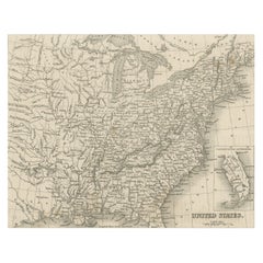
Steel Engraved Map of the United States with Inset Map of Florida
Located in Langweer, NL
Antique map titled 'United States'. Steel engraved map of the United States. With small inset map
Category
Antique Mid-19th Century Maps
Materials
Paper
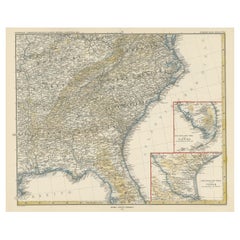
Antique Map of the Region of Georgia with Inset Maps of Florida and Texas
Located in Langweer, NL
, Tennessee, Kentucky, Virginia and part of Florida. With inset maps of the southern part of Florida and the
Category
Antique Late 19th Century Maps
Materials
Paper
H 15.04 in W 18.63 in D 0.02 in
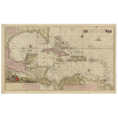
Engraving of a Map of Florida, the Gulf Coast, Caribbean & Central America, 1728
Located in Langweer, NL
early 18th-century mapmaking.
The map showcases a meticulous and comprehensive depiction of Florida
Category
Antique Mid-18th Century European Maps
Materials
Paper
H 24.61 in W 40.56 in D 0.02 in
Original Antique Map of the American State of Florida, 1903
Located in St Annes, Lancashire
Antique map of Florida
Published By A & C Black. 1903
Original colour
Good condition
Unframed
Category
Antique Early 1900s English Maps
Materials
Paper
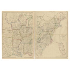
Set of 2 Antique Maps of the United States by W. G. Blackie, 1859
Located in Langweer, NL
Mississippi. With inset map of Florida. This map originates from ‘The Imperial Atlas of Modern Geography
Category
Antique Mid-19th Century Maps
Materials
Paper
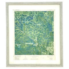
Vintage 50s Topographical Map of the Florida Keys
Located in west palm beach, FL
A fabulous vintage 50 original topographical map. A depiction of the Florida Keys and the
Category
Mid-20th Century American Maps
Materials
Glass, Wood, Paper
Original Antique Map of Central America / Florida, Arrowsmith, 1820
Located in St Annes, Lancashire
Great map of Central America.
Drawn under the direction of Arrowsmith.
Copper-plate engraving
Category
Antique 1820s English Maps
Materials
Paper
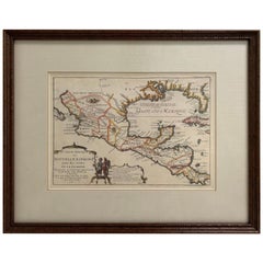
1705 Golfe de Mexico and Florida Framed Map
Located in Stamford, CT
Framed map of Mexico & Florida circa 1705, Paris. Small map with Mexico and the Gulf Coast. Inset
Category
Antique Early 1700s French Spanish Colonial Maps
Materials
Glass, Wood, Paper
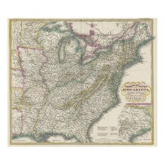
Antique Map of the Eastern United States with Only the Northern Part of Florida
Located in Langweer, NL
Antique map titled 'Verein-Staaten von Nord-America mit Ausnahme Florida's und der Westlichen
Category
Antique Mid-19th Century Maps
Materials
Paper
H 14.45 in W 17.92 in D 0.02 in
Large Original Vintage Map of the South Eastern States Inc. Florida, circa 1920
Located in St Annes, Lancashire
Great map of The South Eastern States
Original color. Good condition
Published by Alexander
Category
Vintage 1920s English Maps
Materials
Paper
H 19.5 in W 25 in D 0.07 in
Antique Map of the Eastern United States with Inset Map of Texas
Located in Langweer, NL
Antique map titled 'Verein-Staaten von Nord-America mit Ausnahme Florida's und der Westlichen
Category
Antique Mid-19th Century Maps
Materials
Paper
Antique Map of Tennessee, Kentucky, Virginia, Alabama, Georgia and Surroundings
Located in Langweer, NL
, Tennessee, Kentucky, Virginia and part of Florida. With inset maps of the southern part of Florida and the
Category
Antique Mid-19th Century Maps
Materials
Paper
H 15.16 in W 18.71 in D 0.02 in
"Choke II: Strait of Florida (Florida & Cuba)" - ceramic - map - Nevelson
By Gregor Turk
Located in Atlanta, GA
This ceramic wall sculpture features a topographic map in black and white.
Gregor is inspired by
Category
2010s Abstract Sculptures
Materials
Ceramic
Vintage 50s Original Topographical Map of the Florida Keys
Located in west palm beach, FL
A fabulous vintage Coastal original topographical map. A view of the Florida Keys and surrounding
Category
Mid-20th Century American Decorative Art
Materials
Glass, Wood, Paper
Catesby Map Table by David Duncan Studio
By David Duncan
Located in New York, NY
stretcher with a round center. The inset wooden top features a high resolution facsimile map of Carolina
Category
21st Century and Contemporary American Coffee and Cocktail Tables
Materials
Brass
1772 Map of Part of "West Florida"
Located in New York, NY
Original 1772 hand-colored copper plate engraving full title "A Map of Part of West Florida, from
Category
1770s Realist Landscape Prints
Materials
Engraving
An Early Map of Florida and the Carolinas by Seligmann
Located in Downingtown, PA
including Florida and The Carolina's,
Nuremberg: Seligmann, 1755.
Copper-engraved map, with
Category
Antique 18th Century and Earlier German Prints
Rare 17th Century American Map of Virginia and Florida by Jan Janssonius
By Jan Johansson
Located in Wiscasset, ME
dedicated to Italy. 1646 a fourth volume came out with "English County Maps", a year after a similar issue
Category
Antique 18th Century and Earlier Dutch Rococo Maps
H 25.25 in W 30.25 in D 2 in
Moll's Famous "Beaver Map"
Located in San Francisco, CA
Harbour of Charles-Town", and a map of Louisiana and East Florida.
Moll's famous "Beaver Map
Category
Antique 18th Century and Earlier English Maps
Americae Pars Magis Cognita.
By Johann Theodor De Bry
Located in New York, NY
Johann van Stadden and Jean de Lery. Cartographically, it is drawn from de Bry's own map of Florida and
Category
16th Century Other Art Style More Prints
Materials
Engraving
Gulf of Mexico, Florida, C. America, Cuba: 18th C. Hand-colored Map by Bellin
By Jacques-Nicolas Bellin
Located in Alamo, CA
This beautiful 18th century hand-colored map entitled "Carte du Golphe du Mexique et des Isles de
Category
1750s Landscape Prints
Materials
Engraving
Antique Map of Florida by Johnson, 1872
Located in Langweer, NL
Antique map titled 'Johnson's Florida'. Original map of Florida with an inset map of the Florida
Category
Antique Late 19th Century Maps
Materials
Paper
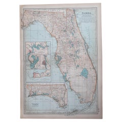
Large Original Antique Map of Florida, USA, C.1900
Located in St Annes, Lancashire
Fabulous map of Florida
Original color
Engraved and printed by the George F. Cram Company
Category
Antique 1890s American Maps
Materials
Paper
Original Antique Map of Florida And The Caribbean, Engraved By Barlow, 1806
Located in St Annes, Lancashire
Great map of Florida And The Caribbean
Copper-plate engraving by Barlow
Published by Brightly
Category
Antique Early 1800s English Maps
Materials
Paper
H 10 in W 15 in D 0.07 in
Antique Map of Florida, the Gulf Coast and Caribbean, 1771
Located in Langweer, NL
antique map of Florida, the Gulf Coast & Caribbean, showing Barroto's influence. Southern Florida is an
Category
Antique 18th Century Maps
Materials
Paper
Large Original Antique Map of Florida, USA, 1894
By Rand McNally & Co.
Located in St Annes, Lancashire
Fabulous map of Forida
Original color
By Rand, McNally & Co.
Published, 1894
Unframed
Category
Antique 1890s American Maps
Materials
Paper
Original Antique Map of Florida & The Caribbean, circa 1800
Located in St Annes, Lancashire
Great map of The Caribbean showing Florida, Bahamas etc.
Copper plate engraving
Published in
Category
Antique Early 1800s English Other Maps
Materials
Paper
Antique Map of Florida and Georgia, Gulf of Mexico, Caribbean Islands, 1802
Located in Langweer, NL
regions of Florida and Georgia in the early 19th century. Created by Pierre Antoine Tardieu, this map
Category
Antique Early 1800s Maps
Materials
Paper
H 16.34 in W 22.25 in D 0.01 in
Very Rare Marine Map of Florida, France, 1864
Located in Miami Beach, FL
Rare marine map engraving of Florida and the Gulf of Mexico dated 1864. The inscription reads
Category
Antique 1860s French Beaux Arts Drawings
Materials
Giltwood, Paper
Original Antique Map of The American State of Florida, 1889
Located in St Annes, Lancashire
Great map of Florida
Drawn and Engraved by W. & A.K. Johnston
Published By A & C Black
Category
Antique 1880s Scottish Victorian Maps
Materials
Paper
Drew's New Map of the State of Florida, 1870
Located in West Palm Beach, FL
Drew's new map of the state of Florida showing the Progress of the U.S. Surveys, the completed and
Category
Antique Mid-19th Century North American Victorian Maps
Materials
Paper
Vintage Coastal Topographical Map of Key West
Located in west palm beach, FL
A fabulous vintage Boho framed topographical map. A vintage look at the Straights of Florida
Category
Mid-20th Century North American Decorative Art
Materials
Wood, Paper
Original Antique Map of Central America And Florida By Thomas Clerk, 1817
Located in St Annes, Lancashire
Great map of Central America
Copper-plate engraving
Drawn and engraved by Thomas Clerk
Category
Antique 1810s English Maps
Materials
Paper
H 8.25 in W 10.25 in D 0.07 in
Large Original Vintage Map of the South Eastern States Inc. Florida, circa 1920
Located in St Annes, Lancashire
Great map of The South Eastern States
Original color. Good condition
Published by Alexander
Category
Vintage 1920s English Victorian Maps
Materials
Paper
H 19.5 in W 25 in D 0.07 in
Large Original Vintage Map of the South Eastern States Inc. Florida, circa 1920
Located in St Annes, Lancashire
Great map of The South Eastern States
Original color. Good condition/repair to a minor tear
Category
Vintage 1920s English Victorian Maps
Materials
Paper
H 19.5 in W 25 in D 0.07 in
Gulf of Mexico, Florida, C. America, Cuba, etc.: 18th C. Hand-colored Bellin Map
By Jacques-Nicolas Bellin
Located in Alamo, CA
This beautiful 18th century hand-colored map entitled "Carte du Golphe du Mexique et des Isles de
Category
Antique Mid-18th Century French Maps
Materials
Paper
H 12.63 in W 18 in D 0.13 in
Map of Florida
Located in New York, NY
Map of Florida, published 1895 by Rand McNally. Highly detailed with key to the locations of
Category
1890s Realist Landscape Prints
Materials
Lithograph
Danckerts Map of Florida, the West Indies and the Caribbean.
Located in Coral Gables, FL
A stunning example of Cornelius Danckerts' important 1696 map of Florida, the West Indies, Central
Category
Antique 18th Century and Earlier Dutch Maps
18th-C. Map of West Florida
By Thomas Kitchin
Located in New York, NY
Map of the Province of West Florida by well known British map maker Thomas Kitchin. Published in
Category
1780s Realist Landscape Prints
Materials
Engraving
Get Updated with New Arrivals
Save "Map Of Florida", and we’ll notify you when there are new listings in this category.
Map Of Florida For Sale on 1stDibs
You are likely to find exactly the map of florida you’re looking for on 1stDibs, as there is a broad range for sale. In our selection of items, you can find contemporary examples as well as an abstract version. You’re likely to find the perfect map of florida among the distinctive items we have available, which includes versions made as long ago as the 18th Century as well as those made as recently as the 21st Century. When looking for the right map of florida for your space, you can search on 1stDibs by color — popular works were created in bold and neutral palettes with elements of gray, beige, brown and blue. Creating a map of florida has been a part of the legacy of many artists, but those crafted by Don Pollack, Bastienne Schmidt, Rob Tarbell, Jacques-Nicolas Bellin and Jan Huygen van Linschoten are consistently popular. Artworks like these of any era or style can make for thoughtful decor in any space, but a selection from our variety of those made in paint, paper and fabric can add an especially memorable touch.
How Much is a Map Of Florida?
A map of florida can differ in price owing to various characteristics — the average selling price for items in our inventory is $2,167, while the lowest priced sells for $1 and the highest can go for as much as $195,000.
