Framing Antique Maps
to
32
245
205
219
181
117
85
77
50
50
44
36
28
25
21
19
19
18
13
13
13
13
11
11
9
8
8
8
8
8
7
7
7
5
5
5
5
5
4
4
3
3
3
3
3
2
1
1
1
5
4
4
4
4
Sort By
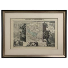
1847 Amerique Septentrionale Framed Map
Located in Stamford, CT
1847 Amerique Septentrionale Framed Map Illustrated by Raimond Bonheur. As found framed condition.
Category
1840s American American Classical Framing Antique Maps
Materials
Glass, Wood, Paper
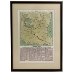
1826 Antigo Impero Messicano Mexico Hand Colored Framed Map
Located in Stamford, CT
1826 Antigo Impero Messicano Mexico Hand Colored Framed Map. As found black wood frame.
Category
1820s Mexican Spanish Colonial Framing Antique Maps
Materials
Glass, Wood, Paper
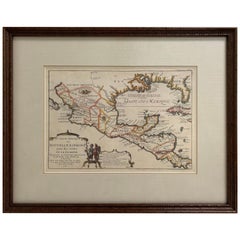
1705 Golfe de Mexico and Florida Framed Map
Located in Stamford, CT
Framed map of Mexico & Florida circa 1705, Paris. Small map with Mexico and the Gulf Coast. Inset
Category
Early 1700s French Spanish Colonial Framing Antique Maps
Materials
Glass, Wood, Paper
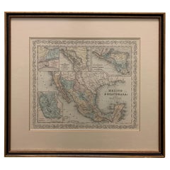
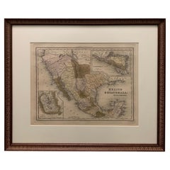
Large 1856 Mexico & Guatemala Framed Map by Charles Desilver
Located in Stamford, CT
Large 1856 Mexico & Guatemala Framed map. Published by Charles Desilver, Philadelphia, Pennsylvania
Category
1850s American American Classical Framing Antique Maps
Materials
Glass, Wood, Paper
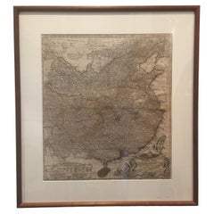
Framed Map of China
Located in Greenwich, CT
Map of China, 19th century. European print map of China
Conservation frame with walnut frame
Category
19th Century European Qing Framing Antique Maps
Materials
Paper
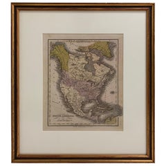
1830 Mexico and United States Framed Map
Located in Stamford, CT
Map of North America published circa 1830. Map shows United States into Canada. Mexico extending
Category
1830s American American Classical Framing Antique Maps
Materials
Glass, Wood, Paper
1834 Mexico & Guatemala Framed Map by H.S. Tanner
Located in Stamford, CT
1834 Mexico & Guatemala map of published by H.S. Tanner, Philadelphia, Pennsylvania. Engraved by J
Category
1830s American American Classical Framing Antique Maps
Materials
Glass, Wood, Paper
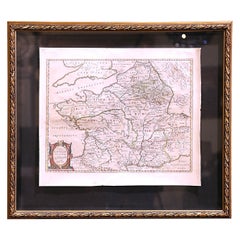
17th Century Framed Map of Ancient France Titled "Typus Galliae Veteris"
Located in Dallas, TX
1630, this beautifully framed antique map with protective glass, titled "Typus Galliae Veteris", is a
Category
17th Century Dutch Baroque Framing Antique Maps
Materials
Glass, Giltwood, Paper
South America: Hand-colored 18th Century Framed Map by Thomas Jefferys
By Thomas Jefferys
Located in Alamo, CA
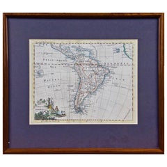
This detailed hand-colored map of South America by Thomas Jefferys was published in London in 1750
Category
Mid-18th Century English Framing Antique Maps
Materials
Paper
17th Century Lithograph Framed Map of Spain
Located in Atlanta, GA
In giltwood frame, dated 1652.
Category
18th Century and Earlier Spanish Baroque Framing Antique Maps
Materials
Ink, Paper
Original Antique Map in Frame of Greece by Smith '1818'
Located in Langweer, NL
Nicely framed map titled 'Greece'. Original antique map of Greece published by C. Smith, 1818
Category
Early 19th Century Framing Antique Maps
Materials
Paper
16th Century Antique Map of Ven Framed in Gold
Located in Haddonfield, NJ
Copenhagen. The 350th anniversary of this transfer was commemorated on the island in 2010.
This framed map
Category
16th Century Danish Baroque Framing Antique Maps
Materials
Wood, Paper
A Hand Colored 18th Century Framed Map of South America by Thomas Jefferys
Located in Alamo, CA
This detailed hand colored map of South America by Thomas Jefferys was published in London in 1750
Category
Mid-18th Century Other Art Style Framing Antique Maps
Materials
Engraving
H 12.25 in W 14.25 in D 1 in
Antique North America Map, USA, Canada, Mexico, Cartography, Colton, Victorian
Located in Hele, Devon, GB
This is an antique North America map. A USA, framed lithography atlas engraving of the continent
Category
Mid-19th Century American Victorian Framing Antique Maps
Materials
Paper
H 22.45 in W 18.71 in D 0.99 in
Map Bedfordshire General Framed
Located in BUNGAY, SUFFOLK
A general map of Bedfordshire with its hundreds
A scale of 5 miles
in the original green mount
Category
18th Century English Georgian Framing Antique Maps
Materials
Paper
Antique 1882 Map of Venezuela, Colombia (New Granada), and Ecuador
Located in Langweer, NL
outlining of borders and divisions is vivid and well-preserved.
Tips on How to Frame This Map:
1. Use a
Category
1880s Framing Antique Maps
Materials
Paper
Map Bedfordshire No 3 General Framed
Located in BUNGAY, SUFFOLK
.
in the original green mount and traditional black and gold frame.
charming map with lovely detailing
Category
18th Century English Georgian Framing Antique Maps
Materials
Paper
1705 Sanson Map of Southern India and Malabar with an Inset Map
Located in Langweer, NL
collection of early maps, colonial trade history, or European cartographic developments.
Framing
Category
Early 1700s Framing Antique Maps
Materials
Paper
Framed 1838 North America & Recent Discoveries Map
Located in Stamford, CT
. This map shows Texas as a Republic without its panhandle.
Framed in brown carved wood frame.
Category
1830s American American Classical Framing Antique Maps
Materials
Glass, Wood, Paper
Framed 1838 Mexico & Gulf of Mexico Map
Located in Stamford, CT
Framed 1838 Mexico & Gulf of Mexico map. Printed by Fisher, Son & Co. of London in 1838. As found
Category
1830s English American Classical Framing Antique Maps
Materials
Glass, Wood, Paper
1882 Blackie Atlas Maps: Atlantic States and Mississippi Valley Compilation
Located in Langweer, NL
detract from their overall appearance.
Tips on How to Frame These Two Maps
1. Choose the Right Frame
Category
1880s Framing Antique Maps
Materials
Paper
H 14.97 in W 11.03 in D 0.01 in
Antique County Map, Buckinghamshire, Bedfordshire, Dutch, Framed, Janssonius
Located in Hele, Devon, GB
This is an antique county map of Buckinghamshire and Bedfordshire. A Dutch, framed atlas engraving
Category
Mid-17th Century Dutch Framing Antique Maps
Materials
Paper
H 24.02 in W 27.76 in D 0.79 in
Antique Lithography Map, Cambridgeshire, English, Framed Cartography, Victorian
Located in Hele, Devon, GB
This is an antique lithography map of Cambridgeshire. An English, framed atlas engraving of
Category
Mid-19th Century British Victorian Framing Antique Maps
Materials
Glass, Wood, Paper
H 16.15 in W 13.39 in D 0.6 in
Antique Lithography Map, Monmouthshire, Framed, Welsh Cartography, Victorian
Located in Hele, Devon, GB
This is an antique lithography map of Monmouthshire. An English, framed atlas engraving of
Category
Mid-19th Century British Victorian Framing Antique Maps
Materials
Glass, Wood, Paper
H 15.75 in W 13.19 in D 0.6 in
Antique Lithography Map, Derbyshire, English, Framed Cartography, Victorian
Located in Hele, Devon, GB
This is an antique lithography map of Derbyshire. An English, framed atlas engraving of
Category
Mid-19th Century British Victorian Framing Antique Maps
Materials
Glass, Wood, Paper
H 16.15 in W 13 in D 0.6 in
Antique Lithography Map, Huntingdonshire, English, Framed Cartography, Victorian
Located in Hele, Devon, GB
This is an antique lithography map of Huntingdonshire. An English, framed atlas engraving of
Category
Mid-19th Century British Victorian Framing Antique Maps
Materials
Glass, Wood, Paper
H 16.15 in W 13.19 in D 0.6 in
Antique Lithography Map, Warwickshire, English, Framed, Cartography, Victorian
Located in Hele, Devon, GB
This is an antique lithography map of Warwickshire. An English, framed atlas engraving of
Category
Mid-19th Century British Victorian Framing Antique Maps
Materials
Glass, Wood, Paper
H 15.95 in W 13.39 in D 0.6 in
Antique Lithography Map, Cumberland, English, Framed, Cartography, Victorian
Located in Hele, Devon, GB
This is an antique lithography map of Cumberland. An English, framed atlas engraving of
Category
Mid-19th Century British Victorian Framing Antique Maps
Materials
Wood
H 15.95 in W 13.19 in D 0.6 in
Antique Lithography Map, Westmoreland, English, Framed, Cartography, Victorian
Located in Hele, Devon, GB
This is an antique lithography map of Westmoreland. An English, framed atlas engraving of
Category
Mid-19th Century British Victorian Framing Antique Maps
Materials
Wood
H 14.18 in W 16.34 in D 0.6 in
Antique Lithography Map, Shropshire, English, Framed, Cartography, Victorian
Located in Hele, Devon, GB
This is an antique lithography map of Shropshire. An English, framed atlas engraving of
Category
Mid-19th Century British Victorian Framing Antique Maps
Materials
Wood
H 16.15 in W 13.19 in D 0.6 in
Antique Leicestershire Map, English, Framed Cartographic Interest, Victorian
Located in Hele, Devon, GB
This is an antique lithography map of Leicestershire. An English, framed atlas engraving of
Category
Mid-19th Century British Victorian Framing Antique Maps
Materials
Wood
H 15.56 in W 13 in D 0.6 in
Antique Nottinghamshire Map, English, Framed, Cartographic Interest, Victorian
Located in Hele, Devon, GB
This is an antique lithography map of Nottinghamshire. An English, framed atlas engraving of
Category
Mid-19th Century British Victorian Framing Antique Maps
Materials
Wood
H 15.75 in W 13 in D 0.6 in
Antique Lithography Map, Buckinghamshire, English, Framed Cartography, Victorian
Located in Hele, Devon, GB
This is an antique lithography map of Buckinghamshire. An English, framed atlas engraving of
Category
Mid-19th Century British Victorian Framing Antique Maps
Materials
Wood, Paper
H 16.15 in W 13.19 in D 0.6 in
Antique Lithography Map, Bedfordshire, English, Framed Engraving, Cartography
Located in Hele, Devon, GB
This is an antique lithography map of Bedfordshire. An English, framed atlas engraving of
Category
Mid-19th Century British Victorian Framing Antique Maps
Materials
Wood
H 15.75 in W 13.19 in D 0.6 in
Antique Lithography Map, Hertfordshire, English, Framed Engraving, Cartography
Located in Hele, Devon, GB
This is an antique lithography map of Hertfordshire. An English, framed atlas engraving of
Category
Mid-19th Century British Victorian Framing Antique Maps
Materials
Wood
H 13.59 in W 15.75 in D 16.34 in
Antique Lithography Map, Gloucestershire, English, Framed Engraving, Cartography
Located in Hele, Devon, GB
This is an antique lithography map of Gloucestershire. An English, framed atlas engraving of
Category
Mid-19th Century British Victorian Framing Antique Maps
Materials
Wood
H 15.75 in W 13 in D 0.6 in
Antique Lithography Map, Northumberland, English, Framed, Engraving, Cartography
Located in Hele, Devon, GB
This is an antique lithography map of Northumberland. An English, framed atlas engraving of
Category
Mid-19th Century British Victorian Framing Antique Maps
Materials
Wood
H 16.74 in W 13.98 in D 0.6 in
Framed Mercator Hondius Hispania Nova Atlas Minor Map
Located in Stamford, CT
Framed colored example of this decorative and important minature map. Newly framed in brown wood
Category
17th Century Dutch Spanish Colonial Framing Antique Maps
Materials
Glass, Wood, Paper
Antique Map of Asia 'in Frame, circa 1739'
Located in Langweer, NL
Antique map titled 'Asia Dividida em suas Regioens & Principaes Estados'. Rare and uncommon map of
Category
Mid-18th Century Framing Antique Maps
Materials
Paper
Antique Lithography Map, Worcestershire, English, Framed Engraving, Cartography
Located in Hele, Devon, GB
This is an antique lithography map of Worcestershire. An English, framed atlas engraving of
Category
Early 19th Century British Regency Framing Antique Maps
Materials
Wood
H 15.95 in W 13.19 in D 0.6 in
Antique North Yorkshire Map, English, Framed Lithography, Cartography, Victorian
Located in Hele, Devon, GB
This is an antique lithography map of North Yorkshire. An English, framed atlas engraving of
Category
Mid-19th Century British Victorian Framing Antique Maps
Materials
Paper
H 13.39 in W 15.95 in D 0.6 in
Antique County Map, Kent, English, Framed, Lithography, Cartography, Victorian
Located in Hele, Devon, GB
This is an antique lithography map of Kent. An English, framed atlas engraving of cartographic
Category
Mid-19th Century British Victorian Framing Antique Maps
Materials
Paper
H 13.78 in W 15.95 in D 0.6 in
Antique County Map, Berkshire, English Framed Lithograph, Cartography, Victorian
Located in Hele, Devon, GB
This is an antique lithography map of Berkshire. An English, framed atlas engraving of
Category
Mid-19th Century British Victorian Framing Antique Maps
Materials
Paper
H 14.38 in W 16.34 in D 0.6 in
Antique West Yorkshire Map, English, Framed Lithography, Cartography, Victorian
Located in Hele, Devon, GB
This is an antique lithography map of West Yorkshire. An English, framed atlas engraving of
Category
Mid-19th Century British Victorian Framing Antique Maps
Materials
Paper
H 13.59 in W 15.75 in D 8.47 in
Antique East Yorkshire Map, English, Framed Lithograph, Cartography, Victorian
Located in Hele, Devon, GB
This is an antique lithography map of East Yorkshire. An English, framed atlas engraving of
Category
Mid-19th Century British Victorian Framing Antique Maps
Materials
Paper
H 13.98 in W 16.15 in D 0.6 in
Antique County Map, Surrey, English, Framed Lithograph, Cartography, Victorian
Located in Hele, Devon, GB
This is an antique lithography map of Surrey. An English, framed atlas engraving of cartographic
Category
Mid-19th Century British Victorian Framing Antique Maps
Materials
Paper
H 13.78 in W 15.95 in D 0.6 in
Antique County Map, Suffolk, English, Framed Lithograph, Cartography, Victorian
Located in Hele, Devon, GB
This is an antique lithography map of Suffolk. An English, framed atlas engraving of cartographic
Category
Mid-19th Century British High Victorian Framing Antique Maps
Materials
Paper
H 14.57 in W 16.74 in D 0.6 in
Antique County Map, Middlesex, English, Framed, Litho, Cartography, Victorian
Located in Hele, Devon, GB
This is an antique lithography map of Middlesex. An English, framed atlas engraving of
Category
Mid-19th Century British Victorian Framing Antique Maps
Materials
Paper
H 13.78 in W 16.15 in D 0.6 in
Antique County Map, Sussex, English, Framed Lithography, Cartography, Victorian
Located in Hele, Devon, GB
This is an antique lithography map of Sussex. An English, framed atlas engraving of cartographic
Category
Mid-19th Century British Victorian Framing Antique Maps
Materials
Paper
H 14.57 in W 16.34 in D 0.6 in
Antique Lithography Map, Oxfordshire, English, Framed Cartography, Robert Morden
Located in Hele, Devon, GB
This is an antique lithography map of Oxfordshire. An English, framed atlas engraving of
Category
Late 17th Century British William and Mary Framing Antique Maps
Materials
Paper
H 23.43 in W 20.48 in D 1.19 in
Antique County Map, Staffordshire, English, Framed Litho, Cartography, Victorian
Located in Hele, Devon, GB
This is an antique lithography map of Staffordshire. An English, framed atlas engraving of
Category
Mid-19th Century British Victorian Framing Antique Maps
Materials
Glass, Wood, Paper
H 16.34 in W 13.59 in D 0.6 in
Antique County Map, Cambridgeshire, English, Framed Cartography, Robert Morden
Located in Hele, Devon, GB
This is an antique county map of Cambridgeshire. An English, framed atlas engraving of
Category
Early 18th Century British Other Framing Antique Maps
Materials
Glass, Wood, Paper
H 24.22 in W 21.26 in D 0.99 in
Antique County Map, Northamptonshire, English, Framed Cartography, Richard Blome
Located in Hele, Devon, GB
This is an antique county map of Northamptonshire. An English, framed atlas engraving by Richard
Category
Late 17th Century British Charles II Framing Antique Maps
Materials
Glass, Wood, Paper
H 15.36 in W 17.72 in D 0.79 in
Antique Berkshire Map, English County, Framed Engraving, Cartography, Lithograph
Located in Hele, Devon, GB
This is an antique county map of Berkshire. An English, framed atlas engraving of cartographic
Category
Mid-19th Century British Victorian Framing Antique Maps
Materials
Glass, Wood, Paper
H 13.98 in W 16.15 in D 0.6 in
Antique County Map, Hertfordshire, English, Framed Engraving, Cartography, Litho
Located in Hele, Devon, GB
This is an antique county map of Hertfordshire. An English, framed atlas engraving of cartographic
Category
Mid-19th Century British Victorian Framing Antique Maps
Materials
Glass, Wood, Paper
H 13.78 in W 16.34 in D 0.6 in
Antique County Map, Dorset, English, Framed Engraving, Cartography, Lithography
Located in Hele, Devon, GB
This is an antique lithography map of Dorset. An English, framed atlas engraving of cartographic
Category
Mid-19th Century British Victorian Framing Antique Maps
Materials
Glass, Wood, Paper
H 14.57 in W 16.34 in D 0.6 in
Antique Lithography Map, Environs of Southampton, English, Framed, Victorian
Located in Hele, Devon, GB
This is an antique lithography map 'The Environs of Southampton'. An English, framed town
Category
Late 19th Century British Victorian Framing Antique Maps
Materials
Wood
H 13.98 in W 11.42 in D 0.6 in
Antique County Map, Oxfordshire, English, Framed Cartography Interest, Victorian
Located in Hele, Devon, GB
This is an antique lithography map of Oxfordshire. An English, framed atlas engraving of
Category
Mid-19th Century British Mid-Century Modern Framing Antique Maps
Materials
Wood
H 16.54 in W 13.78 in D 0.6 in
Antique County Map, Norfolk, English, Framed Lithography, Cartography, Victorian
Located in Hele, Devon, GB
This is an antique lithography map of Norfolk. An English, framed atlas engraving of cartographic
Category
Mid-19th Century British Victorian Framing Antique Maps
Materials
Glass, Wood
H 14.57 in W 16.93 in D 0.6 in
Antique Lithography Map, Coastal England, Framed Cartography Interest, Victorian
Located in Hele, Devon, GB
This is an antique lithography map of Coastal England. A Scottish, framed town engraving of
Category
Mid-19th Century British Early Victorian Framing Antique Maps
Materials
Glass, Wood
H 25.01 in W 19.1 in D 0.99 in
- 1
Get Updated with New Arrivals
Save "Framing Antique Maps", and we’ll notify you when there are new listings in this category.
Framing Antique Maps For Sale on 1stDibs
At 1stDibs, there are several options of framing antique maps available for sale. Frequently made of paper, wood and glass, all framing antique maps available were constructed with great care. Framing antique maps have been made for many years, and versions that date back to the 18th Century alongside those produced as recently as the 20th Century. Framing antique maps are generally popular furniture pieces, but Neoclassical, Mid-Century Modern and Victorian styles are often sought at 1stDibs. George F. Cram, Herman Moll and Townsend MacCoun each produced beautiful framing antique maps that are worth considering.
How Much are Framing Antique Maps?
Prices for framing antique maps can differ depending upon size, time period and other attributes — at 1stDibs, framing antique maps begin at $225 and can go as high as $135,000, while the average can fetch as much as $1,250.
Questions About Framing Antique Maps
- Are antique picture frames valuable?2 Answers1stDibs ExpertAugust 17, 2021Antique picture frames can be very valuable, particularly if they are older and have maintained their high quality. Some designs are considered classically attractive and are more valuable even if they are not as old.1stDibs ExpertAugust 24, 2021Yes, antique picture frames are considered valuable. They are regarded as high-value collectibles and can often be seen in exhibits without canvases, as art pieces on their own. Made of wood traditionally, antique picture frames remain very popular owing to their ability to be shaped in varied profiles. You can choose from a wide variety of antique picture frames, including designs in antique and vintage, new and contemporary, and 21st century pre-owned styles on 1stDibs.
