Caribbean Map

to
18
55
9
64
1
1
1
1
34
26
4
1
2
1
1
1
1
62
2
1
1
1
13
5
5
4
2
65
65
65
4
1
1
1
1
Sort By
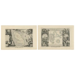
French Colonies in the Caribbean: Maps of Martinique and Guadeloupe (1852)
Located in Langweer, NL
This pair of maps, published in 1852, provides a detailed representation of the French Caribbean
Category

Antique 1850s Maps

Materials

Paper

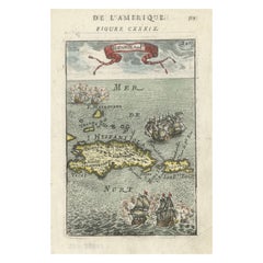
Antique 1683 Map of Hispaniola and Puerto Rico in the Caribbean by Mallet
Located in Langweer, NL
map - Puerto Rico map - Antique Caribbean map - Historical map of the Caribbean - Description de
Category

Antique 1830s Maps

Materials

Paper

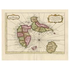
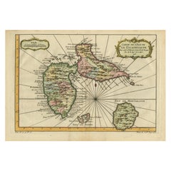
Antique Map of Guadelupe in the Caribbean, 1759
By Jacques-Nicolas Bellin
Located in Langweer, NL
Antique map titled 'Carte De L'Isle De La Guadeloupe'. Detailed map of Guadalupe, Mari-Galante and
Category

Antique Mid-18th Century French Maps

Materials

Paper

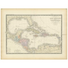
Antique Map of the Antilles in the Caribbean, '1875'
Located in Langweer, NL
Antique map titled 'Carte des Iles Antilles'. Large map of the Antilles. This map originates from
Category

Antique Late 19th Century Maps

Materials

Paper

Antique Map of Guadeloupe, Island in the Caribbean, c.1757
Located in Langweer, NL
Antique map titled 'Carte de L'Isle de la Guadeloupe'. A very decorative map of Guadeloupe in the
Category

Antique 18th Century Maps

Materials

Paper

Detailed Antique Map of the Windward Islands in the Caribbean
By Covens & Mortier
Located in Langweer, NL
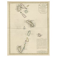
Antique map titled 'Carte des Antilles Francoises et des Isles Voisines'. Original antique map of
Category

Antique Early 18th Century Maps

Materials

Paper

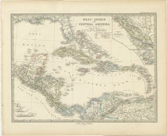
1880 Map of the Caribbean and Central America by Adolf Stieler
Located in Langweer, NL
published in Gotha in 1880. The map covers the Caribbean islands and the Central American region, including
Category

Antique 1880s Maps

Materials

Paper

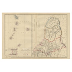
Antique Map the Windward or South Caribbean Islands and Guiana, 1859
Located in Langweer, NL
Antique map titled 'The Windward or South Caribbean Islands'. Original antique map of South
Category

Antique Mid-19th Century Maps

Materials

Paper

Antique Map of the Caribbean Island of St Kitts, ca.1750
Located in Langweer, NL
Description: Antique map titled 'Carte de l'Isle St. Christophe pour Servir a l'Histoire Genle. des
Category

Antique 1750s Maps

Materials

Paper

Martinique Island in the Caribbean by Bellin Original Original Antique Map, 1780
Located in Langweer, NL
This mid-18th century map, "Carte de l'Isle de la Martinique pour servir a l'historie generale des
Category

Antique Late 18th Century Maps

Materials

Paper

Authentic Antique Map of the Caribbean, Gulf Coast and Central America, 1787
Located in Langweer, NL
Antique map titled 'Les Isles Antilles et le Golfe du Méxique'. Original old map of the Caribbean
Category

Antique Late 18th Century Maps

Materials

Paper

Old 18th Century Composite Map of Key Caribbean Islands with Descriptive Texts
Located in Langweer, NL
. Bermudes sonst Sommers genannt'. Beautiful map of the British possessions in the Caribbean. Shows the
Category

Antique 1740s Maps

Materials

Paper

Antique Map with Hand Coloring of the United States and the Caribbean
Located in Langweer, NL
the United States of America showing the Caribbean. With an inset map of the surrounding area of
Category

Antique Late 19th Century Maps

Materials

Paper

Antique Map of the United States of America, also showing the Caribbean
Located in Langweer, NL
the United States of America showing the Caribbean. With an inset map of the surrounding area of
Category

Antique Mid-19th Century Maps

Materials

Paper

Antique Map of the Gulf of Mexico and Caribbean Islands by Tardieu, 1802
Located in Langweer, NL
the Gulf of Mexico and the Caribbean islands. Created by Pierre Antoine Tardieu, this map provides a
Category

Antique Early 1800s Maps

Materials

Paper

Engraving of a Map of Florida, the Gulf Coast, Caribbean & Central America, 1728
Located in Langweer, NL
This exceptional antique map, titled "Nouvelle Carte Marine de Toute les Cotes de l´Amerique" and
Category

Antique Mid-18th Century European Maps

Materials

Paper

Original Antique Map of the Virgin Islands with Insets of Caribbean Isles, 1787
Located in Langweer, NL
Antique map titled 'Supplément pour les Isles Antilles (..)'. Original old map of the Virgin
Category

Antique Late 18th Century Maps

Materials

Paper

Early 19th Century Hand Colored Map of the United States and Caribbean Islands
Located in Hamilton, Ontario
Hand coloured early 19th century map by Giraldon of France titled "Etats Unis et Grandes Antilles
Category

Antique Early 19th Century French Maps

Materials

Paper

Barbados Island at the Height of the Plantation Economy, Circa 1759
Located in Langweer, NL
especially relevant for collectors of Caribbean maps, plantation economy artifacts, and those interested in
Category

Antique 1750s Maps

Materials

Paper

Old Map of the island of Saint Christopher or St. Kitts in the Caribbean, c.1765
Located in Langweer, NL
Antique map titled 'Carte de l'Isle de Saint-Christophe'. A detailed map of the island of Saint
Category

Antique 18th Century Maps

Materials

Paper

Rare North Atlantic and Caribbean Sea Chart: Newfoundland to Venezuela, 1745
Located in Langweer, NL
This impressive map titled "Terra Neuf, en de Custen van Nieu Vranckryck, Nieuw Engeland
Category

Antique 1740s Maps

Materials

Paper

L'isle De La Martinique Caribbean Copper Engraving Original Handcoloring, 1704
Located in Langweer, NL
The original hand-colored map titled "Isle de la Martinique," published in 1704 and part of De
Category

Antique Late 19th Century Maps

Materials

Paper

Original Engraving of the West Indies, Gulf of Mexico, Antilles, Caribbean, 1780
Located in Langweer, NL
during the late 18th century. **Title:** Map of the West Indies, Gulf of Mexico, Antilles, and Caribbean
Category

Antique Late 18th Century Maps

Materials

Paper

Antique Map of the United States with inset map of the region of Mexico City
Located in Langweer, NL
the United States of America showing the Caribbean. With an inset map of the surrounding area of
Category

Antique Mid-19th Century Maps

Materials

Paper

Barados and St Christopher or St Kitts and Nevis Islands in the Caribbean, 1748
Located in Langweer, NL
historical context of these Caribbean territories during the colonial period. The map's delineation of
Category

Antique Mid-18th Century Maps

Materials

Paper

1864 Johnson's Map of the West Indies and Bermuda
Located in Langweer, NL
Title: 1864 Johnson's Map of the West Indies and Bermuda Description: This is an 1864 map titled
Category

Antique 1860s Maps

Materials

Paper

Vintage Map of the Greater Antilles and Lesser Antilles
Located in Langweer, NL
shows the Lesser Antilles, a group of islands in the Caribbean Sea. Inset maps of Guadeloupe and
Category

20th Century Maps

Materials

Paper

Guadeloupe and Dependencies: Mid-19th Century Map from France Pittoresque Series
Located in Langweer, NL
and its surrounding areas: 1. Guadeloupe map 2. Basse-Terre and Grande-Terre map 3. French Caribbean
Category

Antique 1850s Maps

Materials

Paper

Original Antique Map of the West Indies by J. Arrowsmith, 1842
Located in Langweer, NL
depiction of the Caribbean islands, this map is a testament to the skill and craftsmanship of 19th-century
Category

Antique Early 19th Century Maps

Materials

Paper

Antique Map of Jamaica and Hispaniola (Saint-Domingue and Santo Domingo), 1802
Located in Langweer, NL
landscape of these significant Caribbean islands in the early 19th century. Map Details: - **Title
Category

Antique Early 1800s Maps

Materials

Paper

Antique Map of Cuba, Haiti and Porto Rico by W. G. Blackie, 1859
Located in Langweer, NL
Antique map titled 'The Leeward or North Caribbean Islands'. Original antique map of Cuba, Haiti
Category

Antique Mid-19th Century Maps

Materials

Paper

St. Christophe 'St. Kitts' Island: An 18th Century Hand-colored Map by Bellin
By Jacques-Nicolas Bellin
Located in Alamo, CA
Jacques Bellin's copper-plate map of the Caribbean island of Saint Kitts entitled "Carte De De
Category

Antique Mid-18th Century French Maps

Materials

Paper

Antique Map of Guadeloupe with Les Saintes, Grand Bourg and La Désirade, c.1780
Located in Langweer, NL
Antique map titled 'Les Isles de la Guadeloupe (..).' Map of the Caribbean Island of Guadeloupe
Category

Antique 18th Century Maps

Materials

Paper

Antique Map of the Gulf of Mexico and all the islands of the West Indies
Located in Langweer, NL
islands in the Caribbean. This map originates from La Harpe's 'Histoire Generale des Voyages'. Engraved by
Category

Antique Early 19th Century Maps

Materials

Paper

Pair of Canvas Flamingo Throw Pillows, Priced Individually
Located in Palm Beach, FL
British Colonial style pair of canvas throw pillows with flamingos over antique style maps of the
Category

21st Century and Contemporary American British Colonial Pillows and Throws

Materials

Linen

Postmodern 1980s Art Deco Revival Great Escapes on Beckett Cambric Framed Print
Located in Miami, FL
Print. Features the image of a sealing boat superposed over a Caribbean Sea Cartography Map, protected
Category

Vintage 1980s American Post-Modern Posters

Materials

Wood, Paper

Rare Chart of the Caribbean Islands Published by James Imray & Son, London, 1866
Located in Stamford, CT
Rare chart of the Caribbean Islands published by James Imray & Son, London, 1866. FW 1370.
Category

Antique Mid-19th Century English Folk Art Maps

Materials

Paper

Bellin 18th Century Hand Colored Map of St. Christophe (St. Kitts)
By Jacques-Nicolas Bellin
Located in Alamo, CA
Jacques Bellin's hand colored copper plate map of the Caribbean island of Saint Kitts entitled
Category

Antique Mid-18th Century French Maps

Materials

Paper

Bellin 18th Century Hand Colored Map of "L'isle de Sainte Lucie" 'St. Lucia'
By Jacques-Nicolas Bellin
Located in Alamo, CA
Jacques Bellin's map of the Caribbean island of Saint Lucia entitled "Carte de L'isle de Sainte
Category

Antique Mid-18th Century French Maps

Materials

Paper

Original Vintage Poster KLM Air Travel West Indies Caribbean Islands Route Map
Located in London, GB
featuring a map of the Caribbean islands and the Atlantic Ocean Caribbean Sea Gulf of Mexico and Pacific
Category

Vintage 1950s Trinidadian Posters

Materials

Paper

1609 Antique Map of Cuba and Jamaica by Cornelis Claesz, Rare Caribbean Map
Located in Langweer, NL
This 1609 copper-engraved map titled "Cuba ende Iamaica" depicts Cuba, Jamaica, and surrounding
Category

Antique Early 1600s Maps

Materials

Paper

18th Century Antique Map of the Virgin Islands and Caribbean Inset Maps
Located in Langweer, NL
Antilles," featuring inset maps of various islands in the Caribbean, is from the "Atlas Encyclopedique" by
Category

Antique Late 18th Century Maps

Materials

Paper

Original Antique Map of Florida & The Caribbean, circa 1800
Located in St Annes, Lancashire
Great map of The Caribbean showing Florida, Bahamas etc. Copper plate engraving Published in
Category

Antique Early 1800s English Other Maps

Materials

Paper

Antique Map of Florida, the Gulf Coast and Caribbean, 1771
Located in Langweer, NL
antique map of Florida, the Gulf Coast & Caribbean, showing Barroto's influence. Southern Florida is an
Category

Antique 18th Century Maps

Materials

Paper

Detailed Nautical Antique Map of Martinique in the Caribbean, 1762
Located in Langweer, NL
Antique map titled 'Carte de l'Isle de la Martinique'. Detailed nautical map of the island of
Category

Antique 1760s Maps

Materials

Paper

Highly Detailed Antique Map of Jamaica in the Caribbean, c.1780
Located in Langweer, NL
Antique map titled 'Carte de l'Isle de la Jamaique.' Highly detailed map of Jamaica, showing
Category

Antique 18th Century Maps

Materials

Paper

Antique Map of the Caribbean Islands by J. Jansson, circa 1650
By J. Jansson
Located in Langweer, NL
Beautiful hand-colored antique map which includes all the islands between Puerto Rico and Trinidad
Category

Antique Mid-17th Century Maps

Antique Map of the Dutch Antilles 'Caribbean' by R. Bonne, circa 1780
Located in Langweer, NL
Antilles (Caribbean). Published by R. Bonne, circa 1780. The antique map titled 'Kaart van de Antilles' is
Category

Antique Late 18th Century Maps

Materials

Paper

Original Antique Map of Florida And The Caribbean, Engraved By Barlow, 1806
Located in St Annes, Lancashire
Great map of Florida And The Caribbean Copper-plate engraving by Barlow Published by Brightly
Category

Antique Early 1800s English Maps

Materials

Paper

Antique Map of Florida and Georgia, Gulf of Mexico, Caribbean Islands, 1802
Located in Langweer, NL
This is an original antique map titled "Carte de la Floride et de la Georgie," depicting the
Category

Antique Early 1800s Maps

Materials

Paper

Stunning Map of Caribbean Islands, Incl Jamaica, Bermuda, Barbados and St. Kitts
By Homann Heirs
Located in Langweer, NL
Original antique map titled 'Dominia Anglorum in praecipuis Insulis Americae (..) - Die Englische
Category

Antique Mid-18th Century Maps

Materials

Paper

Antique Map of the Caribbean Islands and Gulf of Mexico by Tardieu, 1802
Located in Langweer, NL
This is an original antique map titled "Carte des Antilles," depicting the Caribbean islands
Category

Antique Early 1800s Maps

Materials

Paper

Antique Map of British Possessions in the Caribbean by Homann Heirs 'circa 1740'
Located in Langweer, NL
Barbuda, and St. Kitts and Nevis) based on J.B. Homann's map, showing British possessions in the Caribbean
Category

Antique Mid-18th Century Maps

Materials

Paper

Antique Map of the Island of Grenada 'Caribbean' by A. van Krevelt, 1777
Located in Langweer, NL
Antique map titled 'Carte de l'Isle de la Grenade'. Detailed map of the Island of Grenada
Category

Antique Late 18th Century Maps

Materials

Paper

Old Map the Gulf of Mexico, the Caribbean and Northern South America, ca.1765
Located in Langweer, NL
West-Indien'. Detailed map of Mexico, the Gulf of Mexico, the Caribbean and northern South America
Category

Antique 18th Century Maps

Materials

Paper

Engraving by Tallis and Rapkin of Map of the West Indies in The Caribbean, 1851
Located in Langweer, NL
Caribbean region during the mid-19th century. Title: Map of the West Indies Cartographer/Engraver: John
Category

Antique Mid-19th Century Maps

Materials

Paper

Original Engraving of Tobago, West Indies, Caribbean by John Thomson 1816
Located in Langweer, NL
of the Caribbean. Offering a glimpse into the island's landscape and intricate coastal features
Category

Antique Early 19th Century Maps

Materials

Paper

Antique Map of Curacao by Van den Bosch '1818'
Located in Langweer, NL
map of Curacao with inset maps of the Caribbean and Fort Amsterdam, Curacao. One of 12 maps from
Category

Antique Early 19th Century Maps

Materials

Paper

Antique Map of Curacao by Van den Bosch '1818'
H 18.12 in W 22.84 in D 0.02 in
Antique Map of the West Indies by A & C, Black, 1870
Located in Langweer, NL
Antique map titled 'West India Islands'. Original antique map of the West Indies, Caribbean, with
Category

Antique Late 19th Century Maps

Materials

Paper

Early Map of Puerto Rico Printed in Venice by G. F. Camocio in 1571
Located in Langweer, NL
Porcacchi's map of the Island of Puerto Rico. One of the earliest obtainable maps of the Island and one of the
Category

Antique 16th Century Maps

Materials

Paper

  • 1
Get Updated with New Arrivals
Save "Caribbean Map", and we’ll notify you when there are new listings in this category.

Caribbean Map For Sale on 1stDibs

Choose from an assortment of styles, material and more with respect to the caribbean map you’re looking for at 1stDibs. A caribbean map — often made from paper, fruitwood and hardwood — can elevate any home. Your living room may not be complete without a caribbean map — find older editions for sale from the 18th Century and newer versions made as recently as the 19th Century. A caribbean map is a generally popular piece of furniture, but those created in Folk Art and Regency styles are sought with frequency. You’ll likely find more than one caribbean map that is appealing in its simplicity, but J. Jansson and Nicolas Joannes Piscator produced versions that are worth a look.

Finding the Right Collectibles-curiosities for You

Antique and vintage collectibles and curiosities can bring whimsy and wonder to any interior. 

Decorating with old scientific instruments, historical memorabilia and vintage musical instruments, as well as other authentic collectibles and curiosities that can be found on 1stDibs, presents an opportunity to create a unique, natural history museum-like atmosphere in your home that can provoke conversation as often as it pays tribute to how far we’ve come in understanding our world. 

And bringing collectibles and curiosities into your space is actually on trend — Wunderkammern, or curiosity cabinets, were all the rage in Europe during the 1500s and continued to have adherents there and in the U.S. in the following centuries. Today, however, they’re experiencing a real surge in popularity and influencing how many interior designers are furnishing and decorating homes — combining contemporary with antique, scientific with tribal, earthly with extraterrestrial, Les Lalanne tables with Flemish tapestries.

The original Wunderkammern were entire rooms filled with objects demonstrating their owners’ worldly knowledge: A proper one included artificiala or preciosa (objets d’art); naturalia (such as skeletons, shells, minerals); exotica (taxidermy or dried plants); and scientifica (scientific instruments), frequently alongside religious relics and ancient artifacts.

Pay tribute to a history of rich and diverse musical traditions that have taken shape all over the world by decorating your home with a collection of antique and vintage musical instruments — with a little help from strong hanging wire or some wall hooks, vintage brass instruments such as a gong, French horn or trumpet can help elevate a home office or complement the efforts you’ve made to ensure a welcoming vibe in your home’s entryway. Bells or antique wind instruments can add provocative metallic contrasts to dark woods as tabletop decorative objects.  

Create an intriguing focal point with Georgian scientific instruments, such as stick barometers with mahogany cases or lacquered brass telescopes. These items stem from an era named for the monarchies of the four King Georges, who ruled England in succession starting in 1714 (plus King William’s reign, which lasted until 1837). Just as there was beautiful jewelry produced during the period that today is coveted by collectors, there is much to be found in the collectibles and curiosities realm too.

Wanderlust, nostalgia and a shared love of good design are contributing factors to certain trends in decorating — just as vintage trunks and luggage have reappeared as furniture or home accents in a bedroom or foyer, decorating with globes, maps or nautical objects is similarly rooted in the allure of travel and a penchant for the stylish finishing touch that collectibles bring to our homes.

Find a wide range of antique and vintage collectibles and curiosities on 1stDibs.

Read More

Medal-Worthy Memorabilia from Epic Past Olympic Games

Get into the games! These items celebrate the events, athletes, host countries and sporting spirit.

Ahoy! You’ve Never Seen a Collection of Sailor Art and Kitsch Quite Like This

French trendsetter and serial collector Daniel Rozensztroch tells us about his obsession with objects related to seafaring men.

39 Incredible Swimming Pools

It's hard to resist the allure of a beautiful pool. So, go ahead and daydream about whiling away your summer in paradise.

Pamela Shamshiri Shares the Secrets behind Her First-Ever Book and Its Effortlessly Cool Interiors

The sought-after designer worked with the team at Hoffman Creative to produce a monograph that beautifully showcases some of Studio Shamshiri's most inspiring projects.

Moroccan Artworks and Objects Take Center Stage in an Extraordinary Villa in Tangier

Italian writer and collector Umberto Pasti opens the doors to his remarkable cave of wonders in North Africa.

Montecito Has Drawn Royalty and Celebrities, and These Homes Are Proof of Its Allure

Hollywood A-listers, ex-pat aristocrats and art collectors and style setters of all stripes appreciate the allure of the coastal California hamlet — much on our minds after recent winter floods.

Whaam! Blam! Pow! — a New Book on Pop Art Packs a Punch

Publishing house Assouline and writer Julie Belcove have teamed up to trace the history of the genre, from Roy Lichtenstein, Andy Warhol and Yayoi Kusama to Mickalene Thomas and Jeff Koons.

The Sparkling Legacy of Tiffany & Co. Explained, One Jewel at a Time

A gorgeous new book celebrates — and memorializes — the iconic jeweler’s rich heritage.