Antique Maps California
to
17
43
35
49
29
22
18
13
12
9
9
9
9
9
7
5
5
5
4
4
3
3
2
2
2
2
1
1
1
1
1
1
1
1
1
1
3
2
2
2
1
Sort By
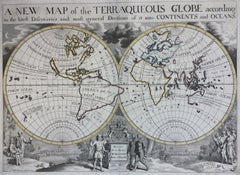
New Map of the Terraqueous Globe - WORLD MAP - CALIFORNIA AS AN ISLAND
By Edward Wells
Located in Santa Monica, CA
EDWARD WELLS (British 1667- 1727)
A NEW MAP of the TERRAQUEOUS GLOBE - according to the latest
Category
Early 1700s Old Masters Antique Maps California
Materials
Engraving
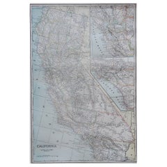
Large Original Antique Map of California, USA, circa 1900
Located in St Annes, Lancashire
Fabulous map of California
Original color
Engraved and printed by the George F. Cram Company
Category
1890s American Antique Maps California
Materials
Paper
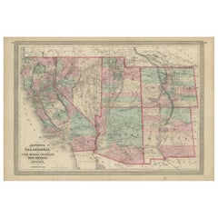
Antique Map of California, Utah, Nevada, Colorado, New Mexico & Arizona '1872'
Located in Langweer, NL
Antique map titled 'Johnson's California (..)'. Original map of California, Utah, Nevada, Colorado
Category
Late 19th Century Antique Maps California
Materials
Paper
H 18.12 in W 26.38 in D 0.02 in
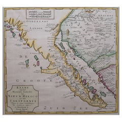
Original Antique Map of the Western Part of NEW MEXICO & CALIFORNIA
Located in Langweer, NL
Title: "Map of the Western Part of NEW MEXICO and CALIFORNIA According to the Latest Discoveries by
Category
1760s Antique Maps California
Materials
Paper
Antique Map of the World with California as an Island, 1788
Located in Langweer, NL
cordiform projections show California as an island. However, as this map was published at the very end of
Category
1780s Antique Maps California
Materials
Paper
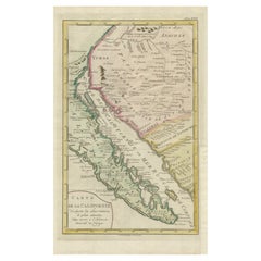
Map of Baja California and Mexico - Jesuit Observations and Native Tribes, 1777
Located in Langweer, NL
1777 A. Krevelt Map of Baja California and Northwestern Mexico - Jesuit Observations and Native
Category
1770s Antique Maps California
Materials
Paper
H 14.38 in W 8.94 in D 0.01 in
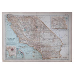
Original Antique Map of the American State of California ( Southern Part ), 1903
Located in St Annes, Lancashire
Antique map of California ( Southern part )
Published By A & C Black. 1903
Original colour
Good
Category
Early 1900s English Antique Maps California
Materials
Paper
H 11.5 in W 16.25 in D 0.07 in
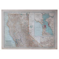
Original Antique Map of the American State of California ( Northern Part ), 1903
Located in St Annes, Lancashire
Antique map of California ( Northern part )
Published By A & C Black. 1903
Original colour
Good
Category
Early 1900s English Antique Maps California
Materials
Paper
H 11.5 in W 16.25 in D 0.07 in
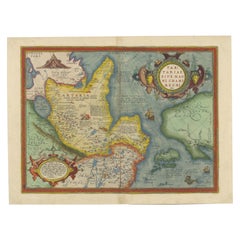
1573 Ortelius Map: First to Name California, Spanning Tartary to North America
Located in Langweer, NL
1573, this map is significant for being the earliest obtainable map that names California and includes
Category
16th Century Antique Maps California
Materials
Paper
H 15.75 in W 21.26 in D 0 in
California, Alaska and Mexico: 18th Century Hand-Colored Map by de Vaugondy
By Didier Robert de Vaugondy
Located in Alamo, CA
cartes publiees au commencement de 17e Siecle" (Map of California and the Northwestern Countries
Category
1770s French Antique Maps California
Materials
Paper
H 13.75 in W 16.63 in D 0.13 in
Antique Map of America with California as an Island by Homann '1710'
Located in Langweer, NL
of the most distinctive features of this map is the depiction of California as an island. This was a
Category
Early 18th Century Antique Maps California
Materials
Paper
Antique Miniature Map of the Western Hemisphere, with California as an Island
Located in Langweer, NL
the Western Hemisphere, published by Alain Manesson Mallet. The map shows California as an Island, no
Category
Late 17th Century Antique Maps California
Materials
Paper
H 8.27 in W 5.6 in D 0.02 in
1847 Antique Map of Mexico, Texas and California by Samuel Augustus Mitchell
By Samuel Augustus Mitchell 1
Located in Colorado Springs, CO
& Upper California, an important map showing the progress of the Mexican-American War. Published in 1847
Category
1840s American Antique Maps California
Materials
Paper
H 32 in W 23.63 in D 0.5 in
Beautiful Antique Map of the Northern Hemisphere with California as an Island
By Isaak Tirion
Located in Langweer, NL
Antique map titled 'Nieuwe Kaart van de Noord Pool na de alderlaatste ontdekking int licht gebracht
Category
Mid-18th Century Antique Maps California
Materials
Paper
H 13.98 in W 18.9 in D 0.02 in
Antique Map of Part of the United States Including Lower California & Arizona
Located in Langweer, NL
Antique map of part of the United States of America including Lower California, Arizona and part of
Category
Late 19th Century Antique Maps California
Materials
Paper
H 15.08 in W 18.75 in D 0.02 in
1890 "Map of Oregon, Kansas, California, and the Territories" by S. A. Mitchell
By Samuel Augustus Mitchell 1
Located in Colorado Springs, CO
Presented is an 1890 map "Map of Oregon, Kansas, California, and the Territories" by S. A. Mitchell
Category
1890s American Victorian Antique Maps California
Materials
Paper
H 13.75 in W 15.75 in D 0.75 in
1873 "Map of the States of California and Nevada" by Chas. Drayton Gibbes
Located in Colorado Springs, CO
Presented is Warren Holt and Charles Drayton Gibbes' 1873 “Map of California and Nevada.” This map
Category
1870s American Antique Maps California
Materials
Paper
Rare 1757 Jesuit Map of California and Baja, Dedicated to the King of Spain
Located in Langweer, NL
Title: Rare 1757 Jesuit Map of California and Baja, Dedicated to the King of Spain
This rare and
Category
1750s Antique Maps California
Materials
Paper
H 14.77 in W 9.22 in D 0.01 in
Antique Map of North and East Asia, 1751
Located in Langweer, NL
maps on one sheet, showing California, Alaska and Siberia, Korea and Japan. South to Korea the island
Category
18th Century Antique Maps California
Materials
Paper
1925 "Colorado" Map by L. L. Poates Eng. Co.
Located in Colorado Springs, CO
. Double-sided map, with California map on the reverse. Very faint bleed through of California’s map colors
Category
1920s American Arts and Crafts Antique Maps California
Materials
Paper
Antique Map of the World on Mercator Projection by Anson, 1749
Located in Langweer, NL
Antique map titled 'Nieuwe Wereld Kaart waar in de Reizen van den Hr. Anson rondsom de Wereld
Category
18th Century Antique Maps California
Materials
Paper
Original Hand-Colored Antique Map of America by Danckerts, circa 1680
Located in Langweer, NL
'. Striking map of America. California is shown as an island, Based Upon Sanson's model. The Great Lakes are
Category
Late 17th Century Antique Maps California
Materials
Paper
H 20.48 in W 24.22 in D 0.02 in
Nice Sheet of the Sangihe Archipelago in Indonesia & California Island, 1788
Located in Langweer, NL
Antique map titled 'De Noord Pool waar in aangetoont werd alle de Nieuwe Landen (..)
De
Category
1780s Antique Maps California
Materials
Paper
H 8.08 in W 12.01 in D 0 in
Antique Map of North Europe and East Asia by Vaugondy, circa 1750
Located in Langweer, NL
Asia. Five maps on one sheet, showing California, Alaska and Syberia, Korea and Japan. South to Korea
Category
Mid-18th Century Antique Maps California
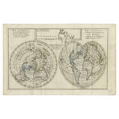
Antique Map of the World in two Hemispheres by Keizer & de Lat, 1788
Located in Langweer, NL
Antique map titled 'Kaart van de Twee platte Warelds Bollen (..)'. Interesting world map in two
Category
Late 18th Century Antique Maps California
Materials
Paper
Unique Antique Projection of the World with Twice California as an Island, c1703
Located in Langweer, NL
Description: Antique map of the world. Printed for Scherer's 'Atlas Novus' (1702-1710).
On this
Category
Early 1700s Antique Maps California
Materials
Paper
H 10.79 in W 15.83 in D 0 in
A NEW MAP OF THE WORLD from the Latest Observations.
By John Senex
Located in New York, NY
.”
A fine British produced double hemisphere world map. On this map, California is shown as an island
Category
18th Century Other Art Style Antique Maps California
Materials
Watercolor, Engraving
H 20.75 in W 23.75 in D 0.94 in
America Septentrionalis by Carroli Allard (1648-1709) Copper Plate Engraving
Located in San Francisco, CA
South America, circa 1700. A lovely hand colored map depicting California as an island as well as an
Category
Late 17th Century Dutch Antique Maps California
Materials
Paper
California: 18th Century Hand-colored Map by de Vaugondy
By Didier Robert de Vaugondy
Located in Alamo, CA
cartes publiees au commencement de 17e Siecle" (Map of California and the Northwestern Countries
Category
1770s Antique Maps California
Materials
Engraving
California, Northern Part. USA Century Atlas state antique vintage map
Located in Melbourne, Victoria
'The Century Atlas. California, Northern Part'
Inset maps of 'Yosemite Valley' and 'San Francisco
Category
Early 20th Century Victorian Antique Maps California
Materials
Lithograph
"San Francisco, Upper California” 1851 Antique Map of San Francisco
Located in Colorado Springs, CO
prodigious body of early California views. Very early on, Britton and Rey earned a reputation for
Category
1850s American Antique Maps California
Materials
Paper
AMERICA
By John Speed
Located in Santa Monica, CA
IMPORTANT AMERICAN MAP - ONE OF THE FIRST TO SHOW CALIFORNIA as an ISLAND
JOHN SPEED (1552-1629
Category
1620s Old Masters Antique Maps California
Materials
Engraving
The 1564 Medici Danti Map of California
By Fra Egnazio Danti
Located in New York, NY
of Danti’s map of California –which includes present-day California, Baja California, northwest
Category
17th Century Old Masters Antique Maps California
Materials
Canvas, Pen, Gouache, Watercolor, Ink, Paper
Relief Map of California and Nevada
Located in Los Angeles, CA
Lovely vintage relief map in the original frame. Great sepia colors
Category
Early 20th Century American Antique Maps California
Materials
Paper, Wood
Carte General du Globe Terrestre
Located in New York, NY
Engraving, late 1600s to early 1700's, with later hand coloring. As typical for all early maps
Category
Late 17th Century Realist Antique Maps California
Materials
Engraving
Western Hemisphere Map with California as an Island
Located in New York, NY
Circa 1675 to 1700 beautifully hand-colored engraved map of the Western Hemisphere including
Category
Late 17th Century Realist Antique Maps California
Materials
Engraving
Western Hemisphere Map with California as an Island
Located in New York, NY
Circa 1675 to 1700 beautifully hand-colored engraved map of the Western Hemisphere including
Category
Late 17th Century Realist Antique Maps California
Materials
Engraving
1701 Western Hemisphere Map with California as an Island
Located in New York, NY
Early 18th Century map of America by Robert Falconer, printed by Timothy Luyts, and Herman Moll and
Category
Early 1700s Realist Antique Maps California
Materials
Engraving
c. 1750 Double-Hemisphere World Map showing California as an Island
Located in New York, NY
c. 1750 beautifully hand-colored engraved double hemisphere world map, showing California as an
Category
1750s Realist Antique Maps California
Materials
Engraving
L' Amerique Septentrionale (North America with California as an Island)
Located in New York, NY
Original and rare 1702 map of North America showing California as a island stretching as far north
Category
Early 1700s Realist Antique Maps California
Materials
Engraving
California Survey Map in Antique Windowpane Frame, circa 1855
Located in Colorado Springs, CO
state of California. Several map sections have a grid overlay, to indicate surveyed lots. Roman numerals
Category
1850s Antique Maps California
Large Original Antique Map of California, USA, C.1900
Located in St Annes, Lancashire
Fabulous map of California
Original color
Engraved and printed by the George F. Cram Company
Category
1890s American Antique Maps California
Materials
Paper
1865 "Johnson's California, Utah, Nevada, Colorado, New Mexico, Arizona" Map
Located in Colorado Springs, CO
Presented is an original 1865 "Johnson's California, with Territories of Utah, Nevada, Colorado
Category
Mid-19th Century Antique Maps California
Materials
Paper
H 22.5 in W 30.5 in D 0.75 in
Antique Map of Mexico, Texas and Upper California by Lapie, 1842
Located in Langweer, NL
Antique map titled 'Carte des États-Unis du Méxique'. Map of Mexico, Texas and Upper California
Category
Mid-19th Century Antique Maps California
Materials
Paper
1846 Antique Map of Texas, Oregon, California, and Regions Adjoining by Mitchell
By Samuel Augustus Mitchell 1
Located in Colorado Springs, CO
Territory, California, and the Transmississippi West. Published in 1846 from Philadelphia, Mitchell's map of
Category
1840s American Antique Maps California
Materials
Paper
H 32.5 in W 31.5 in D 2 in
Antique Whimsical Map of San Diego, California by Jo Mora for Marston Stores
By Jo Mora, A. Marston & Co.
Located in San Diego, CA
Antique whimsical map of San Diego, California by Jo Mora for Marston Stores, circa 1928. The rare
Category
Early 20th Century American Antique Maps California
Materials
Paper
H 30.5 in W 25.25 in D 0.5 in
1857 Wall Map of the United States by Fanning, Bridgman & Ensign
By Thayer, Bridgman and Fanning
Located in Colorado Springs, CO
California. The map notes emigrant and exploration routes to the west, including Fremont's Route, The Oregon
Category
1850s American Antique Maps California
Materials
Paper
Antique Map of the Eastern and Western Hemisphere by Bodenehr, circa 1720
Located in Langweer, NL
America, Africa, Europe and Asia. The map of the Americas shows California as an Island from the Dutch
Category
Early 18th Century Antique Maps California
Materials
Paper
H 11.23 in W 15.56 in D 0.6 in
Florida and Virginia: A 17th Century Hand-colored Map by Hondius after Mercator
By Gerard Mercator
Located in Alamo, CA
. In 1589, Hondius produced a famous map of present-day northern California, which Drake named New
Category
Early 17th Century Dutch Antique Maps California
Materials
Paper
H 6.75 in W 8.63 in D 0.13 in
Rare Print of Archduke Charles of Austria Showing California as an Island, 1704
Located in Langweer, NL
Allegorical portrait of the Archduke Charles of Austria (calling himself the Spanish king Charles III) as Roman general, 1704. In the foreground near Neptune, Africa and Asia carry a...
Category
Early 1700s Antique Maps California
Materials
Paper
H 23.23 in W 15.36 in D 0 in
Mid-Century Framed "Baja California" Map, c.1967
Located in San Francisco, CA
About
An original mid-century framed map of Baja California.
Creator: The Arhur H. Clark
Category
Early 20th Century American Mid-Century Modern Antique Maps California
Materials
Wood, Paper
"San Francisco, Upper California” 1851 Antique Map of San Francisco
Located in Colorado Springs, CO
prodigious body of early California views. Very early on, Britton and Rey earned a reputation for
Category
1850s American Antique Maps California
Materials
Paper
IMPORTANT MAP OF THE N.W. PASSAGE, CALIFORNIA, ASIA - Am. Revolutionary War Time
Located in Santa Monica, CA
, che nell' AMERICA
(Wagner 654. Armstrong, From Sea Unto Sea, 32. Falk, Alaskan Maps, 1776-2. Kershaw
Category
1770s Old Masters Antique Maps California
Materials
Engraving
La Californie ou Nouvelle Caroline, Teatro De Los Trabajos Apostolicos...
By Nicolas de Fer
Located in New York, NY
Southwest and is the biggest large-scale regional map produced which depicts California as an island. It
Category
Early 18th Century Other Art Style Antique Maps California
Materials
Engraving
Original Antique Map of California, 1861
Located in St Annes, Lancashire
Great map of California.
Titled California, Utah, Lr. California and New Mexico.
Drawn and
Category
1860s English Antique Maps California
Materials
Paper
1848 Gold and Quicksilver District of California Map
Located in Colorado Springs, CO
the form of cinnabar) deposits in the territory of California. The map details the Sacramento Valley
Category
1840s American Antique Maps California
Materials
Paper
Original Antique Map of Southern California, circa 1890
Located in St Annes, Lancashire
Great map of Southern California
Original color.
Published, circa1890
Unframed.
Category
1890s English Other Antique Maps California
Materials
Paper
1856 Antique Map of the Surveys of California
Located in Colorado Springs, CO
Offered is a Map of the Surveys of California dating to 1856. The work was issued by the U.S
Category
1850s American Antique Maps California
Materials
Paper
Large Original Antique Map of California, USA, 1894
By Rand McNally & Co.
Located in St Annes, Lancashire
Fabulous map of California
Original color
By Rand, McNally & Co.
Published, 1894
Slight
Category
1890s American Antique Maps California
Materials
Paper
Original Antique Map of The American State of California, 1889
Located in St Annes, Lancashire
Great map of California
Drawn and engraved by W. & A.K. Johnston
Published By A & C Black
Category
1880s Scottish Victorian Antique Maps California
Materials
Paper
- 1
Get Updated with New Arrivals
Save "Antique Maps California", and we’ll notify you when there are new listings in this category.
Antique Maps California For Sale on 1stDibs
Choose from an assortment of styles, material and more with respect to the antique maps california you’re looking for at 1stDibs. Each antique maps california for sale was constructed with extraordinary care, often using paper and wood. Your living room may not be complete without an antique maps california — find older editions for sale from the 18th Century and newer versions made as recently as the 20th Century. An antique maps california, designed in the Mid-Century Modern or Victorian style, is generally a popular piece of furniture. A well-made antique maps california has long been a part of the offerings for many furniture designers and manufacturers, but those produced by Samuel Augustus Mitchell, A. Marston & Co. and Didier Robert de Vaugondy are consistently popular.
How Much is a Antique Maps California?
An antique maps california can differ in price owing to various characteristics — the average selling price 1stDibs is $875, while the lowest priced sells for $55 and the highest can go for as much as $135,000.
More Ways To Browse
Antique Mahogany Ottoman
Japanese Antique Wooden Low Tables
Antique Mercury Glass Vases
Large Mercury Glass Vase
Antique Map By Coronelli
Lane Corner Table
Sphere Ottoman
Antique Map Of Colombia
Naples Map
Atlas Statue
Pair Globe Cary
Ruscelli Map
Antique Iowa Map
Paper Mache Plate
G Plan Ottoman
Maison Delisle
Shagreen Box Made In England
Santa Fe Mirrors
