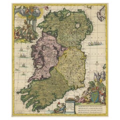
Antique Map Of Ireland

to
16
78
14
46
41
32
18
11
11
11
8
7
7
5
5
5
5
5
3
3
3
3
3
2
2
1
1
1
1
1
1
1
1
1
1
1
3
2
1
1
1
Sort By
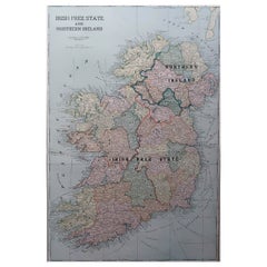
Large Original Antique Map of Ireland. C.1900
Located in St Annes, Lancashire
Fabulous map of Ireland Original color. Engraved and printed by the George F. Cram Company
Category

1890s American Antique Map Of Ireland

Materials

Paper

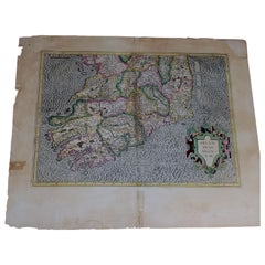
1585 Mercator Map of Ireland, Entitled "Irlandiae Regnvm, " Hand Colored Ric0006
Located in Norton, MA
1585 Mercator map of Ireland, entitled "Irlandiae Regnvm." Hand Colored Description
Category

16th Century Dutch Antique Map Of Ireland

Materials

Paper

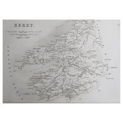
Original Antique Map of Ireland- Kerry. C.1840
Located in St Annes, Lancashire
Great map of Kerry Steel engraving Drawn under the direction of A.Adlard Published by How and
Category

1840s English Antique Map Of Ireland

Materials

Paper

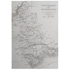
Original Antique Map of Ireland- Tipperary and Waterford. C.1840
Located in St Annes, Lancashire
Great map of Tipperary and Waterford Steel engraving Drawn under the direction of A.Adlard
Category

1840s English Antique Map Of Ireland

Materials

Paper

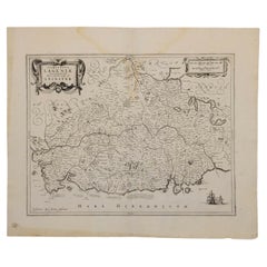
1636 Jansson Map of Ireland Entitled "Comitatus Lageniae, " Ric.a007
Located in Norton, MA
1646 Jansson map entitled "Procinvia connactiae," Ric.a006 Description: The PROVINCE of
Category

17th Century Unknown Antique Map Of Ireland

Materials

Paper

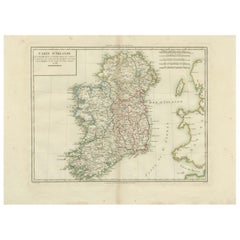
Map of Ireland: Early 19th Century - from the 1802 Tardieu Atlas
Located in Langweer, NL
Revolutionary Calendar) **Geographical Scope:** This antique map illustrates Ireland, providing a detailed
Category

Early 1800s Antique Map Of Ireland

Materials

Paper

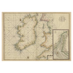
Large 1693 Maritime Map of Irish Sea, West Coasts of Ireland, England, Scotland
Located in Langweer, NL
of Ireland and the Western Coasts of England with a Part of Scotland." The map was first published
Category

1690s Antique Map Of Ireland

Materials

Paper

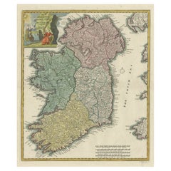
Decorative Hand-Coloured Antique Map of the Four Irish Provinces, Ireland, c1718
Located in Langweer, NL
Title: Regni Hiberniae Accurata Tabula per Hermanum Moll Decorative map of the four Irish
Category

1710s Antique Map Of Ireland

Materials

Paper

Hibernia Regnum Map by Carel Allard, 1700: Hand-Colored Provinces of Ireland
Located in Langweer, NL
This is a historical map of Ireland created by Carel Allard around 1700, titled "Hibernia Regnum in
Category

Early 1700s Antique Map Of Ireland

Materials

Paper

1882 Cartographic Views of Ireland's North and South Regions
Located in Langweer, NL
Title: 1882 Maps of Ireland: Northern and Southern Regions These two maps provide a detailed
Category

1880s Antique Map Of Ireland

Materials

Paper

Antique Map of New Ireland, 1774
Located in Langweer, NL
Antique print titled 'Neu Irrland (..)'. Antique map of New Ireland with 7 coastal profiles, Papua
Category

18th Century Antique Map Of Ireland

Materials

Paper

Antique Map of New Ireland, 1774
H 10.24 in W 14.18 in D 0 in
Rare Small Antique Map of Great Britain and Ireland
Located in Langweer, NL
Antique map titled 'La Grande Bretagne et Irlande'. Small antique map of Great Britain and Ireland
Category

Mid-18th Century Antique Map Of Ireland

Materials

Paper

Original Antique Map of England, Ireland, Scotland and Wales
Located in Langweer, NL
Antique map titled 'Les Isles Britanniques, ou sont les Royaumes d Angleterre (..)'. Detailed map
Category

Early 18th Century Antique Map Of Ireland

Materials

Paper

Antique Map of the United Kingdom and Ireland, 1852
Located in Langweer, NL
Antique map titled 'Groot-Brittanje en Ierland'. Map of the United Kingdom and Ireland. This map
Category

19th Century Antique Map Of Ireland

Materials

Paper

Antique Map of England and Ireland by Lattre, 1789
Located in Langweer, NL
Antique map titled 'Les Royaumes d'Angleterre d'Ecosse et d'Irlande'. Original antique map of
Category

18th Century Antique Map Of Ireland

Materials

Paper

Antique Map of New Ireland with 7 Coastal Profiles
Located in Langweer, NL
Antique print titled 'l'Isle St. Jean (..) - Cap St. George (..)'. Antique map of New Ireland, an
Category

Late 18th Century Antique Map Of Ireland

Materials

Paper

Detailed Antique Map of Britain, Wales and the Coast of Ireland
Located in Langweer, NL
and the coast of Ireland with a list of counties. This map originates from 'Nuovo Atlante Di Geografia
Category

Mid-19th Century Antique Map Of Ireland

Materials

Paper

Antique Map of the United Kingdom and Ireland, circa 1825
Located in Langweer, NL
Antique map titled 'Insula Britannicae'. Old map of the United Kingdom and Ireland originating from
Category

19th Century Antique Map Of Ireland

Materials

Paper

Antique Map of the United Kingdom and Ireland, c.1873
Located in Langweer, NL
Antique map titled 'Groot Brittanje en Ierland'. Old map depicting the United Kingdom and Ireland
Category

19th Century Antique Map Of Ireland

Materials

Paper

1788 Map of Europe - France, Italy, Spain, Germany, Great Britain & Ireland
Located in Langweer, NL
Title: "1788 Map of Europe - France, Italy, Spain, Germany, Great Britain & Ireland by D'Anville
Category

1780s Antique Map Of Ireland

Materials

Paper

Large Original Antique Map of the Environs of Cork, Ireland, circa 1880
Located in St Annes, Lancashire
Great map of The Environs of Cork Published circa 1880 Unframed Free shipping.
Category

1880s Scottish Antique Map Of Ireland

Materials

Paper

Large Original Antique Map of The Environs of Dublin, Ireland, circa 1880
Located in St Annes, Lancashire
Great map of The Environs of Dublin Published circa 1880 Unframed Free shipping.
Category

1880s Scottish Antique Map Of Ireland

Materials

Paper

Antique 1830 Map of Leinster, Ireland with Dublin, Kilkenny, Wexford and Kildare
Located in Langweer, NL
Title: Antique 1830 Map of Leinster, Ireland with Dublin, Kilkenny, Wexford, and Kildare
Category

1830s Antique Map Of Ireland

Materials

Paper

Antique 1830 Map of Ulster, Ireland with Armagh, Down, Antrim, Donegal, Tyrone
Located in Langweer, NL
Title: Antique 1830 Map of Ulster, Ireland with Armagh, Down, Antrim, Donegal, and Tyrone
Category

1830s Antique Map Of Ireland

Materials

Paper

Antique 1830 Map of Munster, Ireland with Limerick, Cork, Kerry and Tipperary
Located in Langweer, NL
Title: Antique 1830 Map of Munster, Ireland with Limerick, Cork, Kerry, and Tipperary
Category

1830s Antique Map Of Ireland

Materials

Paper

Original Antique Map of the United Kingdom and Ireland, Published in 1875
Located in Langweer, NL
United Kingdom and Ireland. This map originates from 'Atlas de Géographie Moderne Physique et Politique
Category

Late 19th Century Antique Map Of Ireland

Materials

Paper

Small Antique Map of England, Wales, Scotland and Ireland with Original Coloring
Located in Langweer, NL
Antique map titled 'Les Royaumes d'Angleterre d'Escosse et d'Irlande (..)'. A lovely, small map of
Category

Early 18th Century Antique Map Of Ireland

Materials

Paper

England, Scotland & Ireland: A Hand Colored Map of Great Britain by Tirion
By Isaak Tirion
Located in Alamo, CA
This is a hand-colored double page copperplate map of Great Britain entitled "Nieuwe Kaart van de
Category

Mid-18th Century Dutch Antique Map Of Ireland

Materials

Paper

Antique Map of the Coast of New Ireland, Earlier Part of German New Guinea, 1833
Located in Langweer, NL
. New Ireland, also New Mecklenburg, is the Northeastern Province of Papua New Guinea. Map no. 26 from
Category

19th Century Antique Map Of Ireland

Materials

Paper

Old Map of the UK & Ireland, Insets of Orkney, Shetland and Faroe Islands, 1786
Located in Langweer, NL
". Hand-colored engraved map with 2 (large) decorative cartouches, inset map of the Orkney, Shetland and
Category

1780s Antique Map Of Ireland

Materials

Paper

Antique Map of New Ireland Island in the Bismarck Archipelago, New Guinea, 1772
Located in Langweer, NL
Antique map titled 'Nova Hibernia'. Antique map of New Ireland, an island in the Bismarck
Category

18th Century Antique Map Of Ireland

Materials

Paper

Antique Map of Great Britain and Ireland by Brion de la Tour, 1766
Located in Langweer, NL
Antique map titled 'Les Isles Britanniques (..).' Attractive map of Great Britain surrounded by
Category

18th Century Antique Map Of Ireland

Materials

Paper

1633 Map Entitled "Beauvaisis Comitatus Belova Cium, Ric.0002
Located in Norton, MA
. 1591-92 Hiberniae novissima descrzptio: Boazio\\\\\\\\\\\\\\\'s map of Ireland: Engraved by Pieter van
Category

17th Century Dutch Antique Map Of Ireland

Materials

Paper

Southeastern Ireland: A 17th Century Hand Colored Map by Mercator and Hondius
By Gerard Mercator
Located in Alamo, CA
A 17th century copperplate hand-colored map entitled "The Second Table of Ireland, Udrone" by
Category

Mid-17th Century Dutch Antique Map Of Ireland

Materials

Paper

Large Original Antique City Plan of Dublin, Ireland, circa 1880
Located in St Annes, Lancashire
Great city plan of Dublin Published circa 1880 Unframed Free shipping. .
Category

1880s Scottish Antique Map Of Ireland

Materials

Paper

Large Antique Map of the British Isles, with inset of the Orkneys and Shetlands
Located in Langweer, NL
Antique map titled 'A Map of Great Britain and Ireland (..)'. Large antique map of the British
Category

Late 18th Century Antique Map Of Ireland

Materials

Paper

Antique Map of the British Isles According to the Geography of the Roman Empire
Located in Langweer, NL
Antique map titled 'Insulae Britannicae'. Interesting map of Britain, Scotland, and Ireland. It
Category

Late 18th Century Antique Map Of Ireland

Materials

Paper

Antique Map of the British Isles with Walls, Settlements and Other Features
Located in Langweer, NL
Antique map titled 'Insulae Britannicae'. Interesting map of Britain, Scotland, and Ireland. It
Category

Late 18th Century Antique Map Of Ireland

Materials

Paper

Pl. 27 Antique Chart of the US Irish and German Population in 1870, '1874'
Located in Langweer, NL
Antique chart titled 'Maps showing the distribution, within the territory of the United States
Category

Late 19th Century Antique Map Of Ireland

Materials

Paper

Hand-colored Nautical Chart: St. George's Channel and the Irish Sea, 1744
Located in Langweer, NL
. Here are the key details and features of the map: The map covers the region of the Irish Sea
Category

1740s Antique Map Of Ireland

Materials

Paper

Early 20th c. Ireland Perrier Motor Map c.1910
Located in San Francisco, CA
ABOUT Large bright vivid color-printed Perrier Motor Map, featuring the motoring roads of Ireland
Category

Early 20th Century British Victorian Antique Map Of Ireland

Materials

Linen, Paper

Southeastern Ireland: A 17th Century Hand Colored Map by Mercator and Hondius
By Gerard Mercator
Located in Alamo, CA
A 17th century copperplate hand-colored map entitled "The Second Table of Ireland, Udrone" by
Category

1630s Antique Map Of Ireland

Materials

Engraving

Great Britain
By John Senex
Located in London, GB
one of His Maj[es]ties most Hono[ra]ble Privy Council for Ye Kingdom of Ireland. This Map is dedicated
Category

1710s Naturalistic Antique Map Of Ireland

Materials

Watercolor, Engraving

Double Map of Ireland
By Richard Diebenkorn
Located in Tbilisi, GE
Suite: Six Etchings for Poems of W.B. Yeats - Hand Initialed and numbered by Diebenkorn
Category

19th Century Contemporary Antique Map Of Ireland

Materials

Etching

Map of ancient Great Britain, Scotland, Ireland by Mercator - Engraving - 17th c
By Gerard Mercator
Located in Zeeland, Noord-Brabant
(…).' - A beautiful Ptolemaic map covering ancient Great Britain, England, Scotland and Ireland. This rare
Category

1690s Old Masters Antique Map Of Ireland

Materials

Engraving

Map of Dublin
Located in New York, NY
1836 map of the city of Dublin, Ireland, issued by the Society for the Diffusion of Useful
Category

19th Century Realist Antique Map Of Ireland

Materials

Engraving

Map of Dublin
Map of Dublin
H 13.5 in W 16 in
Sea chart of Galway Bay and Limerick river in Ireland - Engraving - 18th century
By Alexis Hubert Jaillot
Located in Zeeland, Noord-Brabant
la Baye de Galloway et la riviere de Lymerick [...]' - (Map of the western coasts of Ireland, which
Category

1690s Old Masters Antique Map Of Ireland

Materials

Engraving

Original 1700s Map of Great Britain, England & Wales in 1757 by Thomas Kitchin
Located in Montréal, CA
A New and Accurate Map of that District of Great Britain called England & Wales &c. from the latest
Category

Mid-18th Century British Antique Map Of Ireland

Materials

Paper

To the Honble. Sr. Iohn Lowther.
By Captain Greenvile Collins
Located in Zeeland, Noord-Brabant
A map of the Northern Irish Sea, with the Isle of Man as its main focus. The coasts of Scotland
Category

Late 17th Century Antique Map Of Ireland

Materials

Engraving

Pascaart vant Canaal Tusschen Engelant en Vrancryck [...].
By Johannes Janssonius
Located in Zeeland, Noord-Brabant
A detailed maps of the English and Irish coasts. Numerous coastal places are named, also on the
Category

Mid-17th Century Antique Map Of Ireland

Materials

Engraving

Large University Chart “Physical Map of Ireland” by Bacon
Located in Chillerton, Isle of Wight
Large University Chart “Physical Map of Ireland” by Bacon W&A K Johnston’s Charts of Physical
Category

Early 20th Century International Style Antique Map Of Ireland

Materials

Linen

Map of Ireland Titled "Hiberniae Britannicae Insulae Nova Descriptio Irland"
By Abraham Ortelius
Located in San Francisco, CA
Abraham Ortelius (1527-1598) was a cartographer, geographer and maker from Antwerp in the Spanish Netherlands. He created the first modern atlas titled in Latin Theatrum Orbis Terrar...
Category

Early 18th Century Belgian Antique Map Of Ireland

Materials

Paper

Gold and Enamel Ireland Charm
Located in New York, NY
Figural "map of Ireland." Emerald green enamel with gold letters that spell out "IRELAND." 9ct
Category

1920s Irish Antique Map Of Ireland

Materials

9k Gold

World Map Published in June 1783 by Stackhouse and Engraved by S.J. Neele London
Located in Milan, IT
" by Crosthwaite (along with Ashby and Ellis), "New Map of Ireland, Civil and Ecclesiastical" Daniel
Category

1780s British Antique Map Of Ireland

Materials

Glass, Wood, Paper

Antique Map of England, Wales, Scotland and Ireland, inset of Shetland Isl, 1880
Located in Langweer, NL
Antique map titled 'Iles Britanniques'. Old map of England, Wales, Scotland and Ireland. With
Category

19th Century Antique Map Of Ireland

Materials

Paper

Antique Map of the British Isles by Homann Heirs, c.1749
Located in Langweer, NL
Ireland with Part of Holland, Flanders, France'. Decorative map of the British Isles, includinga large
Category

18th Century Antique Map Of Ireland

Materials

Paper

Antique Map of Ireland by Wyld '1845'
Located in Langweer, NL
Antique map titled 'Map of Ireland divided into Provinces and Counties'. Original antique map of
Category

Mid-19th Century Antique Map Of Ireland

Materials

Paper

Antique Map of Ireland by Wyld '1845'
H 14.18 in W 10.24 in D 0.02 in
Original Antique Map of Ireland. Circa 1880
Located in St Annes, Lancashire
Great map of Ireland Drawn and Engraved by J.Bartholomew Published C.1880 Original colour
Category

1880s English Antique Map Of Ireland

Materials

Paper

Original Antique Map of Ireland. Circa 1880
H 12.5 in W 9.75 in D 0.07 in
Original Antique Map of Ireland, circa 1800
Located in St Annes, Lancashire
Rare map of Ireland Copper plate engraving Published circa 1800. Originally from Barclay's
Category

Early 1800s English Other Antique Map Of Ireland

Materials

Paper

Original Antique Map of Ireland, Arrowsmith, 1820
Located in St Annes, Lancashire
Great map of Ireland Drawn under the direction of Arrowsmith Copper-plate engraving
Category

1820s English Antique Map Of Ireland

Materials

Paper

  • 1
Get Updated with New Arrivals
Save "Antique Map Of Ireland", and we’ll notify you when there are new listings in this category.

Antique Map Of Ireland For Sale on 1stDibs

Choose from an assortment of styles, material and more with respect to the antique map of ireland you’re looking for at 1stDibs. Frequently made of paper, fabric and linen, every antique map of ireland was constructed with great care. You’ve searched high and low for the perfect antique map of ireland — we have versions that date back to the 18th Century alongside those produced as recently as the 20th Century are available. When you’re browsing for the right antique map of ireland, those designed in styles are of considerable interest. You’ll likely find more than one antique map of ireland that is appealing in its simplicity, but Isaak Tirion, Nicolaes Visscher II and R.W. Seale produced versions that are worth a look.

How Much is a Antique Map Of Ireland?

An antique map of ireland can differ in price owing to various characteristics — the average selling price 1stDibs is $418, while the lowest priced sells for $60 and the highest can go for as much as $2,775.

Read More

Medal-Worthy Memorabilia from Epic Past Olympic Games

Get into the games! These items celebrate the events, athletes, host countries and sporting spirit.

Ahoy! You’ve Never Seen a Collection of Sailor Art and Kitsch Quite Like This

French trendsetter and serial collector Daniel Rozensztroch tells us about his obsession with objects related to seafaring men.

39 Incredible Swimming Pools

It's hard to resist the allure of a beautiful pool. So, go ahead and daydream about whiling away your summer in paradise.

Pamela Shamshiri Shares the Secrets behind Her First-Ever Book and Its Effortlessly Cool Interiors

The sought-after designer worked with the team at Hoffman Creative to produce a monograph that beautifully showcases some of Studio Shamshiri's most inspiring projects.

Moroccan Artworks and Objects Take Center Stage in an Extraordinary Villa in Tangier

Italian writer and collector Umberto Pasti opens the doors to his remarkable cave of wonders in North Africa.

Montecito Has Drawn Royalty and Celebrities, and These Homes Are Proof of Its Allure

Hollywood A-listers, ex-pat aristocrats and art collectors and style setters of all stripes appreciate the allure of the coastal California hamlet — much on our minds after recent winter floods.

Whaam! Blam! Pow! — a New Book on Pop Art Packs a Punch

Publishing house Assouline and writer Julie Belcove have teamed up to trace the history of the genre, from Roy Lichtenstein, Andy Warhol and Yayoi Kusama to Mickalene Thomas and Jeff Koons.

The Sparkling Legacy of Tiffany & Co. Explained, One Jewel at a Time

A gorgeous new book celebrates — and memorializes — the iconic jeweler’s rich heritage.