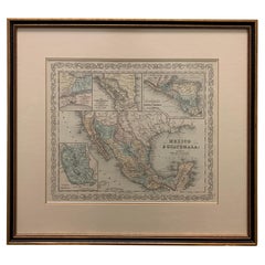
Antique Map Mexico

to
20
66
38
62
33
33
24
18
11
11
11
9
7
6
6
5
5
5
4
4
4
4
4
3
3
2
2
2
2
2
1
1
1
1
1
1
1
1
1
1
2
2
1
1
1
Sort By
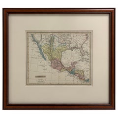
Framed 1838 Mexico & Gulf of Mexico Map
Located in Stamford, CT
Framed 1838 Mexico & Gulf of Mexico map. Printed by Fisher, Son & Co. of London in 1838. As found
Category

1830s English American Classical Antique Map Mexico

Materials

Glass, Wood, Paper

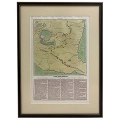
1826 Antigo Impero Messicano Mexico Hand Colored Framed Map
Located in Stamford, CT
1826 Antigo Impero Messicano Mexico Hand Colored Framed Map. As found black wood frame.
Category

1820s Mexican Spanish Colonial Antique Map Mexico

Materials

Glass, Wood, Paper

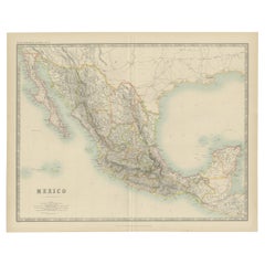
Antique Map of Mexico by Johnston, '1909'
Located in Langweer, NL
Antique map titled 'Mexico'. Original antique map of Mexico. This map originates from the ‘Royal
Category

Early 20th Century Antique Map Mexico

Materials

Paper

Antique Map of Mexico by Johnston, '1909'
H 19.49 in W 24.41 in D 0.02 in
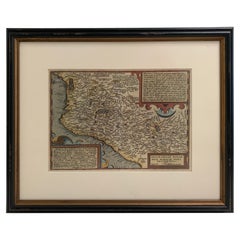
1608 Hispaniae Novae Sive Magnae Vera Descriptio Framed Mexico Map
Located in Stamford, CT
1608 Hispaniae Novae Sive Magnae Vera Descriptio Framed Mexico Map. As found custom black wooden
Category

Early 1600s Mexican Spanish Colonial Antique Map Mexico

Materials

Glass, Wood, Paper

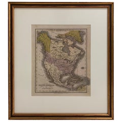
1830 Mexico and United States Framed Map
Located in Stamford, CT
Map of North America published circa 1830. Map shows United States into Canada. Mexico extending
Category

1830s American American Classical Antique Map Mexico

Materials

Glass, Wood, Paper

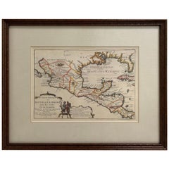
1705 Golfe de Mexico and Florida Framed Map
Located in Stamford, CT
Framed map of Mexico & Florida circa 1705, Paris. Small map with Mexico and the Gulf Coast. Inset
Category

Early 1700s French Spanish Colonial Antique Map Mexico

Materials

Glass, Wood, Paper

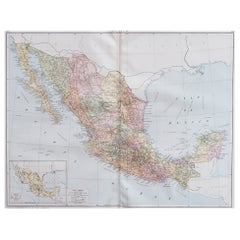
Large Original Vintage Map of Mexico, circa 1920
Located in St Annes, Lancashire
Great map of Mexico Original color. Good condition Published by Alexander Gross Unframed.
Category

1920s English Edwardian Antique Map Mexico

Materials

Paper

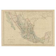
Antique Map of Mexico by W. G. Blackie, 1859
Located in Langweer, NL
Antique map titled 'Mexico'. Original antique map of Mexico. This map originates from ‘The Imperial
Category

Mid-19th Century Antique Map Mexico

Materials

Paper

Antique Map of Mexico by W. G. Blackie, 1859
H 14.57 in W 21.26 in D 0.02 in
Large 1856 Mexico & Guatemala Framed Map by Charles Desilver
Located in Stamford, CT
Large 1856 Mexico & Guatemala Framed map. Published by Charles Desilver, Philadelphia, Pennsylvania
Category

1850s American American Classical Antique Map Mexico

Materials

Glass, Wood, Paper

1834 Mexico & Guatemala Framed Map by H.S. Tanner
Located in Stamford, CT
1834 Mexico & Guatemala map of published by H.S. Tanner, Philadelphia, Pennsylvania. Engraved by J
Category

1830s American American Classical Antique Map Mexico

Materials

Glass, Wood, Paper

Antique Map of the United States with inset map of the region of Mexico City
Located in Langweer, NL
Antique map titled 'Verein-Staaten von Nord-America, Mexico, Yucatan u.a.'. Very detailed map of
Category

Mid-19th Century Antique Map Mexico

Materials

Paper

1882 Antique Map of Mexico Highlighting Geographical and Political Boundaries
Located in Langweer, NL
This 1882 map of Mexico, published by Blackie and Son as part of the 'Comprehensive Atlas and
Category

1880s Antique Map Mexico

Materials

Paper

Antique North America Map, USA, Canada, Mexico, Cartography, Colton, Victorian
Located in Hele, Devon, GB
This is an antique North America map. A USA, framed lithography atlas engraving of the continent
Category

Mid-19th Century American Victorian Antique Map Mexico

Materials

Paper

Antique Map of Mexico and Central America by Johnson '1872'
Located in Langweer, NL
Antique map titled 'Johnson's Mexico (..)'. Two maps one one sheet showing Mexico and Central
Category

Late 19th Century Antique Map Mexico

Materials

Paper

Antique Map of the Port of Acapulco in Mexico, 1749
Located in Langweer, NL
antique map of the Port of Acapulco on the coast of Mexico in the Southern Sea, at 16°.45'. North latitude
Category

18th Century Antique Map Mexico

Materials

Paper

Antique Map of The Harbour of Acapulco in Mexico, 1749
Located in Langweer, NL
(..)'. Original antique map of the Port of Acapulco on the coast of Mexico in the Southern Sea, at 16°.45'. North
Category

1740s Antique Map Mexico

Materials

Paper

Original Antique Map of the Western Part of NEW MEXICO & CALIFORNIA
Located in Langweer, NL
Title: "Map of the Western Part of NEW MEXICO and CALIFORNIA According to the Latest Discoveries by
Category

1760s Antique Map Mexico

Materials

Paper

Antique Map of California, Utah, Nevada, Colorado, New Mexico & Arizona '1872'
Located in Langweer, NL
, New Mexico and Arizona. This map originates from 'Johnson's New Illustrated Family Atlas of the World
Category

Late 19th Century Antique Map Mexico

Materials

Paper

1847 Ornamental Map of the United States & Mexico by H. Phelps
Located in Colorado Springs, CO
States & Mexico" by Humphrey Phelps. The map was issued as an act of Congress by Phelps on Fulton Street
Category

1840s American Antique Map Mexico

Materials

Paper

Antique Map of the Port of Zihuatanejo in Mexico, c.1740
Located in Langweer, NL
Antique map titled 'Plan du Port de Chequetan ou Seguataneo'. Map of the Mexican port of
Category

18th Century Antique Map Mexico

Materials

Paper

Original Antique Map of the American State of Arizona & New Mexico, 1903
Located in St Annes, Lancashire
Antique map of Arizona and New Mexico Published By A & C Black. 1903 Original colour Good
Category

Early 1900s English Antique Map Mexico

Materials

Paper

Map of Baja California and Mexico - Jesuit Observations and Native Tribes, 1777
Located in Langweer, NL
1777 A. Krevelt Map of Baja California and Northwestern Mexico - Jesuit Observations and Native
Category

1770s Antique Map Mexico

Materials

Paper

Original Antique Map of the Bay and Rocks of Petatlan, Mexico, 1749
Located in Langweer, NL
(..)'. Original antique map of the bay and rocks of Petatlan, Mexico. This map originates from 'Reize rondsom de
Category

1740s Antique Map Mexico

Materials

Paper

Old Map the United States and Central America, Including Mexico, ca.1860
Located in Langweer, NL
Antique map titled 'Vereinigte Staaten von Nord America und Mexico'. Old map the United States
Category

1860s Antique Map Mexico

Materials

Paper

1847 Antique Map of Mexico, Texas and California by Samuel Augustus Mitchell
By Samuel Augustus Mitchell 1
Located in Colorado Springs, CO
Presented is the second edition of Samuel Augustus Mitchell's Map of Mexico, Including Yucatan
Category

1840s American Antique Map Mexico

Materials

Paper

California, Alaska and Mexico: 18th Century Hand-Colored Map by de Vaugondy
By Didier Robert de Vaugondy
Located in Alamo, CA
This an 18th century hand-colored map of the western portions of North America entitled "Carte de
Category

1770s French Antique Map Mexico

Materials

Paper

Antique Map of the Gulf of Mexico and Caribbean Islands by Tardieu, 1802
Located in Langweer, NL
the Gulf of Mexico and the Caribbean islands. Created by Pierre Antoine Tardieu, this map provides a
Category

Early 1800s Antique Map Mexico

Materials

Paper

Antique Map of Mexico, Central America and West Indies by A & C. Black, 1870
Located in Langweer, NL
Antique map titled 'Mexico, Central America and West Indies'. Original antique map of Mexico
Category

Late 19th Century Antique Map Mexico

Materials

Paper

Antique Map of the Gulf of Mexico and all the islands of the West Indies
Located in Langweer, NL
Antique map titled 'Carte du Golfe du Mexique'. This uncommon map depicts the Gulf of Mexico and
Category

Early 19th Century Antique Map Mexico

Materials

Paper

1812 United States Map, by Pierre Tardieu, Antique French Map Depicting the U.S.
By Pierre François Tardieu
Located in Colorado Springs, CO
fine works including maps of Louisiana, Mexico, Russia, and Asia in addition to his illustrations of
Category

1810s French Antique Map Mexico

Materials

Paper

Framed Mercator Hondius Hispania Nova Atlas Minor Map
Located in Stamford, CT
Framed colored example of this decorative and important minature map. Newly framed in brown wood
Category

17th Century Dutch Spanish Colonial Antique Map Mexico

Materials

Glass, Wood, Paper

Mexico City by Braun & Hogenberg c. 1590
By Georg Braun and Frans Hogenberg
Located in Stamford, CT
Mexico by Braun & Hogenberg c. 1590
Category

Mid-19th Century European Spanish Colonial Antique Map Mexico

Materials

Glass, Wood, Paper

Mexico City by Braun & Hogenberg c. 1590
H 19 in W 16.5 in D 0.75 in
"The United States from the Latest Authorities" Antique Wall Map, 1835
Located in Colorado Springs, CO
"Oregon District" and several engraved city views and two portraits. The primary map extends to Mexico
Category

1830s American Antique Map Mexico

Materials

Paper

Antique Map with Hand Coloring of the United States and the Caribbean
Located in Langweer, NL
Antique map titled 'Verein-Staaten von Nord-America, Mexico, Yucatan u.a.'. Very detailed map of
Category

Late 19th Century Antique Map Mexico

Materials

Paper

Antique Map of the United States of America, also showing the Caribbean
Located in Langweer, NL
Antique map titled 'Verein-Staaten von Nord-America, Mexico, Yucatan u.a.'. Very detailed map of
Category

Mid-19th Century Antique Map Mexico

Materials

Paper

Antique Map of Part of the United States Including Lower California & Arizona
Located in Langweer, NL
Mexico. This map was part of a set of six individual sheets with maps of the United States and North
Category

Late 19th Century Antique Map Mexico

Materials

Paper

Antique Map of the Bay and Rocks of Petatlan by Anson, 1749
Located in Langweer, NL
(..)'. Original antique map of the bay and rocks of Petatlan, Mexico. This map originates from 'Reize rondsom de
Category

18th Century Antique Map Mexico

Materials

Paper

Antique French Engraving of Mexico with Lots of Details, c.1780
Located in Langweer, NL
.' Detailed map of Mexico, the Yucatan and Central America, prepared under the direction of Rigobert Bonne
Category

18th Century Antique Map Mexico

Materials

Paper

Navigational Chart of Mexico's Coast, with Acapulco and Port Marquis, 1748
Located in Langweer, NL
Antique map titled 'The Form of cruising off Acapulca on the Coast of Mexico in the South Seas in
Category

1740s Antique Map Mexico

Materials

Paper

Original Engraving of the West Indies, Gulf of Mexico, Antilles, Caribbean, 1780
Located in Langweer, NL
Rigobert Bonne and G. Raynal's 1780 map of the West Indies, Gulf of Mexico, Antilles, and the
Category

Late 18th Century Antique Map Mexico

Materials

Paper

Antique Copper Engraving with a Panoramic View of Mexico City, ca.1760
Located in Langweer, NL
Description: Antique print titled 'Nouveau Mexico'. Copper engraving with a panoramic view of
Category

1760s Antique Map Mexico

Materials

Paper

Mexico. Century Atlas antique vintage map
Located in Melbourne, Victoria
'The Century Atlas. Mexico.' Original antique map, 1903. Central fold as issued. Map name and
Category

Early 20th Century Victorian Antique Map Mexico

Materials

Lithograph

Ancient Map of Mexico - Original Etching - 19th Century
Located in Roma, IT
This Map of Mexico is an etching realized in 19th century. The state of preservation of the
Category

19th Century Antique Map Mexico

Materials

Etching

Arizona and New Mexico. USA. Century Atlas state antique vintage map
Located in Melbourne, Victoria
'The Century Atlas. Arizona and New Mexico.' Original antique map, 1903. Central fold as issued
Category

Early 20th Century Victorian Antique Map Mexico

Materials

Lithograph

Mexico City & Cusco Antique Map, Civitates Orbis Terrarum by Braun & Hogenberg
By Franz Hogenberg
Located in Roma, IT
Etching black and white from Civitates Orbis Terrarum. View of the Old Mexico City, built over the
Category

16th Century Antique Map Mexico

Materials

Etching

North America: A Framed Hand-colored 19th Century German Map by Adolph Stieler
By Adolf Stieler
Located in Alamo, CA
and The Osage District. The map does include Canada, Mexico, Central America, Cuba, Jamaica, Haiti
Category

1830s Antique Map Mexico

Materials

Engraving

Direccion de Hidrografia... - Etching by Tomàs Gozàlez - 1802
Located in Roma, IT
(engravers), Juan Morata y Gangoiti (engraver of the text). Rare map of Mexico, Texas, Alta and Baja
Category

Early 1800s Modern Antique Map Mexico

Materials

Etching

1719 Chatelain Map of Mexico, Southeast North America and the Caribbean
By Henri-Abraham Chatelain
Located in New York, NY
Original first edition 1719 engraved map, full title in French "Carte contenant royaume mexique et
Category

1710s Realist Antique Map Mexico

Materials

Engraving

Antique Map of Mexico by G. Mercator, 1637
Located in Langweer, NL
Classical map of Mexico from Tilapa to Catalutla and inland to Mexico City and Tecalco. Includes
Category

Mid-17th Century Antique Map Mexico

Materials

Paper

Antique Map of Mexico by G. Mercator, 1637
H 11.03 in W 6.93 in D 0.02 in
Antique Map of Mexico by R. Bonne, circa 1780
Located in Langweer, NL
map of Mexico, the Yucatan and Central America, prepared under the direction of Rigobert Bonne.
Category

Late 18th Century Antique Map Mexico

Materials

Paper

Antique Map of Mexico by R. Bonne, circa 1780
H 10.24 in W 17.52 in D 0.02 in
1874 Antique Map of Colorado, Utah, New Mexico, and Arizona
Located in Colorado Springs, CO
Presented is an original map of Colorado, Utah, New Mexico, and Arizona from 1874. This authentic
Category

1870s American Antique Map Mexico

Materials

Paper

1865 "Johnson's California, Utah, Nevada, Colorado, New Mexico, Arizona" Map
Located in Colorado Springs, CO
, New Mexico, and Arizona” map. First published in 1864, this map was issued as pages 66 and 67 in the
Category

Mid-19th Century Antique Map Mexico

Materials

Paper

Antique Map of Texas, the Rocky Mountains, Southwest and Mexico
Located in Langweer, NL
Antique map titled 'Carte du Mexique'. Fine Humboldt inspired map of Mexico, in the midst of its
Category

Early 19th Century Antique Map Mexico

Materials

Paper

Republic of Texas and Mexico, Antique French Map, circa 1840
Located in Colorado Springs, CO
Austin, Houston, Nashville and Matagorda to name a few. The map makes note of a Mexican Garrison just
Category

1840s French Antique Map Mexico

Materials

Paper

Antique Map of Mexico, Texas and Upper California by Lapie, 1842
Located in Langweer, NL
Antique map titled 'Carte des États-Unis du Méxique'. Map of Mexico, Texas and Upper California
Category

Mid-19th Century Antique Map Mexico

Materials

Paper

Antique Map of Mexico Covering as far South as Oaxaca and Veracruz, 1760
Located in Langweer, NL
Antique map titled 'Carte du Mexique - Kaart van het Mexico'. Beautiful map of Mexico, covering the
Category

18th Century Antique Map Mexico

Materials

Paper

Antique Map of the Western United States, Mexico and Texas as a Republic
Located in Langweer, NL
Antique map titled 'Mexique'. This map covers the western United States, Mexico and the independent
Category

Mid-19th Century Antique Map Mexico

Materials

Paper

Antique Map of The Gulf of Mexico and The West Indies, ca.1780
Located in Langweer, NL
Antique map titled 'Carte du Golfe du Mexique, pour Servir a l'Histoire Philosophique et Politique
Category

1780s Antique Map Mexico

Materials

Paper

1858 "Mitchell's New National Map Exhibiting the United States" Hanging Wall Map
By Samuel Augustus Mitchell 1
Located in Colorado Springs, CO
Presented is a beautifully engraved, large hanging wall map of the United States, Mexico, and West
Category

1850s American Antique Map Mexico

Materials

Paper

Atwood's Pictorial Map of the United States, circa 1854
Located in Colorado Springs, CO
nations are identified throughout. A smaller map of Mexico appears on the lower left quadrant. True its
Category

1850s American Antique Map Mexico

  • 1
Get Updated with New Arrivals
Save "Antique Map Mexico", and we’ll notify you when there are new listings in this category.

Antique Map Mexico For Sale on 1stDibs

Find many varieties of an authentic antique map mexico available at 1stDibs. Frequently made of paper, wood and glass, every antique map mexico was constructed with great care. Your living room may not be complete without an antique map mexico — find older editions for sale from the 18th Century and newer versions made as recently as the 20th Century. An antique map mexico made by Victorian designers — as well as those associated with Arts and Crafts — is very popular. Abraham Ortelius, Jacques-Nicolas Bellin and Didier Robert de Vaugondy each produced at least one beautiful antique map mexico that is worth considering.

Finding the Right Collectibles-curiosities for You

Antique and vintage collectibles and curiosities can bring whimsy and wonder to any interior. 

Decorating with old scientific instruments, historical memorabilia and vintage musical instruments, as well as other authentic collectibles and curiosities that can be found on 1stDibs, presents an opportunity to create a unique, natural history museum-like atmosphere in your home that can provoke conversation as often as it pays tribute to how far we’ve come in understanding our world. 

And bringing collectibles and curiosities into your space is actually on trend — Wunderkammern, or curiosity cabinets, were all the rage in Europe during the 1500s and continued to have adherents there and in the U.S. in the following centuries. Today, however, they’re experiencing a real surge in popularity and influencing how many interior designers are furnishing and decorating homes — combining contemporary with antique, scientific with tribal, earthly with extraterrestrial, Les Lalanne tables with Flemish tapestries.

The original Wunderkammern were entire rooms filled with objects demonstrating their owners’ worldly knowledge: A proper one included artificiala or preciosa (objets d’art); naturalia (such as skeletons, shells, minerals); exotica (taxidermy or dried plants); and scientifica (scientific instruments), frequently alongside religious relics and ancient artifacts.

Pay tribute to a history of rich and diverse musical traditions that have taken shape all over the world by decorating your home with a collection of antique and vintage musical instruments — with a little help from strong hanging wire or some wall hooks, vintage brass instruments such as a gong, French horn or trumpet can help elevate a home office or complement the efforts you’ve made to ensure a welcoming vibe in your home’s entryway. Bells or antique wind instruments can add provocative metallic contrasts to dark woods as tabletop decorative objects.  

Create an intriguing focal point with Georgian scientific instruments, such as stick barometers with mahogany cases or lacquered brass telescopes. These items stem from an era named for the monarchies of the four King Georges, who ruled England in succession starting in 1714 (plus King William’s reign, which lasted until 1837). Just as there was beautiful jewelry produced during the period that today is coveted by collectors, there is much to be found in the collectibles and curiosities realm too.

Wanderlust, nostalgia and a shared love of good design are contributing factors to certain trends in decorating — just as vintage trunks and luggage have reappeared as furniture or home accents in a bedroom or foyer, decorating with globes, maps or nautical objects is similarly rooted in the allure of travel and a penchant for the stylish finishing touch that collectibles bring to our homes.

Find a wide range of antique and vintage collectibles and curiosities on 1stDibs.

Read More

Medal-Worthy Memorabilia from Epic Past Olympic Games

Get into the games! These items celebrate the events, athletes, host countries and sporting spirit.

Ahoy! You’ve Never Seen a Collection of Sailor Art and Kitsch Quite Like This

French trendsetter and serial collector Daniel Rozensztroch tells us about his obsession with objects related to seafaring men.

39 Incredible Swimming Pools

It's hard to resist the allure of a beautiful pool. So, go ahead and daydream about whiling away your summer in paradise.

Pamela Shamshiri Shares the Secrets behind Her First-Ever Book and Its Effortlessly Cool Interiors

The sought-after designer worked with the team at Hoffman Creative to produce a monograph that beautifully showcases some of Studio Shamshiri's most inspiring projects.

Moroccan Artworks and Objects Take Center Stage in an Extraordinary Villa in Tangier

Italian writer and collector Umberto Pasti opens the doors to his remarkable cave of wonders in North Africa.

Montecito Has Drawn Royalty and Celebrities, and These Homes Are Proof of Its Allure

Hollywood A-listers, ex-pat aristocrats and art collectors and style setters of all stripes appreciate the allure of the coastal California hamlet — much on our minds after recent winter floods.

Whaam! Blam! Pow! — a New Book on Pop Art Packs a Punch

Publishing house Assouline and writer Julie Belcove have teamed up to trace the history of the genre, from Roy Lichtenstein, Andy Warhol and Yayoi Kusama to Mickalene Thomas and Jeff Koons.

The Sparkling Legacy of Tiffany & Co. Explained, One Jewel at a Time

A gorgeous new book celebrates — and memorializes — the iconic jeweler’s rich heritage.