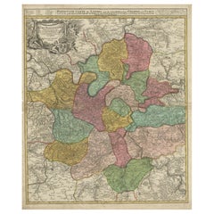
Antique Map Paris
to
11
58
42
60
33
22
13
12
9
8
8
5
4
4
4
4
4
4
3
3
3
3
2
2
2
2
1
1
1
1
1
1
1
1
1
3
2
1
1
1
Sort By
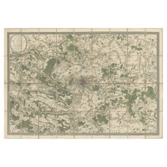
Large Folding Map of Paris, France, on Linen, 36 Segments, Published in 1836
Located in Langweer, NL
Antique map Paris titled 'Carte Topographique des Environs de Paris Nouvelle edition rectifié
Category
1830s Antique Map Paris
Materials
Paper
H 27.96 in W 39.77 in D 0 in
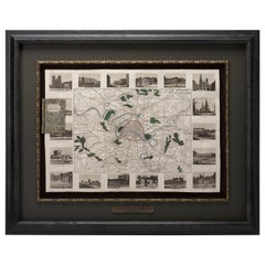
Antique Map of Paris, "Carte Routiere des Environs de Paris" 1841
Located in Colorado Springs, CO
This beautiful hand-colored road map of Paris was published in 1841. The map shows Paris and the
Category
1840s French Antique Map Paris
Materials
Paper
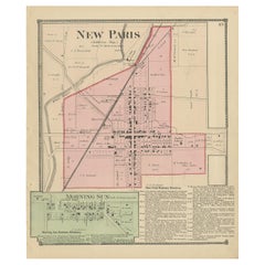
Antique Map of New Paris and Morning Sun, 1871
Located in Langweer, NL
Antique map titled 'New Paris, Morning Sun'. Original antique map of villages and communities of
Category
Late 19th Century Antique Map Paris
Materials
Paper
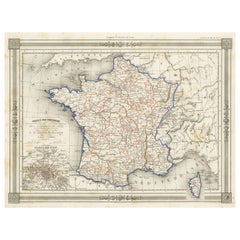
Antique Map of France in Provinces, with Inset of Paris
Located in Langweer, NL
the east. Also includes Corsica. An inset on the bottom left corner details Paris in 1789. This map
Category
Mid-19th Century Antique Map Paris
Materials
Paper
Antique Map of the City of Paris by Tirion '1763'
Located in Langweer, NL
Paris, France. This map originates from 'Nieuwe en Beknopte Hand-Atlas, bestaande in eene Verzameling
Category
Mid-18th Century Antique Map Paris
Materials
Paper
Plan of Paris, France, by A. Vuillemin, Antique Map, 1845
Located in Colorado Springs, CO
This large and detailed plan of Paris was published by Alexandre Vuillemin in 1845. The map conveys
Category
1840s American Antique Map Paris
Materials
Paper
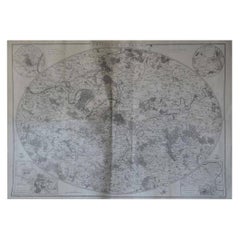
Original Large Antique Map of Paris, France by John Dower, 1861
Located in St Annes, Lancashire
Fabulous monochrome map of Paris.
Vignettes of St Germain En Laye, Saint Cloud, Versailles and
Category
1860s English Victorian Antique Map Paris
Materials
Paper
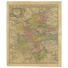
Antique Map of the Region of Paris by Homann Heirs, c.1720
By Homann Heirs
Located in Langweer, NL
. Centered on Paris, the map extends to show these cities at the extremities - Ablis, Messe, Herissy, Senlies
Category
18th Century Antique Map Paris
Materials
Paper
Detailed 18th-Century Map of Paris and Its Surrounding Regions by Johann Homann
Located in Langweer, NL
the early 18th century. This particular map focuses on the region around Paris, illustrating the
Category
1720s Antique Map Paris
Materials
Paper
H 24.02 in W 20.48 in D 0.01 in
Antique Map of the Region of Paris ‘France’ by H. Heirs, circa 1720
Located in Langweer, NL
. Centered on Paris, the map extends to show these cities at the extremities - Ablis, Messe, Herissy, Senlies
Category
Early 18th Century Antique Map Paris
Materials
Paper
Antique Map of France according to the Treaty of Paris '1815', Published in 1854
Located in Langweer, NL
Paris. (1815)'. Large map of France. From James Wyld's 'A New General Atlas of Modern Geography
Category
19th Century Antique Map Paris
Materials
Paper
H 23.04 in W 28.35 in D 0 in
Île-de-France Map, including Paris - Hand-Colored Engraving by F. De Wit c. 1688
Located in Langweer, NL
surrounding Paris, has long been the political and cultural heart of France, making this map historically and
Category
1680s Antique Map Paris
Materials
Paper
H 20.83 in W 24.41 in D 0.01 in
1812 United States Map, by Pierre Tardieu, Antique French Map Depicting the U.S.
By Pierre François Tardieu
Located in Colorado Springs, CO
Map by Tardieu
This attractive map, published in Paris in 1812, is one of the most rare large
Category
1810s French Antique Map Paris
Materials
Paper
H 43.5 in W 48 in D 2.25 in
Antique Map of Germany by Walker, 1820
By R. Walker
Located in Langweer, NL
Antique map Germany titled 'Map of Germany as defined by the Peace of Paris'. Detailed antique map
Category
19th Century Antique Map Paris
Materials
Paper
Antique Map of Southeast Asia by Dussy, 1778
Located in Langweer, NL
Engravers: E. Dussy, a Paris draughtsman and map engraver, active 1754-1784, best known for his long
Category
18th Century Antique Map Paris
Materials
Paper
1705 Golfe de Mexico and Florida Framed Map
Located in Stamford, CT
Framed map of Mexico & Florida circa 1705, Paris. Small map with Mexico and the Gulf Coast. Inset
Category
Early 1700s French Spanish Colonial Antique Map Paris
Materials
Glass, Wood, Paper
Antique Map of Siberia and Russia, c.1885
Located in Langweer, NL
. Migeon (fl. c. 1855 - 1899) was a late 19th century map publisher based in Paris, France. His most
Category
19th Century Antique Map Paris
Materials
Paper
Antique Map of France in Ancient Roman Times, 1880
Located in Langweer, NL
quadrant details Paris (Lutece). The map is decorated with a beautiful illustration of the Dolmen Menhirs
Category
19th Century Antique Map Paris
Materials
Paper
Antique Map of Northern Germany by Wyld, c.1840
Located in Langweer, NL
, Hamburg and Lubeck Conformably with the Treaty of Paris'. Scarce regional map of Northern Germany filled
Category
19th Century Antique Map Paris
Materials
Paper
Antique Map of the United States with Vignette of Washington
Located in Langweer, NL
. Migeon was a late 19th century map publisher based in Paris, France.
Category
Late 19th Century Antique Map Paris
Materials
Paper
Antique Map of the Turkish Empire and Persia, circa 1890
By J. Migeon
Located in Langweer, NL
Antique map Turkish Emprie titled 'Turquie d'Asie et Perse'. Beautiful map depicting the Turkish
Category
19th Century Antique Map Paris
Materials
Paper
Historical Map of Greece and the Eastern Mediterranean by Delisle - 1780
Located in Langweer, NL
. This map was published in Paris, and the 1780 edition reflects both the enduring value of Delisle's
Category
1780s Antique Map Paris
Materials
Paper
H 19.69 in W 26.54 in D 0.01 in
Greece, "Graeciae Antiquae"" A 17th Century Hand-colored Map by Sanson
By Nicolas Sanson
Located in Alamo, CA
Tavernier (1594–1665) in 1636 in Paris. The map is embellished by seven sailing ships and seven sea monsters
Category
Mid-17th Century French Antique Map Paris
Materials
Paper
H 24.75 in W 29.75 in D 0.13 in
1683 Alain Manesson Mallet Map of Ancient India, the Ganges, and Taprobane
Located in Langweer, NL
in 1683 as part of Alain Manesson Mallet’s 'Description de l’Univers'. The map was produced in Paris
Category
1680s Antique Map Paris
Materials
Paper
H 7.88 in W 5.32 in D 0.01 in
Antique Map of Asia with the Porcelain Tower at Nanjing, China, 1884
Located in Langweer, NL
Engravers: J. Migeon (fl. c. 1855 - 1899) was a late 19th century map publisher based in Paris, France. His
Category
19th Century Antique Map Paris
Materials
Paper
Antique Map Depicting Sydney and Surrounding Areas, Known as Port Jackson, c1889
Located in Langweer, NL
," published in Paris.
The map is a color-printed engraving, a common technique of the time, which allowed for
Category
1880s Antique Map Paris
Materials
Paper
H 10.16 in W 13.39 in D 0 in
Antique Map of the Region of 'Île de France' by Janssonius, 1657
By Johannes Janssonius
Located in Langweer, NL
Antique map of France titled 'Ager Parisiensis vulgo l'Isle de France'. Old map of Paris and
Category
17th Century Antique Map Paris
Materials
Paper
1752 Vaugoundy Map of Flanders : Belgium, France, and the Netherlands, Ric.a002
Located in Norton, MA
cartouche is depicted at the lower-left corner.
This map was published in Paris by Gilles Robert de
Category
17th Century Unknown Antique Map Paris
Materials
Paper
H 51.5 in W 66 in D 1 in
Antique Map of the Region of Île-de-France by Hondius, circa 1630
Located in Langweer, NL
("Paris Region") because it includes the city of Paris. This map originates from a composite atlas and
Category
Mid-17th Century Antique Map Paris
Materials
Paper
Antique Map of North America with Vignette of the Statue of Liberty, New York
Located in Langweer, NL
.
Published by J. Migeon, circa 1875. J. Migeon was a late 19th century map publisher based in Paris, France.
Category
Late 19th Century Antique Map Paris
Materials
Paper
H 15.44 in W 20.4 in D 0.02 in
Early 20th Century Terrestrial Globe by G. Thomas Paris
By G. Thomas, Éditeur
Located in Pease pottage, West Sussex
Early 20th Terrestrial Globe by G. Thomas. 44 Rue ND des Champs, Paris. Found on original ebonised
Category
Early 20th Century French Antique Map Paris
Materials
Wood, Paper
Europe Divided into Principal States by Jean Denis Janvier, Paris, 1782
Located in Langweer, NL
This is a historical map of Europe titled "L'Europe divisee en ses Principaux Etats," created by
Category
1780s Antique Map Paris
Materials
Paper
H 14.97 in W 19.1 in D 0.01 in
ANTiQUE CIR 1880 J LEBEGUE & CIE PARIS TERRESTRIAL LITHOGRAPH GLOBE CAST IRON
By J. Lebegue & Cie
Located in West Sussex, Pulborough
Royal House Antiques
Royal House Antiques is delighted to offer for sale this absolutely exquisite original Circa 1860-1880 Globe Terrestre by J Lebegue & Cie on an ornately cast sw...
Category
1880s European Victorian Antique Map Paris
Materials
Iron
18th Century Map of Paris
Located in Washington, DC
18th century map of Paris.
Category
Late 18th Century French Antique Map Paris
Materials
Glass, Wood, Paper
Map of Paris - Original Etching - 19th Century
Located in Roma, IT
This Map of Paris is an original print in etching technique.
The state of preservation of the
Category
19th Century Antique Map Paris
Materials
Etching
Paris, France. Antique Map City Plan Chromolithograph, circa 1895
Located in Melbourne, Victoria
plan of Paris, France.
Central vertical fold. Printed street index on the reverse of the map.
Category
Late 19th Century Victorian Antique Map Paris
Materials
Lithograph
1851 Original map by Maillard - Plan de Paris et ses Fortifications
Located in PARIS, FR
enlightening view of Paris during a period of significant transformation. This extraordinary map not only
Category
1850s Antique Map Paris
Materials
Linen, Paper, Lithograph
H 30.71 in W 39.38 in
1848 Original map by Maillard - Plan de Paris et ses Fortifications
Located in PARIS, FR
, encapsulating the essence of a place at a specific moment in time. The 1848 vintage map, "Plan de Paris et ses
Category
1840s Antique Map Paris
Materials
Paper, Lithograph, Linen
H 27.96 in W 40.56 in
Large Paris Porcelain Map of Italy Cup and Saucer, circa 1810
Located in New York, NY
Large Paris porcelain map of Italy cup and saucer, circa 1810.
Category
1810s French Antique Map Paris
Materials
Porcelain
French 1930s Map of Paris à Vol d'Oiseau under Glass in Custom Iron Frame
Located in Atlanta, GA
A French map of Paris from the early 20th century, with custom iron frame. Created in Paris during
Category
Early 20th Century French Antique Map Paris
Materials
Iron
H 28.75 in W 40.25 in D 1 in
Reapers at Rest
By Charles-Emile Jacque
Located in Middletown, NY
painter. As a young man, Jacque apprenticed to a map maker in Paris, and after military service, where he
Category
Mid-19th Century French School Antique Map Paris
Materials
Handmade Paper, Etching
French Map of Paris, Musuem Carnavalet Rossingol University Map, 1576
Located in WILMINGTON, CA
French Map of Paris, Musuem Carnavalet Rossingol University Map, 1576.
Map of Paris, France
Category
16th Century French Antique Map Paris
Materials
Paper
French Hand Painted Map of Paris City Centre circa 1860
Located in Sint-Kruis, BE
Most unusual map of the centre of Paris, painted by hand on linnen circa 1860. On the map you can
Category
19th Century French Antique Map Paris
Materials
Linen
Paris, 1577
By Georg Braun and Frans Hogenberg
Located in Houston, TX
This fine example of 16th century Paris appeared in volume 1 of Braun & Hogenberg's 6 volume
Category
16th Century German Antique Map Paris
Paris De 1512-1547 de la Gran Gouache apres le plan Tapisserie
By Chardon & Dujardin
Located in Boston, MA
A late nineteenth century heliogravure facsimilie Plan De Paris after the tapestry from 1512-1547
Category
19th Century French Antique Map Paris
18th Century Footprint Paris Map
Located in New York, NY
18th century footprint Paris map.
Category
18th Century and Earlier French Antique Map Paris
19th Century Map of Paris
By Angelique Marie Martin 1
Located in Saint-Ouen, FR
Very beautiful 1887 map of Paris.
Engraved by A.Martin and printed by Hermet.
Map in two parts
Category
1880s French Napoleon III Antique Map Paris
Materials
Paper
Painted on Linen Map of Paris
Located in Sint-Kruis, BE
hand painted on linen plan of Paris, Napoleon III period
Category
19th Century French Antique Map Paris
Materials
Linen
One of the Earliest Modern Maps of Paris
By Georg Braun and Frans Hogenberg
Located in La Jolla, CA
Fine example of this iconic plan of 16th century Paris, which appeared in volume 1 of Braun
Category
16th Century German Northern Renaissance Antique Map Paris
Plan De Paris, wall map, commissioned by Turgot, from 1739
By Michel Etienne Turgot
Located in Boston, MA
Gravé par Claude Lucas / Et Écrit par Aubin. A monumental aerial isometric map of the City of Paris in
Category
18th Century and Earlier French Antique Map Paris
Plan de Paris (Plan of Paris), Turgot, 1739
By Michel Etienne Turgot
Located in Houston, TX
The most beautiful, majestic and exquisite map of Paris from the 18th century. You have perhaps
Category
18th Century and Earlier French Antique Map Paris
Materials
Paper
Pair of Paris Porcelain Flowerbuds Horns of Plenty 1840s
Located in Tours, FR
also signed MAP for Paris. Paris, manufacture Morelle 1840s.
Dimensions for each piece: Width 18 cm
Category
1840s French Louis XV Antique Map Paris
Materials
Porcelain
Mappe Monde … Division par Religions…
By E. Dussy
Located in Zeeland, Noord-Brabant
after Robert de Vaugondy.
We have found little about E. Dussy. A Paris draughtsman and map engraver
Category
1770s Antique Map Paris
Materials
Engraving
Carte d'une Partie de l'Amerique Septentrionale
By Francois Soules
Located in Florham Park, NJ
).
________________________________________
DATE OF PUBLICATION : R1787 (1781MS)
PLACE OF PUBLICATION : PARIS
DESCRIPTION : THIS MAP SHOWING
Category
18th Century and Earlier Academic Antique Map Paris
Materials
Engraving
19th Century Map of Paris
Located in Round Top, TX
A folding pocket map of Paris from the French war department, 1839, mounted on silk in a new frame.
Category
Early 19th Century French Antique Map Paris
Materials
Paper
Map of Paris, Published by Robelin, Antique Pictorial Map, circa 1913
Located in Colorado Springs, CO
center of Paris and its immediate vicinity.
The map conveys a wonderful amount of information and is
Category
1910s French Antique Map Paris
Materials
Paper
Vintage 1927 Paris Map Created by Ilonka Karasz
Located in Dallas, TX
Stylish paper map of Paris mounted on board in colors of red/blue/yellow. The Creator/Designer of
Category
Early 20th Century French Antique Map Paris
1848 Panorama Hand-Colored Map of Paris Showing Notre Dame Cathedral
Located in Colorado Springs, CO
This 1848 panorama map of Paris was published by the Illustrated London News as an insert in its
Category
19th Century British Antique Map Paris
1862 Guittet View and Map of Paris in Antique Windowpane Frame
Located in Colorado Springs, CO
colorful 1862 chromolithograph birds-eye map of Paris, France, and vicinity by Guittet. Centered on the
Category
1860s French Antique Map Paris
World Map of 19th Century
Located in Saint-Ouen, FR
World map signed Maison Delamarche Paris.
19th century.
Measures: D: 30 cm, H: 45 cm.
Category
19th Century French Antique Map Paris
Materials
Wood
- 1
Get Updated with New Arrivals
Save "Antique Map Paris", and we’ll notify you when there are new listings in this category.
Antique Map Paris For Sale on 1stDibs
At 1stDibs, there are many versions of the ideal antique map paris for your home. Each antique map paris for sale was constructed with extraordinary care, often using paper, wood and fabric. Your living room may not be complete without an antique map paris — find older editions for sale from the 18th Century and newer versions made as recently as the 20th Century. An antique map paris made by Neoclassical designers — as well as those associated with Victorian — is very popular. Georg Braun and Frans Hogenberg, Andriveau-Goujon and Angelique Marie Martin each produced at least one beautiful antique map paris that is worth considering.
How Much is a Antique Map Paris?
An antique map paris can differ in price owing to various characteristics — the average selling price 1stDibs is $2,200, while the lowest priced sells for $67 and the highest can go for as much as $32,500.
