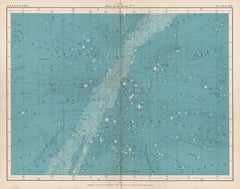
Antique Constellation Map
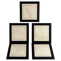
Constellations Engraved Maps Drawn by W. Newton, Published by Baldwin & Grado
Located in Nottingham, GB
Set of five maps of the constellations numbered 1-5, drawn by W. Newton and published by Baldwin
Category
1830s Antique Constellation Map
Materials
Paper
H 16.93 in W 16.15 in D 0.79 in
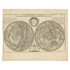
Antique Planisphere with Constellations by Bion, 1751
Located in Langweer, NL
Antique map titled 'Planisphere Celeste'. Planisphere with various constellations. This map
Category
Mid-19th Century Antique Constellation Map
Materials
Paper
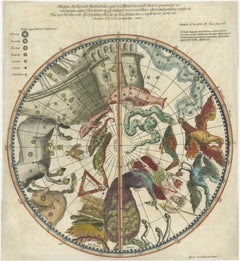
1711 Star Chart of Southern Sky with Mythical Constellations and Exotic Animals
Located in Langweer, NL
the southern sky, centered on the south equatorial pole. The chart includes numerous constellations
Category
1710s Antique Constellation Map
Materials
Paper
H 14.89 in W 13.59 in D 0.01 in
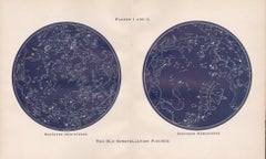
The Old Constellation Figures. Astronomy map of the stars.
Located in Melbourne, Victoria
Colour lithograph, 1890. 285mm by 430mm (sheet). From W Peck's 'A Handbook and Atlas of Astronomy', 1890. Central vertical fold as issued.
Category
Late 19th Century Victorian Antique Constellation Map
Materials
Lithograph
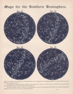
Maps for the Southern Hemisphere. Antique Astronomy star constellation print
Located in Melbourne, Victoria
Colour lithograph, 1890. 285mm by 210mm (sheet). From W Peck's 'A Handbook and Atlas of Astronomy', 1890. Sir William Peck FRSE FRAS (1862 – 1925) was a Scottish astronomer and scien...
Category
Late 19th Century Victorian Antique Constellation Map
Materials
Lithograph
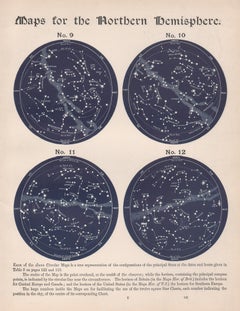
Maps for the Northern Hemisphere. Antique Astronomy star constellation print
Located in Melbourne, Victoria
Colour lithograph, 1890. 285mm by 210mm (sheet). From W Peck's 'A Handbook and Atlas of Astronomy', 1890. Sir William Peck FRSE FRAS (1862 – 1925) was a Scottish astronomer and scien...
Category
Late 19th Century Victorian Antique Constellation Map
Materials
Lithograph
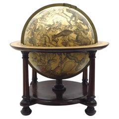
A beautiful Celestial Table Globe produced by Gerard & Leonard Valk
By Gerard and Leonard Valk
Located in ZWIJNDRECHT, NL
constellation. They are mapped onto a sphere to show how they appear in the night sky from the earth, as if the
Category
Early 18th Century Dutch Dutch Colonial Antique Constellation Map
Materials
Other
Recent Sales
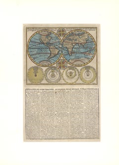
c. 1750 Double-Hemisphere World Map showing California as an Island
Located in New York, NY
, Brahe, and Capela, the brightest star in the constellation of Auriga. The first map to show the island
Category
1750s Realist Antique Constellation Map
Materials
Engraving
Maps of the Stars. Antique astronomy constellations map
Located in Melbourne, Victoria
'Maps of the Stars. No 2'
Antique lithograph by W & AK Johnston, famous Scottish cartographers
Category
Early 20th Century Victorian Antique Constellation Map
Materials
Lithograph
Maps of the Stars. Antique astronomy constellations map
Located in Melbourne, Victoria
'Maps of the Stars. No 1.'
Antique lithograph by W & AK Johnston, famous Scottish cartographers
Category
Early 20th Century Victorian Antique Constellation Map
Materials
Lithograph
1856s The Constellations Map for Each Month in the Year by FJ Huntington N.Y.
Located in Milan, IT
Map VI and VII depicting the constellations titled The Constellations for each Month in the Year
Category
1850s American Antique Constellation Map
Materials
Glass, Wood, Paper
H 18.71 in W 32.17 in D 0.6 in
Maps of the Stars. Antique astronomy constellations map
Located in Melbourne, Victoria
'Maps of the Stars. No 3'
Antique lithograph by W & AK Johnston, famous Scottish cartographers
Category
Early 20th Century Victorian Antique Constellation Map
Materials
Lithograph
Antique Map of the Stars and Constellations by Lapie, 1842
Located in Langweer, NL
Antique map titled 'Planisheres Célestes'. Two hemispheres depicting the stars and constellations
Category
Mid-19th Century Antique Constellation Map
Materials
Paper
Theoria Eclipsium, Atlas Novus Coelestis Johanne Dopplemayr 1742 engraving
By Johann Gabriel Doppelmayr 1
Located in Paonia, CO
that are constellation maps showing the paths of comets and the positions of the stars two of which are
Category
1740s Antique Constellation Map
Materials
Engraving
19th Century George III 1817 Pair of Astrology Scientific Engravings
Located in Lowestoft, GB
globe, which is a smooth sphere whose principal purpose is to map the constellations. It was invented
Category
1810s English George III Antique Constellation Map
Materials
Pine, Glass, Paper
Constellation Map
Located in New York, NY
Very fresh and attractive black and white print of Constellations. Print measures 4-1/2" x 10
Category
Early 20th Century American Antique Constellation Map
Monumental Pair of Cary's Library Globes
Located in New York, NY
.
The celestial globe is mapped with constellations elegantly depicted by mythical
Category
19th Century English Antique Constellation Map
Materials
Mahogany
People Also Browsed
Nebulae, antique astronomy science diagram illustration print
Located in Melbourne, Victoria
Nebulae.
Antique lithograph by W & AK Johnston, famous Scottish cartographers.
Central vertical fold as issued. From Thomas Heath's 'The Twentieth Century Atlas of Popular Astronom...
Category
Early 20th Century Victorian Antique Constellation Map
Materials
Lithograph
The Position of the Constellations. Antique Astronomy diagram
Located in Melbourne, Victoria
Colour lithograph, 1890. 210mm by 285mm (sheet). From W Peck's 'A Handbook and Atlas of Astronomy', 1890. Sir William Peck FRSE FRAS (1862 – 1925) was a Scottish astronomer and scien...
Category
Late 19th Century Victorian Antique Constellation Map
Materials
Lithograph
Star Chart. Antique Astronomy celestial print
Located in Melbourne, Victoria
Colour lithograph, 1890. 210mm by 285mm (sheet). From W Peck's 'A Handbook and Atlas of Astronomy', 1890. Sir William Peck FRSE FRAS (1862 – 1925) was a Scottish astronomer and scien...
Category
Late 19th Century Victorian Antique Constellation Map
Materials
Lithograph
The Stars Visible to the Naked Eye. Antique Astronomy print
Located in Melbourne, Victoria
Colour lithograph, 1890. 210mm by 285mm (sheet). From W Peck's 'A Handbook and Atlas of Astronomy', 1890. Sir William Peck FRSE FRAS (1862 – 1925) was a Scottish astronomer and scien...
Category
Late 19th Century Victorian Antique Constellation Map
Materials
Lithograph
Double Stars. Antique Astronomy science print
Located in Melbourne, Victoria
Colour lithograph, 1890. 285mm by 210mm (sheet). From W Peck's 'A Handbook and Atlas of Astronomy', 1890. Sir William Peck FRSE FRAS (1862 – 1925) was a Scottish astronomer and scien...
Category
Late 19th Century Victorian Antique Constellation Map
Materials
Lithograph
Get Updated with New Arrivals
Save "Antique Constellation Map", and we’ll notify you when there are new listings in this category.
Antique Constellation Map For Sale on 1stDibs
You are likely to find exactly the antique constellation map you’re looking for on 1stDibs, as there is a broad range for sale. Making the right choice when shopping for an antique constellation map may mean carefully reviewing examples of this item dating from different eras — you can find an early iteration of this piece from the 19th Century and a newer version made as recently as the 20th Century. These artworks were handmade with extraordinary care, with artists most often working in lithograph.
How Much is a Antique Constellation Map?
The price for an antique constellation map in our collection starts at $150 and tops out at $1,300 with the average selling for $150.
