Antique Celestial Maps
to
4
26
14
28
18
14
7
6
5
5
4
2
2
2
2
1
1
1
1
1
1
1
1
1
1
1
1
3
3
3
2
2
Sort By
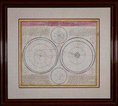
Theories of Planetary Motion: An 18th C. Framed Celestial Map by Doppelmayr
By Johann Gabriel Doppelmayr 1
Located in Alamo, CA
This 18th century hand-colored copperplate celestial map by Johann Doppelmayr entitled "Theoria
Category
Early 18th Century Antique Celestial Maps
Materials
Engraving
H 31.25 in W 34.88 in D 1 in
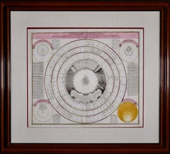
Theories of Planetary Orbits: A Framed 18th C. Celestial Map by Doppelmayr
By Johann Gabriel Doppelmayr 1
Located in Alamo, CA
This 18th century hand-colored copperplate celestial map by Johann Doppelmayr entitled "Astronomia
Category
Early 18th Century Antique Celestial Maps
Materials
Engraving
H 31.5 in W 34.94 in D 1 in
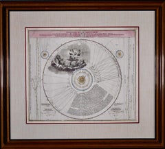
The Orbits of Venus and Mercury: An 18th C. Framed Celestial Map by Doppelmayr
By Johann Gabriel Doppelmayr 1
Located in Alamo, CA
This 18th century hand-colored copperplate celestial map by Johann Doppelmayr entitled "Phænomena
Category
Early 18th Century Antique Celestial Maps
Materials
Engraving
H 31.13 in W 34.88 in D 1 in
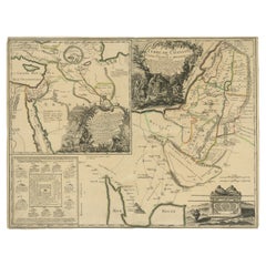
Detailed Map of Arabian Peninsula and Canaan, Highlighting Biblical Territories
Located in Langweer, NL
globes and was also known for innovating with educational products, including thematic and celestial maps
Category
1750s Antique Celestial Maps
Materials
Paper
H 21.86 in W 16.74 in D 0 in
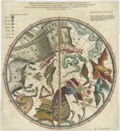
1711 Star Chart of Southern Sky with Mythical Constellations and Exotic Animals
Located in Langweer, NL
Pavo (peacock). The map is hand-colored, bringing life to these celestial figures and adding artistic
Category
1710s Antique Celestial Maps
Materials
Paper
H 14.89 in W 13.59 in D 0.01 in
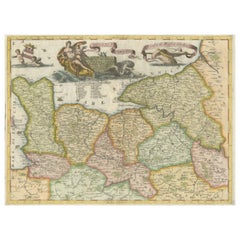
Decorative Original Antique Map of Normandy, France
Located in Langweer, NL
. Cornelli produced more than one hundred terrestrial and celestial globes, several hundred maps, and a
Category
Late 17th Century Antique Celestial Maps
Materials
Paper
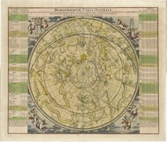
1730 Southern Hemisphere Celestial Chart with Zodiac Signs and Decorative Putti
Located in Langweer, NL
: This stunning 1730 celestial map, "Hemisphaerium Coeli Australe," showcases the Southern Hemisphere's
Category
1730s Antique Celestial Maps
Materials
Paper
H 21.15 in W 24.81 in D 0.01 in
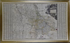
Meissen, Germany : A Large Framed 18th Century Map by Petrus Schenk
Located in Alamo, CA
celestial maps by Andreas Cellarius. Peter Schenk, the Younger inherited his father's business in Leipzig
Category
Mid-18th Century Old Masters Antique Celestial Maps
Materials
Engraving
H 26.13 in W 42.13 in D 0.75 in
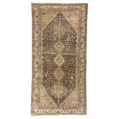
1920's Distressed Persian Malayer Carpet with Modern Style
Located in Dallas, TX
brown field, where intricate geometric motifs unfold like a celestial map. The hooked lozenge medallions
Category
Early 20th Century Persian Malayer Antique Celestial Maps
Materials
Wool
Antique Print of Celestial Hemispheres, 1854
Located in Langweer, NL
Antique world map titled 'Northern Celestial Hemisphere - Southern Celestial Hemisphere'. Old map
Category
19th Century Antique Celestial Maps
Materials
Paper
William IV Terrestrial And Celestial Floor Globes By J. W. Cary
By John & William Cary
Located in New Orleans, LA
during expeditions to the North Pole, while the celestial globe provided a timeless map of the heavens
Category
19th Century English Regency Antique Celestial Maps
Materials
Mahogany
Constellations Engraved Maps Drawn by W. Newton, Published by Baldwin & Grado
Located in Nottingham, GB
observers identify and locate specific constellations and celestial objects. Constellation maps typically
Category
1830s Antique Celestial Maps
Materials
Paper
H 16.93 in W 16.15 in D 0.79 in
Planiglobii Terrestris Mappa Universalis / Mappe Monde
By Homann Heirs
Located in New York, NY
This map was printed from a copperplate engraving in 1746. The printed image size is 18.25 x 21.75
Category
18th Century Other Art Style Antique Celestial Maps
Materials
Engraving
H 20.13 in W 23.88 in D 0.94 in
Pair of 19th Century Newton, Son & Berry Terrestrial and Celestial Globes
By Newton, Son & Berry
Located in Salt Lake City, UT
A pair of Newton, Son & Berry terrestrial and celestial globes made in London, circa 1836. Marked
Category
Early 19th Century Antique Celestial Maps
Materials
Brass
Solis Circa Orbem Terrarum Spiralis Revolution
By Andreas Cellarius
Located in Mount Vernon, NY
Engraving after celestial map from Dutch-German mathematician and cosmographer Andreas Cellarius
Category
17th Century Antique Celestial Maps
Materials
Engraving
Planisphaerivm Brahevm, Sive Structura Mvndi Totivs
By Andreas Cellarius
Located in Mount Vernon, NY
Engraving after celestial map from Dutch-German mathematician and cosmographer Andreas Cellarius
Category
17th Century Antique Celestial Maps
Materials
Engraving
Set of Six Johann Bayer Celestial Engravings
By Johann Bayer
Located in New York, NY
celestial maps that were not only highly appealing on a visual level, but also significant in the history
Category
18th Century and Earlier Antique Celestial Maps
Star Chart from the Early Seventeenth Century by German Astronomer Johann Bayer
By Johann Bayer
Located in New York, NY
1603, the Uranometria included celestial maps that were not only highly appealing on a visual level
Category
18th Century and Earlier German Antique Celestial Maps
Star Chart from the Early Seventeenth Century by German Astronomer Johann Bayer
By Johann Bayer
Located in New York, NY
published in Augsburg in 1603, the Uranometria included celestial maps that were not only highly appealing
Category
18th Century and Earlier Antique Celestial Maps
Most Desirable of Cellarius's Celestial Engravings
By Andreas Cellarius
Located in La Jolla, CA
example is from the 1661 edition of Cellarius' Harmonia Macrocosmica.
The map illustrates the
Category
1660s Dutch Renaissance Antique Celestial Maps
Materials
Paper
Antique Engraving of Terrestrial and Celestial Globes Framed
By George Louis Le Rouge
Located in Pataskala, OH
frame with a bead detail.
Title/Content of Map: Terrestrial and celestial globes
Date Printed
Category
1760s French Louis XVI Antique Celestial Maps
Celestial Maps, Set of Four, Ignace Gaston Pardies
By Ignace Gaston Pardies
Located in Pasadena, CA
-1673) Celestial Maps. The folios were colored contemporaneously and are in over all excellent condition
Category
17th Century French Baroque Antique Celestial Maps
Materials
Paper
Nathaniel Hill Pocket Globe, 1754
Located in Lincolnshire, GB
the case shows the celestial map.
The fish skin case close and retains the catches.
Category
1750s Antique Celestial Maps
Materials
Shagreen
Hand-Colored Astronomical Engravings by Louis Charles Desnos, 1766
By Louis Charles Desnos
Located in Kinderhook, NY
Collection of three hand-colored astronomical map engravings illustrating celestial spheres in
Category
Mid-18th Century French Rococo Antique Celestial Maps
Materials
Glass, Wood, Paper
Novissium Astronomiae, Geographiae Tobias Lotter 1770's celestial map engraving
By Tobias Conrad Lotter
Located in Paonia, CO
figuris, earu explicatione et uso un unius mappae geographicae philyram Collectum map by Tobias Conrad
Category
Late 18th Century Antique Celestial Maps
Materials
Engraving
Antique Map of a Celestial Hemisphere by Van Dùren, 1749
Located in Langweer, NL
(..)'. Original antique map of a celestial hemisphere, with descriptive text in German. This map originates from
Category
Mid-18th Century Antique Celestial Maps
Materials
Paper
Early 19th Century Celestial Globe by Cary
By John & William Cary
Located in Greenwich, CT
Fine Georgian Celestial globe by J. & W. Cary of London, circa 1800, the mahogany Stand with ring
Category
1790s English George III Antique Celestial Maps
Materials
Mahogany, Paper
Celestial Pocket Globe by Newton London, 1860 Circa
By Newton and Son
Located in Milano, IT
cartouche with the inscription:
NEWTON’S
Improved Pocket
Celestial
GLOBE
The celestial sphere is
Category
1850s English Victorian Antique Celestial Maps
Materials
Wood, Paper
Antique Double Hemisphere Celestial Chart by Lotter, 'circa 1770'
Located in Langweer, NL
Antique map titled 'Planisphaerium Coeleste'. A very decorative double hemisphere celestial chart
Category
Late 18th Century Antique Celestial Maps
Materials
Paper
19th Century Franklin Celestial Tabletop Globe by Nims and Company
By H.B. Nims & Co.
Located in Philadelphia, PA
The Franklin Globe.
A fine and rare H. B. Nims and Company 12-inch Celestial globe
Category
Late 19th Century American Late Victorian Antique Celestial Maps
Pegasus Celestial Map
Located in Toronto, ON
PLATE X11 FROM JAMIESONS CELESTIAL ATLAS C 1822 CONTAINING A SYSTEMATIC VIEW OF THE HEAVENS.
Category
19th Century English Antique Celestial Maps
Celestial Maps
Located in Los Angeles, CA
1735 terrestrial and celestial globes as well as Armillary Sphere and compass by VAN DER AA
Category
18th Century and Earlier Belgian Antique Celestial Maps
Set of Four 18th Century French Celestial Map Engravings
By John Flamsteed
Located in New York, NY
Set of four 18th century French celestial map engravings from astrological "Atlas Celeste de John
Category
Late 18th Century French Antique Celestial Maps
Materials
Paper
Cetus Celestial Map
Located in Toronto, ON
PLATE XXX111 FROM JAMIESONS CELESTIAL ATLAS C1822,CONTAINING A SYSTEMATIC DISPLAY OF THE HEAVENS.
Category
19th Century English Antique Celestial Maps
Hercules Celestial Map
Located in Toronto, ON
PLATE V111 FROM JAMIESONS CELESTIAL ATLAS C 1822, CONTAINING A SYSTEMATIC DISPLAY OF THE HEAVENS.
Category
19th Century English Antique Celestial Maps
Hammett's Planisphere Celestial Map
Located in Dallas, TX
This wonderful astrological map was made for the J. L. Hammett Co. of Boston, Massachusetts and
Category
Early 20th Century Antique Celestial Maps
Hydra And Felis Celestial Map
Located in Toronto, ON
PLATE XXV1 FROM JAMIESONS CELESTIAL ATLAS C 1822 CONTAINING A SYSTEMATIC DISPLAY OF THE HEAVENS.
Category
19th Century English Antique Celestial Maps
Johann Bayer "Uranometria" Celestial Map Engravings, 1641 Edition
By Johann Bayer
Located in New York, NY
Selection of six hand colored engravings from Johan Bayer's "Uranometria" star atlas, 1641 edition. Guache added later, likely in the early to mid-20th century. Newly framed. Engr...
Category
17th Century German Antique Celestial Maps
Hand-Colored Map of Rome, circa 1720
By Johann Baptist Homann
Located in New York, NY
producing maps, globes, and celestial charts out of Nuremberg. His business monopolized both German and
Category
1720s German Antique Celestial Maps
Materials
Paper, Watercolor
An impressive French astronomical centerpiece table clock, circa 1880
Located in Amsterdam, Noord Holland
the top we find the celestial map with all the heavenly bodies, not connected with the movement. It is
Category
19th Century French Renaissance Revival Antique Celestial Maps
Materials
Ormolu
Globe/map Celestial 18th century
Located in Stratford upon Avon, GB
Late 18th century celestial globe on a mahogany tripod stand with brass castors by Nevil Maskelyne
Category
Late 18th Century Antique Celestial Maps
Materials
Wood
Pair of Antique Desk Globes by Newton
By Newton and Son
Located in London, GB
base raised on turned feet. The terrestrial and celestial globes retain their original maps dated 1847
Category
1840s English Victorian Antique Celestial Maps
Materials
Iron
Monumental Pair of Cary's Library Globes
Located in New York, NY
.
The celestial globe is mapped with constellations elegantly depicted by mythical
Category
19th Century English Antique Celestial Maps
Materials
Mahogany
19th Century Celestial Globe by W & A K Johnston, Edinburgh
Located in London, Greenwich
19th century celestial globe with compass on mahogany base by W & A K Johnston, Edinburgh.
This
Category
1850s British Early Victorian Antique Celestial Maps
Materials
Gesso, Mahogany
Get Updated with New Arrivals
Save "Antique Celestial Maps", and we’ll notify you when there are new listings in this category.
Antique Celestial Maps For Sale on 1stDibs
Find a variety of antique celestial maps available on 1stDibs. Frequently made of paper, wood and mahogany, all antique celestial maps available were constructed with great care. There are all kinds of antique celestial maps available, from those produced as long ago as the 18th Century to those made as recently as the 20th Century. Antique celestial maps bearing Victorian or Baroque hallmarks are very popular at 1stDibs. Antique celestial maps have been a part of the life’s work for many furniture makers, but those produced by H.B. Nims & Co., Ignace Gaston Pardies and John & William Cary are consistently popular.
How Much are Antique Celestial Maps?
Prices for antique celestial maps start at $275 and top out at $8,800 with the average selling for $2,288.
More Ways To Browse
Cast Iron Fluted Columns
George Nelson Orange
Armillary Globe
Galaxy Globe
Large Mercury Glass Vase
Antique Map By Coronelli
Lane Mahogany Table
Sphere Ottoman
Brass Hunting Dogs
G Plan Ottoman
Shagreen Box Made In England
18th Century Taurus
Aries Table
Brass Astrological Globe
Hydra Castor
Orreries
Azimuth Compass
A Galleon Figure
