Items Similar to Roman Hills, Aqueducts and Roads: An Early 18th Century Map by Jan Goeree


Want more images or videos?
Request additional images or videos from the seller
1 of 10
Jan GoereeRoman Hills, Aqueducts and Roads: An Early 18th Century Map by Jan Goeree1704
1704
About the Item
This richly engraved map of Rome and its environs entitled "Urbis Cum Vicis Seu Pagis Adiacentibus Dissertationi III De Aq et Aqueaed Veteris Promae Praemissa Authore Raph Fabretto Gast f. Urbinate" from Francois Desseine's Beschrijving van oud en niew Rome verdeelt in drie deelen. The work was engraved by Jan Goeree (1670-1731) and published by Francois Halma (1653-1722) in Amsterdam in 1704. The map appears mounted on a wall with a glimpse of architecture in the background on the left. A half naked female mythical god with an animal, possibly a greyhound, is seated in the left corner looking at two putti who hold open a book to the title page. Cartographic instruments and a linear scale are below the map to the right. The map depicts Rome with its seven hills (and one additional) to the left and above center, with many roads about the city, including Via Appia (the Appian Way) to the south. The Tiber River (Tiberis Fl.) and the many Roman aqueducts are also depicted.
This somewhat whimsical map of Rome is printed on laid, chain-linked paper with wide margins. The sheet measures 20.75" high and 24.75" wide. There is a vertical center fold, as issued and one small spot in the lower right margin of the map on the wall and another at the upper left edge of the sheet. It is otherwise in very good condition.
Francois Desseine was a Dutch librarian who authored the work 'Beschrijving van oud en niew Rome verdeelt in drie deelen' (Description of ancient and new Rome divided into three parts). It was a description of Rome, illustrated with numerous maps and engravings, depicting its people, customs, and architecture, etc.
Jan Goeree (1670-1731) was a Dutch artist, engraver, and art theorist, known for his prolific output of prints and drawings. He was born in Amsterdam and began his artistic training under the tutelage of his father, Willem Goeree, a famous art writer and publisher. Jan Goeree specialized in the production of prints, which were highly popular in his time, and he also created a large number of drawings and paintings. Goeree's work was highly influenced by the Dutch Golden Age, with its focus on realism, detail, and naturalism. He produced a wide variety of prints, including landscapes, genre scenes, and portraits, often working in collaboration with other artists. Goeree was also an important art theorist and published several influential books on art, including "Inleydinge Tot de Al-gemeene Teyken-Konst" (Introduction to the General Art of Drawing), which became a standard textbook for Dutch art schools in the 18th century. Despite his prolific output and influence, Goeree's reputation as an artist declined in the 19th century, and his work fell out of favor. However, in recent years, there has been renewed interest in his prints and drawings, and he is once again recognized as an important figure in Dutch art history.
- Creator:Jan Goeree (1670 - 1731, Dutch)
- Creation Year:1704
- Dimensions:Height: 20.75 in (52.71 cm)Width: 24.75 in (62.87 cm)
- Medium:
- Movement & Style:
- Period:
- Framing:Framing Options Available
- Condition:
- Gallery Location:Alamo, CA
- Reference Number:Seller: # 46781stDibs: LU1173211524512
About the Seller
5.0
Platinum Seller
Premium sellers with a 4.7+ rating and 24-hour response times
Established in 2011
1stDibs seller since 2019
281 sales on 1stDibs
Typical response time: 2 hours
- ShippingRetrieving quote...Shipping from: Alamo, CA
- Return Policy
Authenticity Guarantee
In the unlikely event there’s an issue with an item’s authenticity, contact us within 1 year for a full refund. DetailsMoney-Back Guarantee
If your item is not as described, is damaged in transit, or does not arrive, contact us within 7 days for a full refund. Details24-Hour Cancellation
You have a 24-hour grace period in which to reconsider your purchase, with no questions asked.Vetted Professional Sellers
Our world-class sellers must adhere to strict standards for service and quality, maintaining the integrity of our listings.Price-Match Guarantee
If you find that a seller listed the same item for a lower price elsewhere, we’ll match it.Trusted Global Delivery
Our best-in-class carrier network provides specialized shipping options worldwide, including custom delivery.More From This Seller
View AllFrankfort, Germany: A 16th Century Hand-colored Map by Braun & Hogenberg
By Franz Hogenberg
Located in Alamo, CA
This is a 16th century original hand-colored copperplate engraved map of Frankfort, Germany entitled "Francenbergum, vel ut alij Francoburgum Hassiae Opp" by Georg Braun & Franz Hogenberg, from their famous city atlas "Civitates Orbis Terrarum", published in Cologne, Germany in 1595.
This is an English translation of an excerpt from the original text in the atlas:
"Frankenberg or, according to others, Francoburgum, a town in Hesse. Charlemagne vested the town of Frankenberg with many freedoms and privileges, which it still enjoys to this day, and on account of its valiant and victorious soldiers awarded a signet, upon which there formerly appeared a golden castle with a tower, together with the letter F and a golden crown.
Frankenberg, seen here from the northeast, lies on a hill above the River Eder. The hillside is covered with fields neatly separated by bushes and fences. Soaring above the town is the massive Liebfrauenkirche, which was modelled on St Elizabeth's church in Marburg. The New Town was founded in 1335 at the foot of the hill (right) and merged with the Old Town as late as 1556. Frankenberg was founded by Conrad of Thuringia in 1233/34 to prevent the archbishops of Mainz from expanding their sphere of influence...
Category
16th Century Old Masters Landscape Prints
Materials
Engraving

Meissen, Germany : A Large Framed 18th Century Map by Petrus Schenk
Located in Alamo, CA
This is a hand-colored 18th century map of the Meissen region of Germany, entitled "Geographischer Entwurff Derer Aemmter Meissen als Creys-Procuratur-Schul-und Stiffts-Ammt benebst ...
Category
Mid-18th Century Old Masters Landscape Prints
Materials
Engraving

Danube River, Italy, Greece and Croatia: A Hand-colored 18th C. Homann Map
By Johann Baptist Homann
Located in Alamo, CA
"Fluviorum in Europa principis Danubii" is a hand-colored map of the region about the Danube river created by Johann Baptist Homann (1663-1724) in his 'Atlas Novus Terrarum', publish...
Category
Early 18th Century Old Masters Landscape Prints
Materials
Engraving

L'Isle de France: A Hand-colored 17th Century Map by De Wit
By Frederick de Wit
Located in Alamo, CA
This colorful and detailed 17th century hand-colored copperplate map by Frederick De Wit was published in Amsterdam between 1666 and 1760. The map depicts the Île-de-France, which is one of the ancient provinces of France. Paris is located in the center of the map, with Versailles to the southwest The map extends from Rouen in the west to Reims in the east. The area around Paris, the Véxin Français, was the original domain of the king of France. Other areas were ruled by French feudal lords. For example, the Véxin Normand area was the domain of the Duke of Normandy...
Category
Early 18th Century Old Masters More Prints
Materials
Engraving

View of Emden, Germany: A 16th Century Hand-colored Map by Braun & Hogenberg
By Franz Hogenberg
Located in Alamo, CA
This is a 16th century original hand-colored copperplate engraved map of a bird's-eye View of Embden, Germany entitled " Emuda, vulgo Embden vrbs Frisia orientalis primaria" by Georg Braun & Franz Hogenberg, in volume II of their famous city atlas "Civitates Orbis Terrarum", published in Cologne, Germany in 1575.
This is a beautifully colored and detailed map of Emden, a seaport in northwestern Germany, along the Ems River and perhaps portions of over Dollart Bay, near the border with the Netherland. The map depicts a bird's-eye view of the city from the southwest, as well as a view of the harbor and an extensive system of canals. Numerous ships of various sizes, as well as two rowboats containing numerous occupants are seen in the main waterway in the foreground and additional boats line two canals in the center of the city. Two men and two women are shown on a hill in the foreground on the right, dressed in the 16th century style of nobility. Two ornate crests are included in each corner. A title strap-work cartouche is in the upper center with the title in Latin. The crest on the right including Engelke up de Muer (The Little Angel on the Wall) was granted by Emperor Maximilian I in 1495.
This is an English translation of an excerpt of Braun's description of Embden: "In Emden, the capital of East Frisia, rich merchants live in very fine houses. The city has a broad and well-situated harbour, which in my opinion is unique in Holland. Frisia and the whole of the Netherlands, for the ships can anchor here right under the city walls. They have also extended the harbour as far as the New Town, so that up to 400 ships can now find shelter here when the sea is rough."
The emphasis on the harbor and waterways within the city highlights the importance of Emden's place as a seaport at this time. Embden developed from a Dutch/Flemish trading settlement in the 7th-8th centuries into a city as late as late 14th century. In 1494 it was granted staple rights, and in 1536 the harbour was extended. In the mid-16th century Emden's port was thought to have the most ships in Europe. Its population then was about 5,000, rising to 15,000 by the end of the 16th century. The Ems River flowed directly under the city walls, but its course was changed in the 17th century by the construction of a canal. Emden has canals within its city limits, a typical feature of Dutch towns, which also enabled the extension of the harbor. In 1744 Emden was annexed by Prussia and is now part of Germany. It was captured by French forces in 1757 during the Seven Years' War, but recaptured by Anglo-German forces in 1758. During the Napoleonic French era, Emden and the surrounding lands of East Frisia were part of the short-lived Kingdom of Holland.
References:Van der Krogt 4, 1230, State 2; Taschen, Braun and Hogenberg...
Category
16th Century Old Masters Landscape Prints
Materials
Engraving

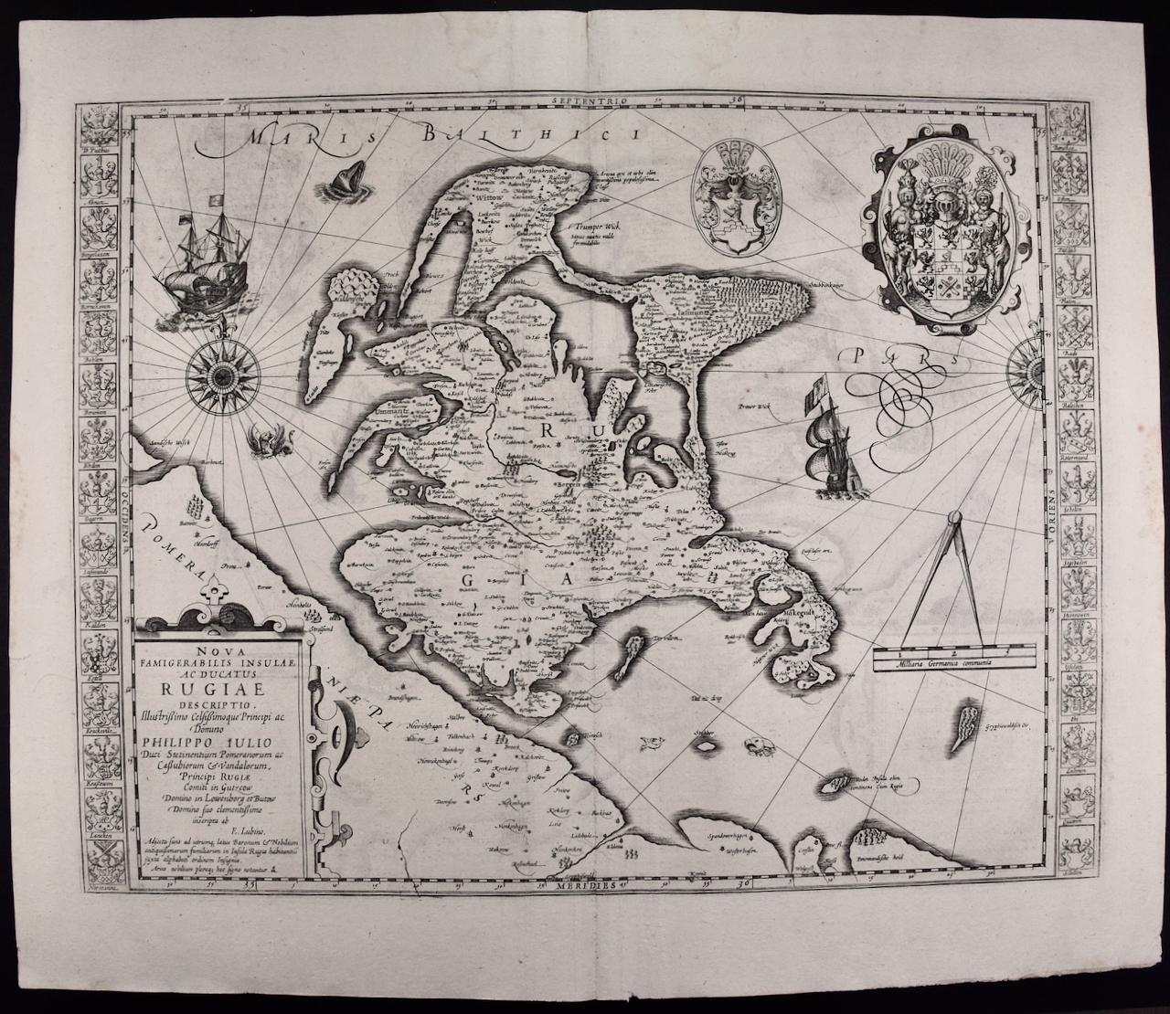
Rugen Island, Germany: An Early 17th Century Map by Mercator and Hondius
By Gerard Mercator
Located in Alamo, CA
This is an early 17th century map entitled "Nova Famigerabilis Insulae Ac Ducatus Rugiae Desciptio" (Map of Rugen Island, Germany) by Gerard Mercator and Henricus and Joducus Hondiu...
Category
Early 17th Century Old Masters Landscape Prints
Materials
Engraving

You May Also Like
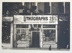
LITHOGRAPHS Greenwich Village NYC, Signed Mezzotint, Art Gallery, Photorealism
By John Baeder
Located in Union City, NJ
LITHOGRAPHS Greenwich Village NYC by the American photorealist artist John Baeder is a limited edition mezzotint printed using hand printmaking techniques on archival, cream colored ...
Category
1970s Photorealist Landscape Prints
Materials
Mezzotint
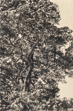
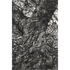
Branches Gold, Limited edition print, Landscape, Tree, Nature art
By Fiona Hamilton
Located in Deddington, GB
Scots Pine drypoint etching printed onto Japanese gampi tissue and backed onto German Hahnemule printmaking paper. This print depicts a mature pine tree, standing proud from the rest...
Category
2010s Contemporary Landscape Prints
Materials
Drypoint, Etching
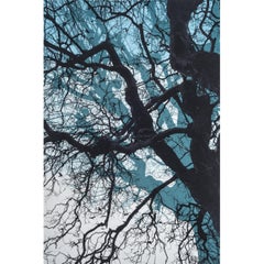
Branches Blue, Limited edition print, Landscape, Tree, Nature art
By Fiona Hamilton
Located in Deddington, GB
This print is part of a small series of works to investigate the use of layering, colour blends and texture in screen print to elicit an ethereal, eerie and potentially dizzying sens...
Category
2010s Contemporary Landscape Prints
Materials
Drypoint, Etching
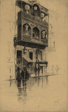
Restaurant in Mott Street
By Charles Frederick William Mielatz
Located in New Orleans, LA
The image depicts a restaurant on New York's Mott Street with ornamental iron work on the balconies. There are six figures in the scene in various stages of contrast. Mott Street is considered the unofficial Main Street of New York's Chinatown. Ella Fitzgerald sang it best: “And tell me what street compares with Mott Street in July? Sweet pushcarts gently gliding by.”
CFW Mielatz was an early influence on the drypoints and etchings of Martin Lewis. This piece was created in 1906 and it is signed in pencil. It is part of the collection of New York's Metropolitan Museum of Art
C.F.W. Mielatz
American, 1860-1919
Born in Bredding, Germany in 1864, Mielatz emigrated to the United States as a young boy and studied at the Chicago School of Design. Mostly self-taught, his first prints were large New England landscapes reminiscent of the painter-etcher school of American Art. Around 1890 he started to produce prints of New York City and by the time of his death, the number totaled over ninety images. He was a master technician in the field of etching, reworking many of his plates to get the exact feeling he was seeking. Mielatz was a member of the New York Etching...
Category
Early 20th Century American Modern Landscape Prints
Materials
Drypoint, Etching
$400 Sale Price
27% Off
Winter Chestnut, Limited edition print, Landscape, Tree, Nature art
By Fiona Hamilton
Located in Deddington, GB
Scots Pine drypoint etching printed onto Japanese gampi tissue and backed onto German Hahnemule printmaking paper. This print depicts a mature pine tree, standing proud from the rest...
Category
2010s Contemporary Landscape Prints
Materials
Drypoint, Etching
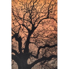
Autumn Pine, Limited edition print, Landscape, Tree, Nature art
By Fiona Hamilton
Located in Deddington, GB
This print of a pine tree uses kitakata Japanese tissue chine collé to depict the warmth and colour of early autumnal light. It is then backed onto Hahnemule printmaking paper. The subject matter is from Ashton Court Estate in Bristol. This body of work is based on the book by Suzanne Simard, 'Finding the Mother Tree'. Trees communicate via mycorrhizal fungi to trade water and other nutrients. Ancient and mature trees nurture their offspring via these networks, as well as trading nutrients between other species. Botanist Simard has spent years working on this theory as part of a wider body of work, discovering what it means for forests, the climate and the wider Anthropocene. My work explores the ecological sublime and an appreciation of the majesty of nature. I use detailed intaglio etching, drypoint, lithography and chine collé to draw the viewer into an ethereal landscape that has an impact on our sense of place in relation to the natural world. I use primarily black and white with natural tones of chine collé and sometimes layers of lithographic texture to introduce warmth to the stark palette and to invoke a sublime emotional connection. I work from sketches, photographs, notes and memory to create my prints.
ADDITIONAL INFORMATION:
Black & White, Chine Collé, Drypoint, Drypoint print, Etching, Etching print on Paper
Edition of 20
44 H x 32 W x 1 D cm (17.32 x 12.60 x 0.39 in)
Sold unframed
Image size:
Height: 30cm (11.81 in)
Width: 20cm (7.87 in)
Complete size of sheet
Height: 44cm (17.32 in)
Width: 32cm (12.60 in)
Depth: 1cm (0.39 in)
ARTIST BIOGRAPHY:
Fiona Hamilton is a printmaker based in Bristol. Interested in process she uses a combination of mediums, both traditional and contemporary, to produce unique imagery, often as one off pieces or in small limited editions. She currently works in silkscreen, cyanotype and foil.
Fiona’s artwork draws on a lot of natural themes such as plants, leaves, trees and creatures including lots of birds. She mostly works directly from nature or from photographs she has taken. She regularly lugs a heavy telephoto lens about to get photos of birds...
Category
2010s Contemporary Landscape Prints
Materials
Drypoint, Etching