Items Similar to Kolkata (Calecut), Map from "Civitates Orbis Terrarum" - by F. Hogenberg - 1575

Want more images or videos?
Request additional images or videos from the seller
1 of 2
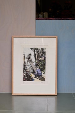
Franz HogenbergKolkata (Calecut), Map from "Civitates Orbis Terrarum" - by F. Hogenberg - 15751575
1575
About the Item
Braun G., Hogenberg F., "Calecut", (Kolkata) from the collection "Civitates Orbis Terrarum", Cologne, T. Graminaeus, 1572-1617. Image Dim: cm 18.5 x 48 Dim: cm 21.5 x 53 .
Very Fine B/W Aquatint showing One of the first View of the Indian city of Kolkata, with ships and elephant well in sight. Braun defines the city “Celeberrimum Indiae Emporium”, thus emphasizing the role of commercial port and crossroads between the West and the East. Lightly Browned paper on margins, usual medial fold, in general Very Good conditions.
The “Civitates Orbis Terrarum” (Atlas of Cities of the World) was the second oldest printed atlas in the history of world cartography and the first atlas totally dedicated to topographical views. The first volume of this collection was published at Cologne in 1572; the others following in 1575, 1581, 1588 and 1598. The sixth and final volume appeared in 1617, just before the extensive devastation wreaked by the Thirty Years’War.
“The most original and magnificent of all city-atlases, which drew on the work of accomplished topographical artists; and…reproduced it in pictorial compositions of great charm and individuality”. R.A.Skelton
This artwork is shipped from Italy. Under existing legislation, any artwork in Italy created over 70 years ago by an artist who has died requires a licence for export regardless of the work’s market price. The shipping may require additional handling days to require the licence according to the final destination of the artwork.
- Creator:Franz Hogenberg (1540 - 1590, Flemish)
- Creation Year:1575
- Dimensions:Height: 7.29 in (18.5 cm)Width: 18.9 in (48 cm)Depth: 0.04 in (1 mm)
- Medium:
- Period:
- Condition:Insurance may be requested by customers as additional service, contact us for more information.
- Gallery Location:Roma, IT
- Reference Number:Seller: J-719141stDibs: LU65034562191

Franz Hogenberg
Braun and Hogenberg's 'The Civitates Orbis Terrarum' was the second atlas of maps ever published and the first atlas of cities and towns of the world. It is one of the most important books published in the 16th century. Most of the maps in the atlas were engraved by Franz Hogenberg and the text, with its descriptions of the history and additional factual information of the cities, was written by a team of writers and edited by Georg Braun. The work contained 546 bird-eye views and map views of cities and towns from all over the world. It gave graphic representation of the main features of the illustrated cities and towns, including the buildings and streets. Although the ordinary buildings are stylized, the principal buildings are reproduced from actual drawings created on location. The principal landmarks and streets can still be recognized today. In addition, the maps often include the heraldic arms of the city, the nature of the surrounding countryside, the important rivers, streams and harbors, even depicting stone bridges, wooden pontoons, flat-bottomed ferries, ships and working boats, wharves and jetties, as well as land-based activities, including horsemen, pedestrians, wagons, coaches, and palanquins. Small vignettes are often included which illustrate the trade, occupations and habits of the local inhabitants, such as agriculture, paper-making and textiles, as well as local forms of punishment, such as gibbets, wheels, floggings etc. Large figures dressed in their local costume are often presented out of proportion in the foreground. The aim of the authors was to give as much information as possible in a pleasing visual form. They succeeded in creating maps that were both informative and decorative works of art. The atlas is a wonderful glimpse of life in medieval Europe. Georg Braun (1541-1622) was German Catholic cleric who was born and who died in Cologne, Germany. He was the principal editor of 'The Civitates Orbis Terrarum', acquiring the tables, hiring the artists, and composing the texts. Abraham Ortelius, whose Theatrum Orbis Terrarum of 1570 was the first atlas of maps ever published, assisted Braun in his compilation of the details and maps for the atlas. The Civitates was intended as a companion for the Ortellius' Theatrum, as suggested by the similarity in the titles. Braun was the only survivor of the original team to live to see the publication of last volume (VI) in 1617. Franz Hogenberg (1535-1590) was a Flemish and German painter, engraver, and mapmaker. He was born in Mechelen (also known as Malines) in Flanders, the son of an engraver. After being expelled from Antwerp by the Duke of Alva, he moved to London and then eventually to Cologne, Germany, where he met Georg Braun and Abraham Ortellius. He engraved most of the plates for Ortelius's Theatrum and the majority of those in the Civitates. Many believe that he was responsible for originating the Civitates project.
About the Seller
4.9
Platinum Seller
Premium sellers with a 4.7+ rating and 24-hour response times
1stDibs seller since 2017
7,494 sales on 1stDibs
Typical response time: 1 hour
- ShippingRetrieving quote...Shipping from: Roma, Italy
- Return Policy
Authenticity Guarantee
In the unlikely event there’s an issue with an item’s authenticity, contact us within 1 year for a full refund. DetailsMoney-Back Guarantee
If your item is not as described, is damaged in transit, or does not arrive, contact us within 7 days for a full refund. Details24-Hour Cancellation
You have a 24-hour grace period in which to reconsider your purchase, with no questions asked.Vetted Professional Sellers
Our world-class sellers must adhere to strict standards for service and quality, maintaining the integrity of our listings.Price-Match Guarantee
If you find that a seller listed the same item for a lower price elsewhere, we’ll match it.Trusted Global Delivery
Our best-in-class carrier network provides specialized shipping options worldwide, including custom delivery.More From This Seller
View AllIschia Gardens - Etching by Eduard Bargheer - 1977
By Eduard Bargheer
Located in Roma, IT
Ischia Gardens is an artwork realized in 1977 by the artist Eduard Bargheer.
Hand-signed, dated on the lower right margin.
Numbered by the artist in pencil on the lower left margi...
Category
1970s Contemporary Figurative Prints
Materials
Etching, Aquatint

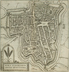
Ypra, Map from "Civitates Orbis Terrarum" - by F. Hogenberg - 1575
By Franz Hogenberg
Located in Roma, IT
Braun G., Hogenberg F., Ypra (Ypres), from the collection Civitates Orbis Terrarum, Cologne, T. Graminaeus, 1572-1617.
The “Civitates Orbis Terrarum” (Atlas of Cities of the World) ...
Category
16th Century Figurative Prints
Materials
Aquatint, Etching
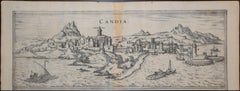
Heraklion, Map from "Civitates Orbis Terrarum" - by F. Hogenberg - 1575
By Franz Hogenberg
Located in Roma, IT
Braun G., Hogenberg F., Candia, (Heraklion, Crete) from the collection Civitates Orbis Terrarum, Cologne, T. Graminaeus, 1572-1617.
Very fine B/W aquatint showing a view of Heraklio...
Category
16th Century Figurative Prints
Materials
Aquatint, Etching
Liber Veritatis - B/W Etching after Claude Lorrain - 1815
By Ludovico Caracciolo
Located in Roma, IT
Image dimensions: 21 x 27 cm.
Liber Veritatis - Plate 61 is a beautiful black and white etching and aquatint on paper realized by the Italian artist Ludovico Caracciolo, after Claud...
Category
1810s Old Masters Figurative Prints
Materials
Etching, Aquatint
Cascale, Map from "Civitates Orbis Terrarum" - by F. Hogenberg - 1575
By Franz Hogenberg
Located in Roma, IT
Braun G., Hogenberg F., Cascale, from the collection Civitates Orbis Terrarum, Cologne, T. Graminaeus, 1572-1617.
Good conditions expect tue usual central fold.
The “Civitates Orbis...
Category
16th Century Figurative Prints
Materials
Aquatint, Etching
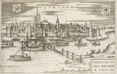
Goricum, Map from "Civitates Orbis Terrarum" - by F.Hogenberg - 1575
By Franz Hogenberg
Located in Roma, IT
"Goricum", from the collection "Civitates Orbis Terrarum", Cologne, T. Graminaeus, 1575.
The “Civitates Orbis Terrarum” (Atlas of Cities of the World) was the second oldest printe...
Category
16th Century Figurative Prints
Materials
Aquatint, Etching
You May Also Like
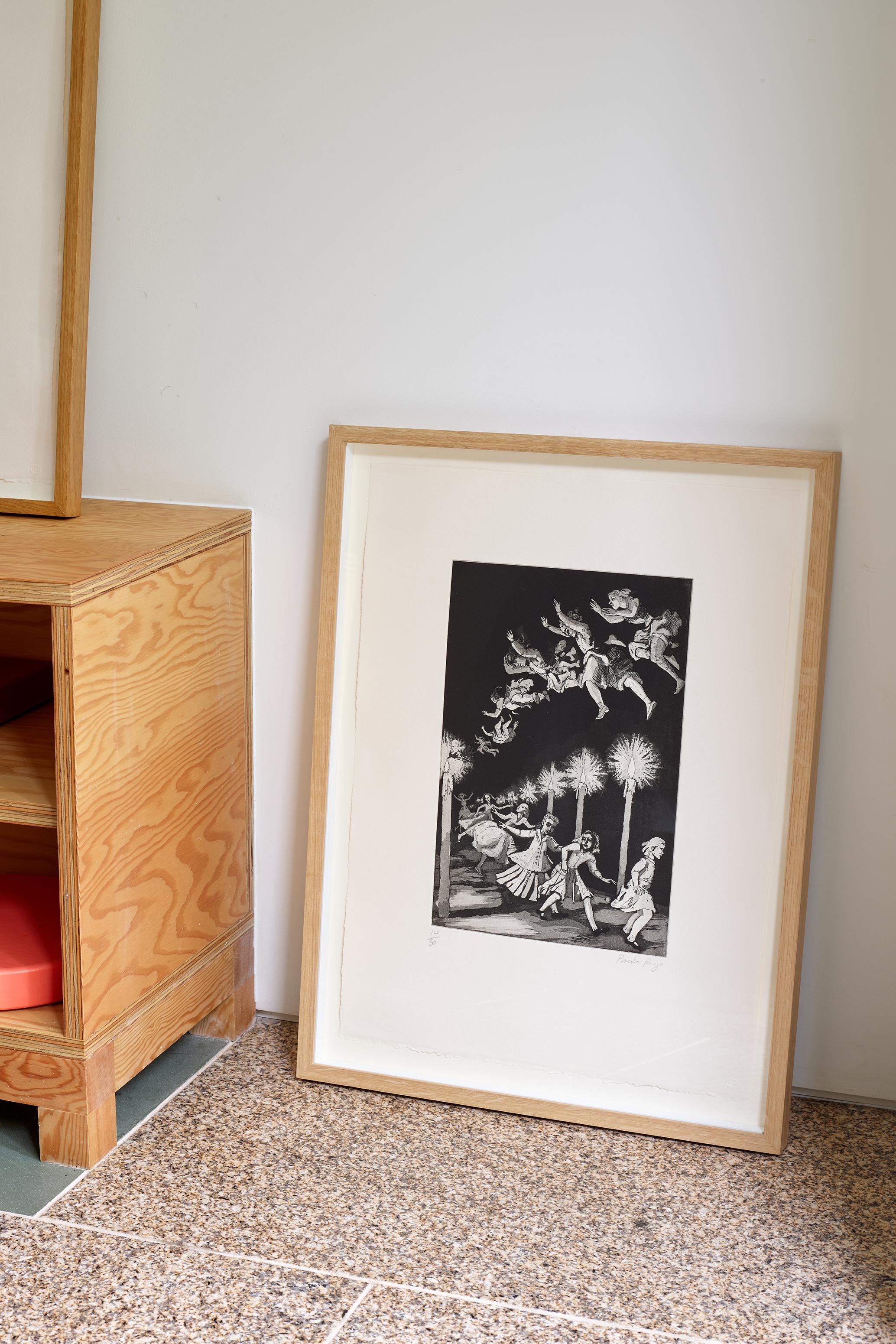
How Many Miles to Babylon -- Print, Etching, Nursery Rhymes by Paula Rego
By Paula Rego
Located in London, GB
How Many Miles to Babylon, 1989
Paula Rego
Etching with aquatint, on velin Arches
Signed and inscribed ‘A/P’, apart from the edition of 50
From Nursery Rhym...
Category
1980s Contemporary Figurative Prints
Materials
Etching, Aquatint
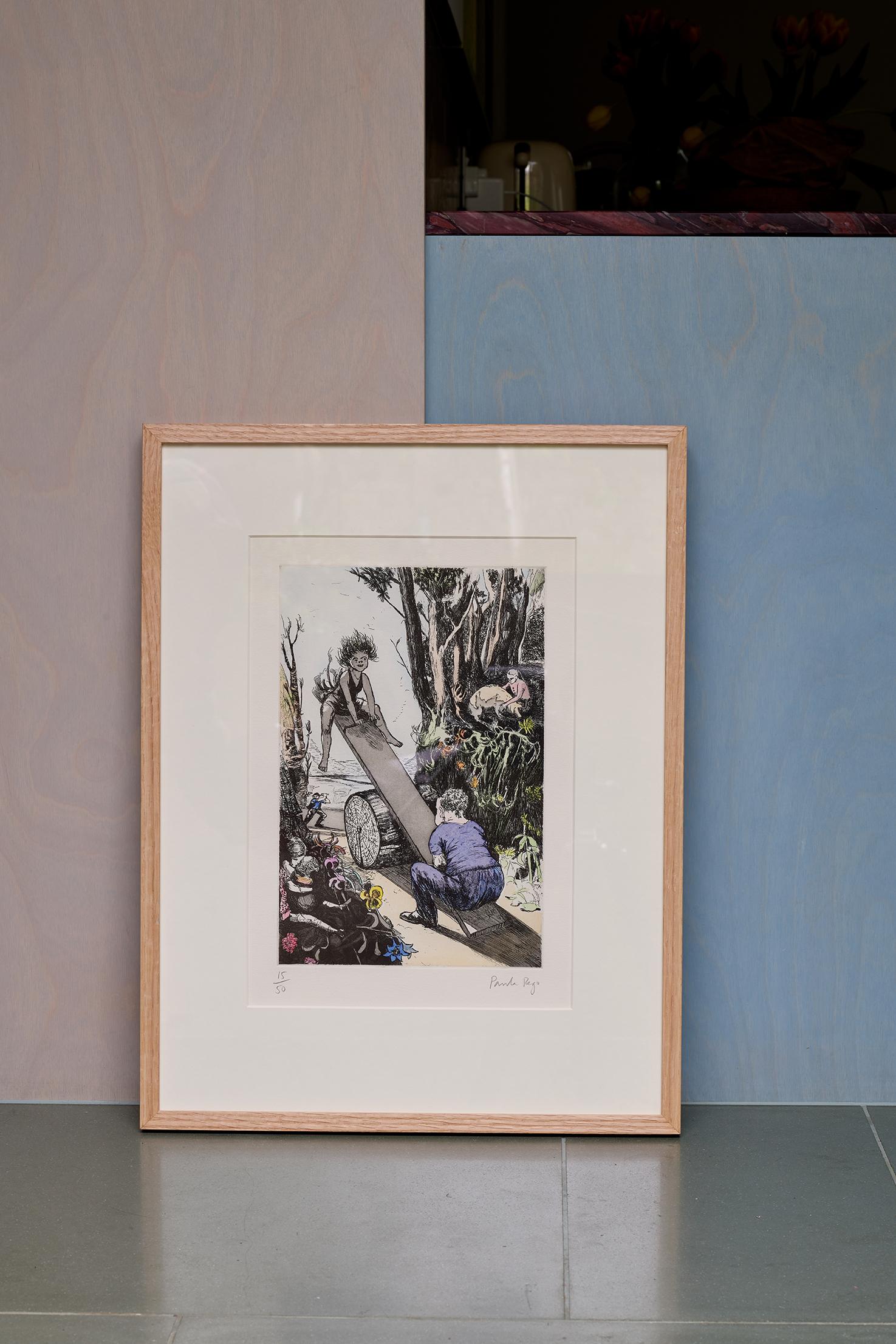
See-saw, Margery Daw -- Print, Etching, Nursery Rhymes by Paula Rego
By Paula Rego
Located in London, GB
See-saw, Margery Daw, 1994
Paula Rego
Etching with aquatint and hand-colouring, on velin Arches
Signed and numbered from the edition of 50
From Nursery Rhymes
Printed by Culford P...
Category
1980s Contemporary Figurative Prints
Materials
Etching, Aquatint
Tim Southall, Kings, Limited Edition Print, Affordable Art, Contemporary Art
By Tim Southall
Located in Deddington, GB
Tim Southall
Kings
Limited Edition Print
Etching and Aquataint made on a Copper Plate
(Please note that in situ images are purely an indication of how a p...
Category
21st Century and Contemporary Contemporary Landscape Prints
Materials
Etching, Paper, Aquatint

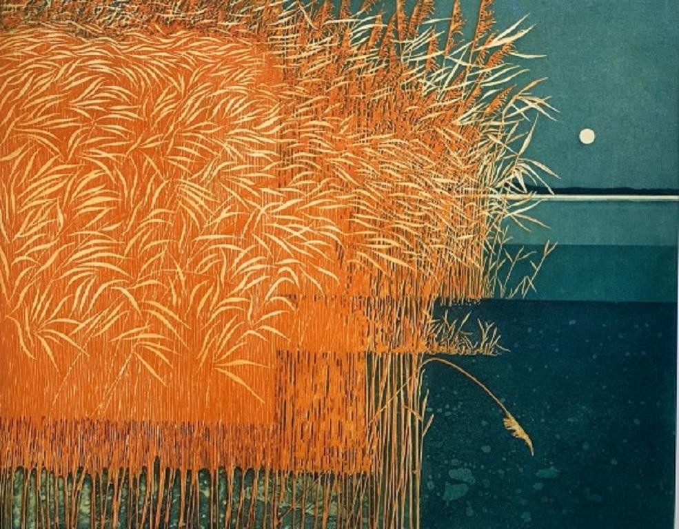
Phil Greenwood, Reeds, Limited edition landscape print
By Phil Greenwood
Located in Deddington, GB
Reeds by Phil Greenwood [2021]
limited_edition
Aquatint Etching
Edition number 150
Image size: H:48 cm x W:59.5 cm
Complete Size of Unframed Work: H...
Category
21st Century and Contemporary Contemporary Landscape Prints
Materials
Aquatint
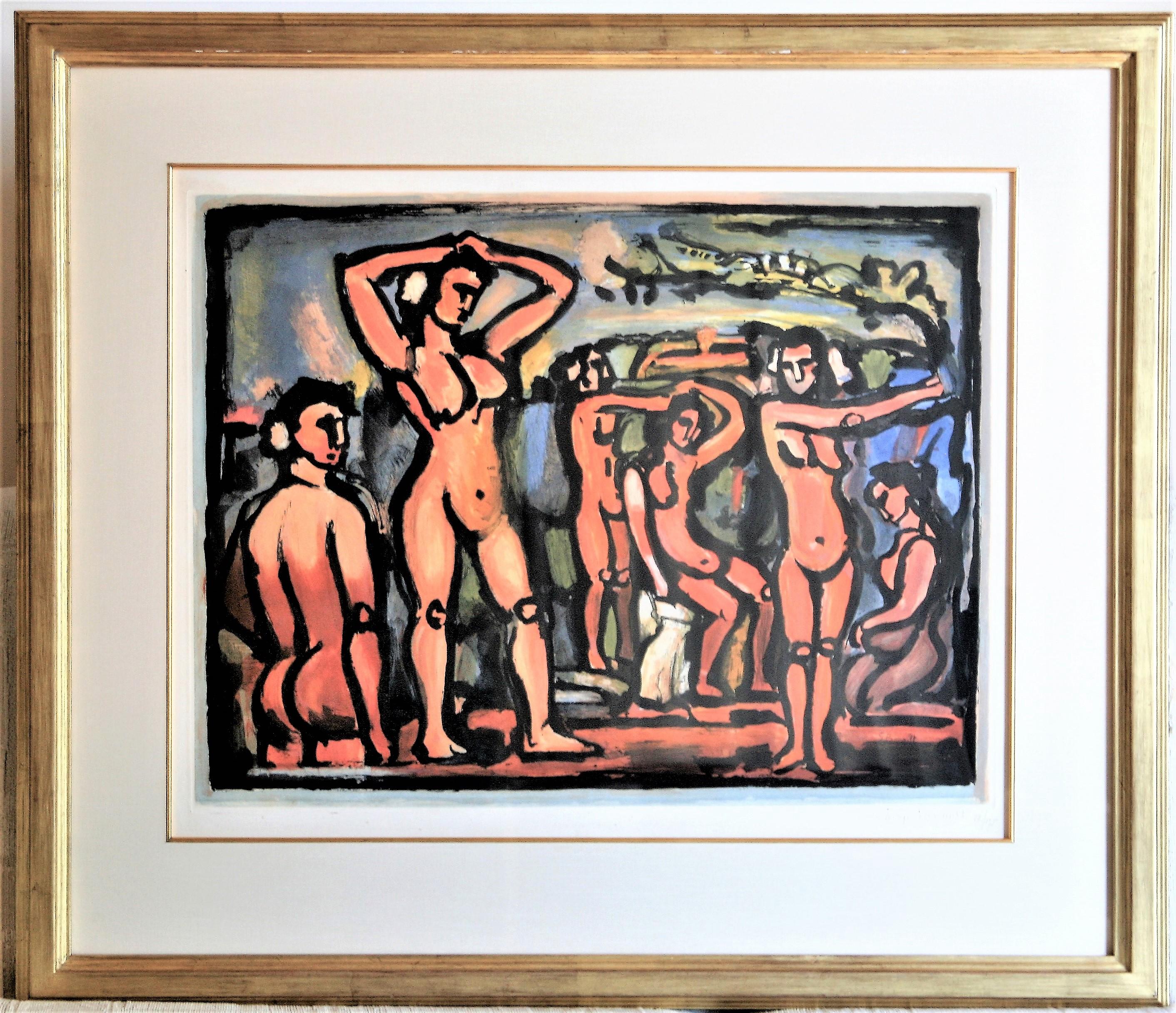
Automne (Autumn)
By Georges Rouault
Located in Storrs, CT
Automne (Autumn). 1938. Aquatint print in colors. Chapon/Rouault 288C. 19 1/2 x 25 1/2 ( sheet 22 5/8 x 30 3/4). Edition 175, #58. Published by Vollard. A rich impression with brigh...
Category
Mid-20th Century Expressionist Figurative Prints
Materials
Aquatint, Color

$14,000 Sale Price
50% Off
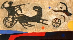
Prehistoria II, Modern Aquatint Etching by Max Papart
By Max Papart
Located in Long Island City, NY
Prehistoria II by Max Papart, French (1911–1994)
Date: circa 1982
Aquatint Etching with Carborundum, Collage, signed and numbered in pencil
Edition of 16/25
Size: 21 x 40 in. (53.34 ...
Category
1970s Modern Figurative Prints
Materials
Etching, Aquatint